News in 2014

|
Third High Level Forum on Global Geospatial Information
Management
22-24 October 2014, Beijing, PR China
“Timely and urgent to consider Sustainable
Development with Geospatial Information"
(WU Hongbo, Under-Secretary General for
Economic and Social Affairs, United Nations)

The Third High Level Forum on Global Geospatial Information Management
was hosted by Government of PR China through the National Administration of
Surveying, Mapping and Geoinformation (NASG) with the theme ‘Sustainable
Development with Geospatial Information’. This Forum is organized based on
the mandate from the United Nations Economic and Social Council (ECOSOC) to
convene global forums to promote comprehensive dialogue on global geospatial
information management with all relevant governments, non-governmental
organizations and the private sector.
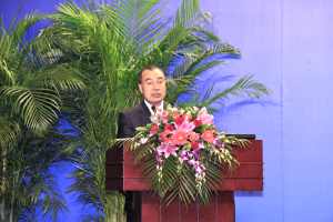
The event was officiated by His Excellency Kurexi Maihesuti, Vice
Minister, Ministry of Land and Resources PR China and Director General of
the National Administration of Surveying, Mapping and Geoinformation (NASG)
together with His Excellency WU Hongbo Under-Secretary General for
Economic and Social Affairs, United Nations. During the Opening Ceremony,
Mr. Eduardo Sojo, Co-Chair, UN-GGIM Committee of Experts and Mr Mark Cygan, Joint Board of Geospatial Information Societies also
delivered statements.
The Forum itself was well structured and organized with good keynote
speakers for each of the sessions and the segments within the sessions. A
total of five sessions were programmed and they were –
Session 1: Geospatial information for the post-2015 development agenda
Session 2: Sustainable cities and human settlements
Session 3: Climate change and disaster mitigation
Session 4: Science, technology, and innovation to measure and monitor
progress
Session 5: Working together across borders and regions
The Forum was attended by 261 delegates from 44 countries, 9 United
Nations representatives, and 27 representatives from international
organizations and the private sector. FIG was represented by Vice President
Pengfei CHENG and President CheeHai TEO.
In his address to the Forum, the Under-Secretary General of the United
Nations, WU Hongbo said that the Forum “is most timely, and
carries with it some level of urgency. The UN system and Member States are
charting a path forward towards the post-2015 development agenda, including
setting new Sustainable Development Goals. This week provides an opportunity
for you, the global geospatial information community, to focus on the
critical roles of geospatial information science in integrating the 3
pillars – economic, social and environmental – of sustainable development.
Your consideration of ‘Sustainable Development with Geospatial Information’
can build on the dialogues and ongoing initiatives of United Nations
programmes convened in recent months.”
His Excellency WU Hongbo also commented the global diversity of
expertise at the Forum representing Member States within the United Nations
and particularly welcomed international partners, FIG being one, and the
private sector. He said, “This High-Level Forum offers a unique platform
for free flowing, open and inclusive dialogue. The UN-GGIM helps to shape
national systems, influences common practices, and brings our professionals
from the public and private sectors together to harness the power of
geospatial information”
In his officiating address, His Excellency Kurexi Maihesuti
said,
“We share a common fate on this shared planet. Sustainable development
has emerged as a global issue that has a bearing on the fate of humanity as
a whole”.
At the close of the Forum, Dr. Li Pengde, President of
UN-GGIM-Asia Pacific presented the Chairperson’s summary. The Forum adopted
the Beijing Declaration at the conclusion of the Forum.

His Excellency
Kurexi Maihesuti, Chinese Vice Minister
delivering his officiating address, photo kindly by NASG |

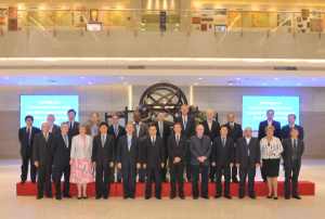
Group Photo: Third High Level Forum on UNGGIM, photo kindly by NASG |
Prof. PengFei CHENG
CheeHai TEO
October 2014
30 October 2014
|


