News in 2022

|
New FIG publication on Geospatial Data in the 2020s
October, 2022
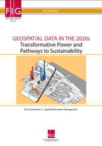
Fig publication 78 - Geospatial Data in the 2020s - Transformative
Power and Pathways to Sustainability
This FIG Report, which is no 78 in the series of FIG Publications is
prepared by FIG Commission 3 - Spatial Information Management.
Editors: Claire Buxton, Marije Louwsma, Hartmut Müller and
Markus Schaffert

|
In his forweword, President of FIG, Rudolf Staiger writes:
Megatrends in the 2020s, such as climate change and resource
scarcity, rapid advances in technology like artificial
Intelligence and machine learning, changes in global
demographics, in particular the ongoing growth of the world’s
population, the rapid ageing of populations in many countries,
and global migration to megacities, are causing disruptions and
will pose major challenges in the coming years.
This FIG-publication is the result of a very fruitful
cooperation between the FIG Commissions 3 and 8 together with
VCSP (Volunteer Community Surveyor Program) of the Young
Surveyors Network over the last years.
|
Traditionally, land surveyors used to be viewed as ‘measurers’. In
recent years, the surveyor has evolved to a professional who measures,
models and manages all kind of location related data. Surveyors use open
standards, incorporate volunteered information, and ensure
interoperability of systems to deliver knowledge derived from geospatial
data of different scales and origin in the form of user-adapted
geospatial information.
Today, geospatial information is widely recognized as an indispensable
source for informed decision making in many fields, such as achieving
the Sustainable Development Goals.
One technological advancement is Earth observation from space, which
provides geospatial data at various spatial, spectral, radiometric and
temporal resolutions and enables the use of the data for a variety of
applications. The COVID-19 pandemic has demonstrated the importance to
all stakeholders of having trusted geospatial health data readily
available more or less in real time. Particularly in less developed
regions of our world, where officially maintained geospatial data sets
are a scarce resource, citizen input of volunteered geographic
information can be very valuable. Digital land administration platforms
can provide ready to use geospatial data to support emergency response,
climate change response, disaster and conflict management, health
management, spatial land use planning, real estate market stimulation,
infrastructure provision, protection of women and vulnerable groups, and
business activation and citizen action.
This FIG report
Geospatial Data in the 2020s - transformative Power and Pathways
to Sustainability
sheds
light on several areas where geospatial data can be particularly
useful in supporting the path to sustainability in the 2020s,
for spatial land use planning and health monitoring, with data
collection through voluntary geographic information, with
attention to diversity and inclusion, and by providing
information on property, including property values.
Evelien Hertz
October 2022


