News in 2024

|
Geospatial Development, Driving Quality Development - GISTC-2024
25-26 June 2024, Beijing, China
FIG President Diane Dumashie attends the
Geospatial Intelligence Software Technology Conference (GISTC-2024)

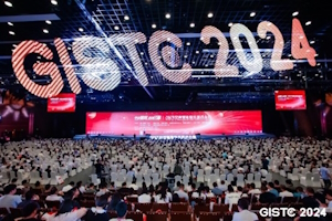
GISTC-2024 Opening count-down pictured Senior
Directors from organisers, led by Geographic Information System
Technology Innovation centre (MNR of China)
At the invitation of FIG Corporate member Mr. Prof. Song
Guanfu, SuperMap President & CEO, FIG President Diane
Dumashie attended the 2024 Geospatial Intelligence Software
Technology Conference (GISTC-2024). The 2024 conference with the
overall theme theme: Geospatial Development, Driving Quality
Development was held at the Beijing International Convention
Centre, China 25-26th June 2024.
An insightful symposium providing possibilities to meet with fellow
professionals and the Chinese software industry, and a good opportunity
to reconnect with many FIG colleagues. There are a total of seven FIG
members in China including: CSGPC, CIREA, CLSS, Affiliate, Academic and Corporate
members (* Full names listed below). And it was greatly
appreciated to meet with Dr Song, President of Chinese Society for
Geodesy, Photogrammetry and Cartography (CSGPC) along with Professor
Yan
Qin, Vice President of CSGPC & President of the Chinese Academy of
Surveying & Mapping (CSAM) (and incoming FIG Vice President).
 |
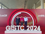
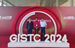
Meeting with Dr Song, President CSGPC
(centre), Professor Yan Qin, Vice President CSGPC & President
CSAM (second right).
|

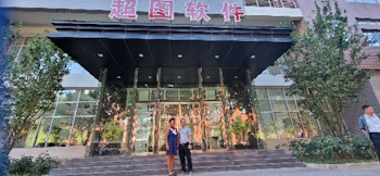
CSGPC offices
|
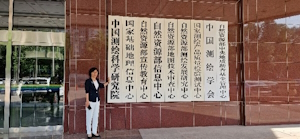
Professor Yan Qin, Vice President CSGPC & President CSAM
indicating CSGPC listed as the first name plate
|
The GISTC-2024 lead host is the Geographic Information System Technology
Innovation centre in the Ministry of Natural Resources of the Peoples
Republic of China, with important support from the UN Global Geospatial
Knowledge and Innovation Centre located and recently opened in Deqing
county, Huzhou, China. The GISTC-2024 is a GIS event that has been
running since 2017 and is increasing its exposure not just in the
continent of China but across the wider Asia region and internationally.
The two conference days were formatted as Day 1 Plenary conference, and
Day 2 Parallel sessions (including international forum) with an
exhibition across both days, (see program)
FIG was very pleased to support the event with the attendance by FIG
President presenting in both the opening and international session.
Day 1
The conference focus on geospatial development was highlighted in the
opening speeches. These included: Li Weisen, President of China
Association for Geospatial Industry and Sciences, Diane Dumashie FIG
President (speech), Li Pengde, Director UN Global Geospatial
Knowledge and Innovation Centre.
|
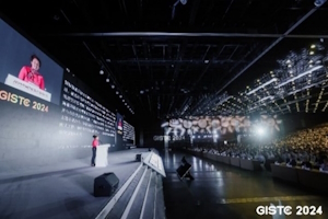
FIG President opening address
|

|
The plenary speakers highlighted the theme to ‘drive quality
development’. With specific focus on data promoting development
(Director of National Electronic Government Expert Committee), digital
governance (Director of the Information Centre of the Ministry of
Natural Resources), and accelerating survey, mapping and geographic
information upgrades (Director of Survey and Mapping Development
Research Centre, Min of Natural Resources)
Day 2
Mr Wang Roger Haitao VP SuperMap, & President of SuperMap International
opened the international forum. Reflecting SuperMap’s outreach to the
international community, the international participants attended from
countries that are well known to the FIG community, including:
Indonesia, Kenya, Malaysia, Mexico, Philippines, Serbia, South Korea and
Thailand amongst others.
|
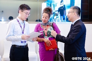
Session Chair Prof Dr Wang Tao (left), FIG President, and Wang Roger Haito President of SuperMap International (right)
|

Colleagues from across the world at international evening dinner reception
|
FIG President D Dumashie, presented ‘FIG Vision Toward 2030: Partnership
in Geospatial Working’. (see ppt). Prof Yan Qin in her
role as President of CSAM provided a keynote with a ‘China perspective
on the SDG’s and natural resources’.
|

FIG President D Dumashie presents at the International session
Left photo presenting
|

FIG President D Dumashie with Professor Yan Qin, incoming FIG Vice President.
|
Key take aways
The conference facilitated discussion, sharing, and learning about GIS
platform software technologies and GIS applications across all land and
built environment sectors. Further, demonstrating that
geospatial technologies and products integrate GIS with RS, GPS and
cutting edge IT technologies.
To use geospatial intelligence to drive quality development through
innovation it is clear that we must continue to work to strengthen the
use, and further development, of geospatial information in all its forms
in the wider geospatial ecosystem. We must do this work by joining up
the dots of our expertise across the FIG Commission disciplines, and
also across survey community and software GIS developer communities to
better articulate how the overlap in land management and administration.
Ultimately for societal benefit.
FIG’s dedicated Task Force on Future Geospatial Information Ecosystem is
looking at this wider ecosystem, and many of FIG commissions are also
deliberating on how to articulate this in their commission domains.
The organisers are thanked for including FIG, as the global
representative of all survey disciplines in the bult and natural
environment. In particular FIG thanks Mr Wang Roger
Haito President of SuperMap International and Mr Gordon Yu
SuperMap Head of European & African Centre who not
only worked tirelessly for the international attendees, but also for
their invaluable help to make my own visit a success.
|
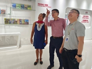
|
FIG President with hosts, SuperMap at their HQ: Mr Wang Roger Haito
President SuperMap International (right) and Mr Yu Gordon Zang Wen Head
of European & African Centre, SuperMap (centre)
|
The GISTC-2024 was a very good opportunity to see the extent of GIS
technology interwoven into the Chinese profession along with enjoyable
times with FIG friends and colleagues.
|
 Excellent Chinese meal with FIG friends
|

Great Wall of China- Bejing
|
* FIG China members:
- Chinese Society for Geodesy, Photogrammetry and
Cartography (CSGPC);
- China institute of real estate appraisers and
agents (CIREA);
- China Land Science Society (CLSS)
- Affiliate member:
China Land Surveying and Planning institute, Ministry of Land and Resources
- Academic member: School of Public Administration Academic Renmin
University of China
- Corporate membe: SuperMap Group
- Corporate member: Beijing iSpatial Co., Ltd
Links to:
FIG President D Dumashie
July 2024






 Excellent Chinese meal with FIG friends