FIG President Stig Enemark Attends the The Eighteenth United
Nations Regional Cartographic Conference for Asia & the Pacific (UNRCC-AP)
United Nations Headquarters, Bangkok, Thailand, 26-29 October 2009
|

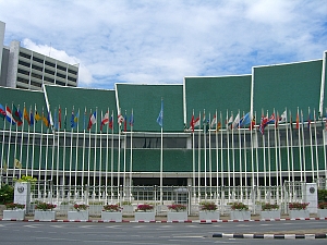
The United Nations Headquarter in Bangkok.
|

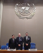
Paul Cheung, Director UNSD, Stig Enemark, President
FIG, and Greg Scott, President of the 18th UNRCC-AP. |
President Stig Enemark attended the Eighteenth United Nations
Cartographic Conference for Asia & the Pacific (UNRCC-AP) held in
Bangkok 26-29 October 2009. The conference is convened every three years
(since 1955) the last one being held in Bangkok, September 2006.
The conference was organized by the UN Statistics Division in Bangkok at
the Economic and Social Commission for Asia and the Pacific (ESCAP) and
headed be Mr. Paul Cheung, Director of the United Nations Statistical
Division (UNSD). The conference provides a regional forum where
approximately 200 participants (mostly heads of Mapping Agencies and Land
Surveys and experts from Asia and the Pacific and other regions, as well as
representatives from International Organizations and NGO´s meet to address
the common needs, problems and experiences in the field of Geospatial
Information Management and related institutional and capacity building
issues. The conference provided a unique platform for discussion and
understanding of the regional needs, and for networking with national
agencies and other NGO´s.
The conference was chaired by the President of the 18th UNRCC-AP Mr.
Greg Scott from Australia. The overall theme was “Spatial Enablement
and the Response to Climate Change and the Millennium Development Goals”.
The program and
proceedings of the conference is available on line at:
http://unstats.un.org/unsd/METHODS/CARTOG/unrccap.htm.
Stig Enemark presented the conference keynote “Spatial
Enablement and the Response to Climate Change and the Millennium Development
Goals”. The paper included the role of land governance in response to
climate change and natural disasters and in support of the MGDs. The paper
was very well received. Other keynotes were given by Mr. John Schneider,
Geoscience Australia; and Associate Professor Abbas Rajabifard,
President of GSDI.
The Permanent Committee on Geographical Information Systems
Infrastructure for Asia and the Pacific (PCGIAP) reported from the four
working groups of which especially working group 3 on Land Administration as
closely related to work of FIG Commission 3 and 7 (see e.g. the last working
group meeting held in Tehran, May 2009
http://www.fig.net/news/news_2009/tehran_may_2009.htm). This working
group has been lead by Prof. Ian Williamson over the last nine years
and he is now stepping back. All working group reports are available on the
conference website.
An invited pre-conference meeting was held Sunday 25 October to discuss
the proposal of UNSD to establish a United Nations Committee on Global
Geographic Information Management. A general consensus was reach for this
idea. Such a forum should play a leadership role in setting the agenda for
further development of geographic information, and promote the use of
geographical information to address key global challenges (poverty
reduction, sustainable development climate change and disaster management)
and, thus, raise the professional visibility. The forum should further
propose principles for standardization; collect good practices; provide a
vehicle for liaison and coordination; and provide a platform to develop
effective strategies on how to build and strengthen capacity for the
management of geographic information especially in developing countries. A
first UN global conference on Geographic Information Management will be
organised in 2011.
The outcome of the conferences is summarized in the adopted resolutions
which will be posted at the conference website.
Read more:

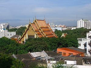
Bangkok, a modern city and cultural heritage.
|

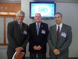
Prof. Iain Williamson,
Stig Enemark, FIG President,
and Ass. Professor Abbas Rajabifard, President of GSDI. |
13 November 2009
|


