FIG Working Week 2024
PROCEEDINGS
/ TECHNICAL PROGRAMME
ISBN 978-87-93914-15-5
ISSN 2307-4086
| Note: In technical sessions the author(s) presenting the paper have been marked in italic style. |
| Friday, 17 May |
Friday,
17 May
09:00–17:00
Kwafie - FIG President's Room, La Palm
| FIG COUNCIL MEETING
Chair: Dr. Diane Dumashie, FIG President, United Kingdom
Rapporteur: Ms. Louise Friis-Hansen, FIG Director, Denmark
| | Saturday, 18 May |
Saturday,
18 May
08:30–17:00
| Social Tour: Shai Hills Game Reserve
|
Saturday,
18 May
09:00–16:00
Kundum, La Palm
| Reference Frame in Practice - Day 1
Commission: 5
The main focus is on reference frames in general with a specific focus on UN initiatives, global and regional frames as well selected national case studies.
The technical seminar is aimed at surveyors, spatial professionals, students and operational geodesists who are interested in learning more about practical aspects of reference frames from some of the world’s leading geodesists and geodetic surveyors. More information, see website
|
Saturday,
18 May
09:00–17:00
Damba 1, La Palm
| BIM for Surveyors
Building Information Modeling (BIM) is changing the way how surveyors work, think, collaborate and earn money. Using and sharing multidimensional digital representations of buildings are the driving forces for the digitalization of our work. This affects many tasks surveyors and GIS professionals perform, e. g. cost estimation, GIS analysis, engineering surveying, construction work, land management and facilities management. More information, see website
Prof. Dr.-Ing. Robert Kaden and Prof. Dr.-Ing.
Christan Clemen (Germany):
Basics on BIM for Surveyors
[handouts]
|
Saturday,
18 May
09:00–17:30
Adae Kesie, La Palm
| FIG Young Surveyors Conference - Day 1
Chair: Ms. Shirley TendaI Chapunza, Chair Young Surveyors Network, Zimbabwe
Rapporteur: Mr. James Appiah, Ghana
The conference will draw from the present societal challenges of climate change, and it’s impacts, social injustices while drawing light to the importance of surveying in sustainable development and addressing these challenges. To preserve the tomorrow of both the profession and our world, young surveyors need to acknowledge their role in safeguarding the environment, maintaining professional standards while promoting technological advancements. More information, see website
|
Saturday,
18 May
09:00–18:00
Odwira, La Palm
| ESRI Event: Sustainable Land Administration Modernization
In this workshop, delve into the Parcel Fabric data model and its extension for data migration. Explore record-driven and quality-driven workflows post-migration. Bring your laptops for hands-on exercises using ArcGIS Pro (instructions sent beforehand). Ideal for organizations managing cadastral records, the Parcel Fabric is LADM conformant, accommodating diverse data sources. More information, see website
|
Saturday,
18 May
09:30–16:30
Kwafie - FIG President's Room, La Palm
| ACCO MEETING
Chair: Mr. Mikael Lilje, FIG Vice President
Rapporteur: Ms. Louise Friis-Hansen, FIG Director
| | Sunday, 19 May |
Sunday,
19 May
09:00–12:00
Adae Kesie, La Palm
| FIG Young Surveyors Conference - Day 2 |
Sunday,
19 May
09:00–13:00
Kundum, La Palm
| Reference Frame in Practice - Day 2
Commission: 5
Rui Fernandes (Portugal), José Antonio Tárrio (Chile), Chokila Chokila (Bhutan), Gonçalo Henriques, Pedro Almeida and Marcelo Caverlotti (Portugal):
Using NTv2 Files for Datum Transformations in Deforming Regions: The Cases of Bhutan and Chile (12678)
[abstract] [paper] [handouts] [video] |
Sunday,
19 May
09:00–15:00
Plenary Dome, La Palm
| FIG General Assembly Day 1
Chair: Dr. Diane Dumashie, FIG President
Rapporteur: Ms. Louise Friis-Hansen, FIG Director
FIG General Assembly will be held on 19 and 23 May in Accra, Ghana at La Palm Royal Beach Hotel.
Under the leadership of FIG President Diane Dumashie and her Council, we are looking forward to greeting many members, presidents, heads of delegation, and FIG representatives onsite in Accra. During the Assembly, the Council, alongside chairs of Commissions, Networks, Permanent Institutions, and Task Forces, will provide updates on their ongoing work. Additionally, the Council recommends the addition of extra ex-officio members to the council.
Appointment of Honorary Member - Enrico Rispoli [nomination
letter] [handouts]
President's Report [handouts]
Co-Operation with the United Nations and the World Bank
Liaison with International Professional Organizations
New Publications
FIG Accounts for 2023 and Auditor's Report and Budgets 2024-2027
Subscription Rates For 2026
FIG Foundation Report
FIG Commissions
FIG Networks
- Young Surveyors Network
[report] [handouts]
- Standards Network
[report]
[handouts]
- FIG Regional Capacity Development Networks
- Africa Network Report (Mohammed M Kabir) [report] [handouts]
- Asia/Pacific Network report (Rob Sarib)
[report] [handouts]
- Americas Network report (Dan Roman)
[report]
[handouts]
FIG Permanent Institutions
- OICRF [report]
[handouts]
- IIHS&M [report] [handouts]
FIG Task Forces
- Task Force on FIG and the Sustainable Development Goals
[report] [handouts]
- Task Force on the role of FIG in International Trends and
Future Geospatial Information Ecosystem
[report]
[handouts]
- Task Force on Diversity and Inclusion in the Surveying
Profession
[report]
[handouts]
- Task Force on Reimagining the Climate Action Agenda for the
Global Surveyor Community through FIG
[report]
[handouts]
Election of two Vice Presidents for 2025-2029 - Presentation of
Candidates
- Stephen Djaba – Licenced Surveyors Association of Ghana -
LISAG, Ghana [handouts]
- Michail Kalogiannakis – Technical Chamber of Greece,
Greece [video]
- Tomasz Malinowski – Association of Polish Surveyors, Poland
[handouts]
- Volker Schwieger – German Association for Geodesy,
Geoinformation and Land Management DVW, Germany [handouts]
- Qin Yan – Chinese Society for Geodesy, Photogrammetry and
Cartography CSGPC, China [handouts]
|
Sunday,
19 May
09:00–15:00
| Social Tour: Aburi Botanical Gardens & Tetteh Quarshie Cocoa Farm
|
Sunday,
19 May
14:00–16:00
La Palm Beach
| FIG YSN Charity Event
Join us for a fun-filled charity beach volleyball event!
Are you ready to spike for a cause? We invite you to join us for an exhilarating day of beach volleyball in support of two incredible organizations the VCSO (Volunteer Community Surveyors Program) and the FIG Foundation.
Why It Matters
Your involvement can make a significant difference. The FIG YSN-VCSP is dedicated to empowering young surveyors and communities through volunteerism, offering vital support and resources where they're needed most, Meanwhile, the FIG Foundation focuses on advancing the geospatial sciences, aiding in research, education, and outreach worldwide.
|
Sunday,
19 May
15:00–16:00
Royal Dragon - African Corner, La Palm
| FIG Working Week 2028 Reception
This year, the location for the FIG Working Week 2028 was up for a vote. However, the decision has been made, and we'll be heading to Paris, France, to commemorate the 150th anniversary of FIG's founding. In 1878, seven national associations - Belgium, France, Germany, Great Britain, Italy, Spain, and Switzerland - came together in Paris to establish FIG on 18 July.
- For official member delegates only.
|
Sunday,
19 May
17:00–18:30
Plenary Dome, La Palm
| OPENING CEREMONY
The opening ceremony will provide a spectacular introduction to the Working Week, its theme, and its unique location - a festive start of the Week.
During the opening all attendees will be met by the national and local culture and welcome addresses by our host from the Ghana and locally from Accra.
- Dr. Anthony Arko Adjei, GhIS President
- Surv. Ing. Samuel Larbi Darko, LiSAG
President
- Hon. Samuel A. Jinapor, Minister for Lands
and Natural Resources
- Ms. Nsama Nsemiwe Chikolwa, Africa Union
Representative
- Dr. Diane Dumashie, FIG President
- President Nana Addo Dankwa Akufo-Addo,
President of Ghana
|
Sunday,
19 May
19:00–21:00
African Village, La Palm
| Welcome Reception: Akwaaba Night
Welcome to Accra! As the sun sets on the first day of the FIG Working Week, we invite all delegates, registered accompanying persons, and exhibitors to join us for the official Welcome Reception. Embrace the spirit of companionship and connection as we gather to renew old friendships and forge new acquaintances. This special evening, also known as Akwaaba Night, embodies the warmth and hospitality of Ghanaian culture, with 'Akwaaba' meaning 'Welcome' in the local language. Let's come together to celebrate the beginning of our conference journey and the vibrant community awaiting us in Accra. See you there!"
To attend the Welcome Reception, participants must first pick up their conference badge, which serves as their entry pass to the event. Upon badge collection, each participant will also receive two drink tickets, redeemable at the reception for complimentary beverages.
| | Monday, 20 May |
Monday,
20 May
08:00–09:00
Royal Dragon - African Corner, La Palm
| Newcomers Session
Chair: Mr. Mikael Lilje, FIG Vice President, Sweden
Rapporteur: Ms. Claudia Stormoen, FIG Event Manager
New to the FIG Working Week?
Join us at the session for newcomers to meet members of the council, the FIG Office and other participants who will experience the FIG Working Week for the first time. Do not miss this opportunity to learn more about FIG, on how to maximize your conference experience and making most of your attendance. First time attendees will be introduced to the programme, the keynote speakers, the session tracks, the roundtable discussions, the sponsors and social events.
We look forward to seeing you there!
|
Monday,
20 May
08:00–09:00
Kundum, La Palm
| TS01F: Novel Cost-Effective Positioning & Engineering Systems and their Applications for Africa
Commission: 5 & 6
Chair: Mr. Peter Bauer, Austria
Rapporteur: Mr. David Mulindwa, Uganda
The growth of African industries are heavily dependent on major civil infrastructure such as roads, rail tracks and ports allowing the transport of resources across and beyond the region. Energy infrastructure is also critical in supporting the civil infrastructure. The outputs of these infrastructures are dependent on its continuous operation under challenging conditions and environments, and benefit from all of positioning and measurement systems used to build, maintain and operate the industries, as well as monitor their stability and safety.
A number of case studies will be shared from Africa on how these positioning and surveying technologies are used in engineering projects. A panel discussion will delve into these technologies, and also allow questions from the audience.
Guiding Question for Discussions:
- How can surveying help ensure that safe and reliable infrastructure is available for the African region?
Krasimir Matev, Raphael Goudard and Craig Hill (Switzerland):
Best Practices for Adopting 3D Laser Scanning and Mobile Mapping (12437)
[abstract] [paper] [handouts] [video] Jun Wang, Lee Hellen, Gao Wenzong, Wang Charles and Ryan Keenan (Australia):
Low-Cost GNSS Solution to Densify the National Terrestrial Reference Frame Stations (12561)
[abstract] [paper] [handouts] [video] Okorocha Chika and Raphael Ehigiator (Nigeria):
The Applications of Sacredion Online GNSS Positioning Service (SOGPOS) for Real-Time Kinematic GNSS Correction in Asset Mapping and Management (12563)
[abstract] [paper] [handouts] [video] Joseph Owusu-Awuah (Ghana):
Delivering Sustainable Surveying Engineering Business in the 21st century - The Entrepreneurial Approach (12577)
[abstract] [paper] [handouts] [video] |
Monday,
20 May
08:00–09:00
Adae Kesie, La Palm

| TS01G: Climate Change and Land Administration
Commission: 7 & TF Climate
Chair: Ms. Angela Anyakora, Nigeria
Rapporteur: Dr. Charisse Griffith-Charles, Trinidad and Tobago
A rapid unpacking of the links between climate change and administration, and how that connection is playing out in terms of policies, laws, challenges, and innovations at the country and international level.
Guiding Questions for Discussions:
- Which countries are active on climate change with respect to land administratiomn?
- How are minority groups, youth, and the private sector being involved?
- Are there successes? What about failures?
Panel Discussion: Bamiji Michael Adeleye, Kenneth Ssemwogerere, Isolo Paul Mukwaya (Uganda), Oluibukun Gbenga Ajayi (Namibia) and Morenikeji Gbenga (Nigeria):
Spatio-temporal assessment of the influence of urban change on land surface temperature (12361)
[abstract] [paper] [handouts] [video]
Markus Junttila (Finland):
Finnish wind power projects and its legal survey in expropriation procedure (12381)
[abstract] [paper] [handouts] [video]
Ganesh Prasad Bhatta, Reshma Shrestha, Dev Raj Paudyal and Sunil Babu Shrestha (Nepal):
Resilient for Tenure Security in the Face of Climate Change: a Case from Nepal (12695)
[abstract]
[paper] [video]
Ugonna Nkwunonwo, Ndukwe Chiemelu and Elijah Ebinne (Nigeria):
Sustainable Land Resources Management Using Goal programming MCDA model: Evidence from Best Practice in Natural Resources Management (12676)
[abstract] [paper] [handouts] [video]
|
Monday,
20 May
09:15–10:05
Plenary Dome, La Palm
| PLENARY SESSION 1 - part 1: People and Place: Africa insights connecting Land Governance for All
Chair: Dr. Diane Dumashie, FIG President, United Kingdom
The land and climate action agenda necessary to underpin governance needs strong institutions with good land laws operating on the land (and marine) continuum of rights, for a healthy planet and healthy people as well as good stakeholder practice.
Capturing insights by dividing this into two sections first UN multi-lateral approaches and second Traditional African Authority approaches. The speakers will be exploring the nexus of Geography and the rights and responsibilities of land tenure and people recognising that Africa is on the critical path to achieve sustainability in the context of SDG13 (Climate).
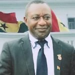 |
Hon Dr Henry Kwabena Kokofu,
Immediate past Executive Director
Environmental Protection Agency (EPA)
IMPLEMENTING AMBITIOUS
CLIMATE ACTIONS IN GHANA'S NDCS: THE
ROLE OF THE SURVEY PROFESSION AND
GEOSPATIAL TECHNOLOGIES
[bio]
[Abstract] [handout]
|
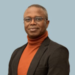 |
Ernest Acheampong,
Capacity Development
coordinator,
Group on Earth Observation GEO
SUPPORTING THE SUSTAINABLE
DEVELOPMENT GOALS – A STRATEGIC ACTION
FOR THE GROUP ON EARTH OBSERVATIONS
(GEO)
[bio]
[Abstract]
[handouts]
|
|
Monday,
20 May
10:05–11:15
Plenary Dome, La Palm
| PLENARY SESSION 1 - part 2: Traditional Leaders, Africa: Governance Connectivity Challenges and Positive Impacts of Technology
Chair: Prof. Stig Enemark, FIG Honorary President, Denmark
Panel:
- Nana Kobina Nketsia V,
Paramount Chief of Essikado Traditional Area, Sekondi, Western Region of Ghana [bio]
- H.M (Arc,) Barr. King Adedapo Aderemi Adeen
of Ido-Osun, Nigeria
- His Royal Highness Chief Chamuka VI -
MorganKumwenda Zambia [bio]
[handouts]
|
Monday,
20 May
11:15–11:45
Exhibition Hall, La Palm
| Morning Break |
Monday,
20 May
11:15–11:45
Plenary Dome, La Palm
| Deep-Dive Session on SDG
Commission: SDG
Chair: Ms. Marisa Balas, Mozambique & Mr. Ronald Ssengendo, Uganda
Join the plenary speakers on stage for a dedicated Q&A session. Dive deeper into the climate challenges in Africa and the role of land towards a more sustainable planet. Share knowledge, brainstorm and formulate actions for FIG to take the inspiring stories and lessons learned on board to achieve the Sustainable Development Goals.
|
Monday,
20 May
11:45–13:15
Plenary 1, La Palm
| TS02A: Open Spatial Digital Data for Resilient Environments and Societal Well-being
Commission: 3
Chair: Mr. Cromwell Manaloto, Italy
Rapporteur: Mr. Daniele Camele, Italy
In this session we will discover how digital spatial data is utilized to enhance resilience against environmental challenges, fostering sustainable and social development and effective disaster response strategies. Experts will discuss innovative approaches, best practices, and case studies showcasing the transformative potential of open spatial data in creating resilient ecosystems and communities.
Guiding Questions for Discussions:
- How can open spatial digital data contribute to building resilience in environmental and social-urban contexts?
- What are the key challenges and opportunities in leveraging digital spatial data for planning and implementation?
- What are the ethical, legal, and technical considerations associated with the collection, sharing, and use of open spatial data?
- What lessons can be learned from successful case studies and initiatives that have effectively utilized spatial data for building resilient environments?
- What are the future trends and opportunities in the field of open spatial digital data for resilience, and how can we prepare for them?
- Ultimately, how can we ensure that open spatial digital data is effectively utilized to create more resilient and sustainable communities and ecosystems?
Benedict Mberede (Nigeria):
The Need for an Open Geospatial Data Platform for Smart City Development in Lagos, Nigeria (12711)
[abstract] [paper] [handouts] [video] Dorus Kruse (Netherlands):
Digitalisation and New Technologies Within Spatial Data in Relation to Key Registers Topography, Addresses / Buildings and 3d Cadastre. (12712)
[abstract] [paper] [handouts] [video] |
Monday,
20 May
11:45–13:15
Plenary 2, La Palm
| TS02B: Transparency: Definition and Measurement of Transparency in the Real Estate Market, Good Cases
Commission: 9
Chair: Mrs. Grazyna Wiejak-Roy, United Kingdom
Rapporteur: Dipl.- Ing. Peter Ache, Chair FIG Commission 9, Germany
Transparency in the property market is an important element of a country's social order and economy. We want to clarify the different perceptions of transparency around the world, what transparency has to do with property valuation and what needs to be done to meet modern market transparency requirements.
Guiding Questions for Discussions:
- How is the term "transparency" perceived in relation to the property market in different countries?
- How could a global definition of transparency be formulated?
- How different is the assessment of the importance of transparency by citizens, experts and policy makers?
Grazyna Wiejak-Roy, Jaideep Roy and Andrew D.A.C. Smith (United Kingdom):
Opacity by Design - Transparency of the Allotment Gardens' Market in Warsaw (12422)
[abstract] [paper] [handouts] [video] Ruud Kathmann, Luc Hermans and Marco Kuijper (Netherlands):
Fit For Purpose Real Estate Valuation (12520)
[abstract] [paper] [handouts] [video] Charl-Thom Bayer (Denmark) and Laura Meggiolaro (Italy):
The State of Land Data in Africa: Fuelling Africa’s Future (12521)
[abstract] [paper] [handouts] [video] |
Monday,
20 May
11:45–13:15
Royal Dragon - African Corner, La Palm
| TS02C: The Quest for Good Land Governance in Africa
Chair: Mr. Mohammed Mamman Kabir, Chair FIG ARN, Nigeria
Rapporteur: Mr. Sulemana Mahama, Ghana
- Connecting the Modern and Traditional Land Administration Systems to Bridge the Chasms
Discover the intricate tapestry of land governance in Africa. Uncover the clash between traditional and modern approaches, the struggle for inclusivity, and the rising conflicts over land rights. Join us as we delve into the urgent need for reevaluation and explore how traditional wisdom can shape a path towards sustainable development. Don't miss the chance to be part of the solution for Africa's land challenges.
The session aims to build upon the presentation of traditional leaders at the plenary session to create awareness on the need to connect modernity with tradition for a sustainable land governance in Africa.
The panelists and Discussants:
- Paramount Chief Nana Kobina Nketia V. (Ghana)
- His Royal Highness Chief Chamuka VI Morgan Kumwenda (Zambia)
- H.M (Arc,) Barr. King Adedapo Aderemi Adeen (Nigeria)
- Mayor Adama Sarr (Senegal) to present city government’s perspectives
[handouts]
- Mrs. Godelive Phanzu Bitaka (DRC) to present women perspectives
- Oumar Sylla (UN-Habitat)
- Mr. Eric Nyadimo (Kenya) to represent land professionals’ perspectives
- Innocent Antoine Houedji, Coordinator of Youth Initiative for Land in Africa (YILAA) to represent African youth and NGOs
- Dr. Celestina Nkechi Eke Ugoeze, , Ksm, FNIQS, FICIArb, mni [handouts]
|
Monday,
20 May
11:45–13:15
Stage area - "the Market", La Palm
| TS02D: Deformation Monitoring of Civil Structures and Natural Phenomena
Commission: 6
Chair: Prof. Dr. Werner Lienhart, Chair FIG Commission 6, Austria
Rapporteur: Dr. Craig Hill, Switzerland
Unstable slopes due to climate change and ageing infrastructure need reliable monitoring methods and early warning systems. Engineering Geodesy can contribute to the increased safety and initiate counter actions at an early stage.
Guiding Questions for Discussions:
- How can surveyors take a leading role in the design, implementation and operation of early warning systems?
- How can the lifetime of ageing infrastructure be extended with monitoring techniques?
Lidija Špiranec (Switzerland):
Transforming Big Monitoring Data into Reliable Information About Movements (12432)
[abstract] [paper] [handouts] [video] Adamu Bala (China, PR), Bilal Sani, AbdulAzeez Onotu Aliyu and Aliyu Zailani Abubakar (Nigeria):
Analyzing a Section of Ahmadu Bello University's Electrical Grid Using Geometric Network Analysis and Trace Function (12554)
[abstract] [paper] [handouts] [video] Arnessa Gooding, Dexter Davis and Keith Miller (Trinidad And Tobago):
Hybrid Networks for Geodetic Data Collection toward Deformation Monitoring (12683)
[abstract] [paper] [handouts] [video] Further Reading: Prosper Laari, Ziggah Yao Yevenyo and Adusei Stephen (Ghana):
A Composite Open Pit Mine Wall Geodetic Deformation Prediction Model Based on Grasshopper Optimisation and Artificial Neural Network
(12412)
[abstract] [paper] [handouts] [video] |
Monday,
20 May
11:45–13:15
Odwira, La Palm
| TS02E: Land Use Planning for Tenure Security in and around Urban, Peri-Urban and Rural Areas
Commission: 8, GLTN, NUST
Chair: Ms. Elvena Hayford, Namibia
Rapporteur: Ms. Penehafo Ricardo, Namibia
In this session, we will be exploring the importance of land use planning for tenure security in urban, peri-urban, and rural areas. Land use planning provides a crucial framework for strengthening land rights, securing livelihoods, and enhancing productivity in urban areas. Additionally, the sessions aim to understand the relationship between land use planning and tenure security as well as outline the land tools for solving tenure security challenges. Lastly, the session will also share details on the Tenure-Responsive Land Use Planning (TR-LUP) guide, as one of the land tools that simultaneously tackles land use and tenure security challenges..
Guiding Questions for Discussions:
- What is land use planning?
- What is land tenure security?
- What is the relationship between land use planning and tenure security?
- How does land use planning contribute to tenure security?
- What tools can be applied to address land use planning and tenure security challenges in urban areas?
Xavier Prigent (France):
The Concept of Land Sobriety: Zero Net Land Take
The new challenges of urban and rural planning in Europe
Proposal of a game to set up the territorial strategy (12647)
[abstract] [paper] [handouts] [video] Jennilee Kohima (Namibia), John Gitau (Kenya), Cathrine Marenga, Malcon Mazambani and Uchendu Chigbu (Namibia):
Critical Issues with Social Tenure Domain Model in Tenure-Responsive Land Use Planning in Okahandja, Namibia (12665)
[abstract] [paper] [handouts] [video] Further Reading: Isham Pelpuo, Anthony Arko-Adjei and Kwame Obeng (Ghana):
Impact of Cashew Plantation on Land Tenure in Jaman South Municipality (12541)
[abstract] [paper] [handouts] [video] |
Monday,
20 May
11:45–13:15
Kundum, La Palm
| TS02F: The Future of FIG YSN: Charting A Course For Sustainable Growth And Impact
Commission: YSN
Chair: Ms. Shirley Chapunza, Chair, FIG Young Surveyors Network, Zimbabwe
Rapporteur: Mr. James Appiah, Ghana
The session is poised to be a pivotal discussion that delves into the evolving landscape of the Young Surveyors Network (YSN). As we navigate the dynamic challenges and opportunities in the field of surveying, this session aims to shape a forward-thinking strategy for the network, ensuring its continued relevance and impact within the FIG community and across the surveying profession. The goal is to foster an inclusive and collaborative YSN environment shaped by diverse perspectives, innovative ideas, and a commitment to global collaboration and sustainable development.
Guiding Questions for Discussions:
- Vision and Goals: What should be the specific goals for YSN in the next year? How can these align with the broader objectives of the FIG Council and surveying profession?
- Leadership Transition: How can we ensure a smooth transition of leadership within YSN? What qualities and skills should new leaders possess?
- Membership Engagement: In what ways can YSN enhance engagement with its members, considering diverse geographical locations and professional backgrounds?
- Global Collaboration and DEI: What opportunities exist for YSN to collaborate with other young surveyors’ networks globally? How can such collaborations benefit the members and the profession as a whole?
- Technological Integration: How can YSN leverage emerging technologies and trends to better connect with and serve its members?
|
Monday,
20 May
11:45–13:15
Adae Kesie, La Palm

| TS02G: Fit-for-Purpose Land Administration: Cases and Impacts
Commission: 7
Chair: Mr. Israel Taiwo, Nigeria
Rapporteur: Mr. Rafic Khouri, France
Fit for Purpose Land Administration (FFPLA) has been driven and supported by FIG C7, UN-Habitat, and the World Bank for over a decade. There are policy guides, implementation support, and academic publications. There also remains resistance within the land administration community. The state-of-play, best practices, and new developments will be shared and captured.
Guiding Questions for Discussions:
- Is FFPLA still considered controversial? Is it?
- What are the latest country-level examples and technological developments?
Israel Taiwo, Matthew Ibitoye and Sunday Oladejo (Nigeria):
Comparison between Fit-for-Purpose and Conventional Cadastral Mapping Practices in Ekiti State; Nigeria (12407)
[abstract] [paper] [handouts] [video]
This is a peer reviewed paper. Salaheldin Abukashawa (Sudan), Rafic Khouri (France), Bidour Gusai (Saudi Arabia), Hisham Et Tigani (Egypt) and Ombretta Tempra (Italy):
Land Professionals in the Arab Region, Roles, capacities and contribution to land governance and land tenure security (12718)
[abstract] [paper] [handouts] [video] Åse Christensen and Stig Enemark (Denmark):
Providing Secure Land Rights in Informal Settlements:
A Case Study from Mombasa, Kenya (12728)
[abstract] [paper] [handouts] [video] Solomon Njogu and John Gitau (Kenya):
Towards a Framework for Community Land Registration in Informal Settlement; Lessons and Experiences From Four Informal Settlements in Kenya (12601)
[abstract] [paper] [handouts] [video] Aurélia Decherf, Aude Areste Lamendour (France), Severin Nibitanga (Burundi) and Jean Philippe Lestang (France):
PRRPB: a Project to Secure the Land Rights of the Most Vulnerable People (12584)
[abstract] [paper] [handouts] [video] Eva-Maria Unger, Claudia Lindner, Rohan Bennett (Netherlands), Mahamat Abdoulaye Malloum (Chad), Kaspar Kundert (Rwanda), Kate Fairlie (Australia) and Christelle van den Berg (Netherlands):
Spatial Framework in Chad: An Assessment using COFLAS and the MCC Land Records and Transaction Systems Technology Toolkit for Effective Land Administration (12617)
[abstract] [paper] [handouts] [video] Malcon Mazambani (Namibia):
Advancing Land Administration Systems: Namibia’s communal land administration system (12660)
[abstract] [paper] [handouts] [video] Further Reading: Patrick Matata and Gordon Wayumba (Kenya):
Utilizing Open Source Geospatial Technologies to Map Communal Land Rights in Kenya. (12550)
[abstract] [paper] [handouts] [video] Ahmed Hemoudi, Malumbo Chipofya and Dimo Todorovski (Netherlands):
Community Land Registers for Internally Displaced Persons, South Darfur, Sudan: ICT Solution (12615)
[abstract] [paper] [handouts] [video] |
Monday,
20 May
11:45–13:15
Damba 1, La Palm

| TS02H: Smart Construction Approaches for Sustainable Development
Commission: 10
Chair: Mr. Bolaji Sotunde, Nigeria
Rapporteur: Ms. Gabriel Nani, Ghana
This session explores the concept of sustainability in Construction with highlights on the many trajectories to achieving smart and sustainable cities.
Guiding Questions for Discussions:
- Are smart contracts important part of smart city outcomes?
- What is the need for carbon foot print of data?
- How important are smart assets for future -ready buildings?
Daniele Camele, Enrico Davoli, Leonardo Franchi and Sara Gepponi (Italy):
Future-Ready Buildings: Increase Smart Assets Now to Prepare an Effective Building Renewal Tomorrow. (12638)
[abstract] [paper] [handouts] [video] Nani Gabriel, Emmanuel Wiribare, Nkrumah Kwabena Mante and Yussif Halitu (Ghana):
Smart Contracts for Decentralized Construction Project Bidding in Ghana: Challenges and Feasibility (12616)
[abstract] [paper] [handouts] [video] Princess Nortey and Gabriel Nani (Ghana):
Essentials for Green Building Adoption in Ghana (12424)
[abstract] [paper] [handouts] [video] Robert Sarib, Damon Whish-Wilson and Bill Payze (Australia):
A Multi-disciplinary and Collaborative Approach for Defining Cadastral Boundaries and Recognising Traditional / Customary Lands (12719)
[abstract] [paper] [handouts] [video] |
Monday,
20 May
13:15–14:30
Restaurant, La Palm
| Lunch |
Monday,
20 May
13:15–14:30
Stage area - "the Market", La Palm
| Leica Geosystems: Addressing Complex Global Challenges through Geospatial Innovation
Governments around the world are currently experiencing major global challenges, such as climate change, rapid population growth, resource shortages, and urbanisation. Join Leica Geosystems, part of Hexagon, to see why data is key to finding solutions to these problems, and discover how some of the latest geospatial innovations are already helping.
Speaker:
Dr. Simon Musäus, Vice President, Hexagon
FIG Corporate Platinum Member:

|
Monday,
20 May
14:00–17:00
| Technical Tour: Mapping the Plastic
This technical tour will not be pretty, but it will be informative! We’ll
revisit the Lagoon where UMaT students have conducted a comprehensive
survey using UAV multispectral and aerial imagery sensors.
Representatives from various organizations including government
ministries, universities, and UNDP have been invited to join us. Let’s
explore how the surveying and spatial community, especially Working
Group 4.3, can contribute to addressing plastic waste issues in
Ghana and beyond.
|
Monday,
20 May
14:00–17:30
| Social Tour: Accra City Tour including Kwame Nkrumah Memorial Park and Mauso
|
Monday,
20 May
14:00–17:30
| Technical Tour: Visit to the Land Commission Office
You are invited to join us for an insightful visit to the Lands Commission,
where you’ll explore Ghana’s land administration and
management practices firsthand. Engage with local professionals
and learn about the Commission’s vital role in shaping the country’s
land governance framework.
During the visit, you’ll interact with staff from the Client Service
Access Unit (CSAU) and the Commission’s four divisions: Land
Valuation Division, Public and Vested Land Management Division,
Survey and Mapping Division, and Land Registration Division.
Gain valuable knowledge about the Commission’s modernization
efforts through digitalization and improved records management
practices.
|
Monday,
20 May
14:30–16:00
Plenary 2, La Palm

| TS03B: Facing the Changing Climate & Environmental Degradation: Hydrospatial Solutions
Commission: 4 & TF Climate
Chair: Dr. Malavige Don Eranda Kanchana Gunathilaka, Sri Lanka
Rapporteur: Dr. Clarissa Augustinus, Ireland
Facing the challenges posed by changing climate and environmental degradation requires a comprehensive and integrated approach. Hydrography can play a crucial role in addressing these issues. These solutions involve the use of spatial technologies and data to manage and analyse water-related information.
Guiding Questions for Discussions:
- How serious is the climate change induced environmental degradation?
- What are the hydrospatial solutions which can contribute to mitigating the impacts of climate change and environmental degradation?
Gordon Johnston (United Kingdom):
Hydrographic Surveying and the Carbon Footprint of Data – Can we establish Sustainable Surveying? (12482)
[abstract] [paper] [handouts] [video] Ivan Dario Camacho Puerto, Ana María Estupiñán Muñoz and Johan Andrés Avendaño Arias (Colombia):
Effect of Sea Level Rise (SLR): Global Warming and, cadastral and population conformation of the Colombian Caribbean. (12546)
[abstract] [paper] [handouts] [video] Priscilla Djaba and Stephen Djaba (Ghana):
The Integration of Geographic Information Systems to Monitor and Analyze Coastal Erosion in the Central Region of Ghana (12572)
[abstract] [paper] [handouts] [video] Laurent Pronier, Benoit Cajelot and Jean Louis Carme (France):
A High Resolution Accurate Seamless Coastal Model of 650+ km, North of France (12631)
[abstract] [paper] [handouts] [video] Celine Buisson Rosvold (Norway):
Marine Base Maps in the Coastal Zone – the Norwegian model for sustainable development (12689)
[abstract] [paper] [handouts] [video] Tanja Dufek, Ralf Freitag, Thomas Kuhn and Harald Sternberg (Germany):
Navigation Improvement in Post-Processing of Deep-Towed Multibeam Echo Sounder Data Used for Exploration of Hydrothermal Venting Sites (12751)
[abstract] [paper] [handouts] [video] Jeff Opoku-Gyambibi, Michael Nyoagbe and Kweku Nyarko (Ghana):
Leakage Reporting and Management Using GIS: A Case Study of the Tema Region (12783)
[abstract] [paper] [handouts] [video] Further Reading: Fatima Eshun, Shine Francis Gbedemah, Samuel Joe Acquah, Eric Nyarko-Sampson and Edward Wiafe Debrah (Ghana):
Geospatial Techniques in Mitigating the Effects of Climate Change to Create a Sustainable Environment in Yilo Krobo Municipality (12779)
[abstract] [paper] [handouts] [video] |
Monday,
20 May
14:30–16:00
Royal Dragon - African Corner, La Palm
| FIG Director Generals Forum
Chair: Dr. Mikael Lilje, FIG Vice President, Sweden
The annual FIG Director Generals Forum brings together Chief Executives or Director Generals of national (or provincial) agencies and FIG Affiliate Members that have responsibility over mapping, cadastre, valuation, planning and development, land administration and management from around the world. The Forum allows peer-to-peer engagement to address the present challenges and opportunities, including the responsibility of national agencies to stay relevant and effective.
This year the DG Forum is intended to focus on the 2030 Agenda for Sustainable Development and the 17 Sustainable Development Goals (SDGs). During this and the previous term, FIG has a Task Force on the Sustainable Development Goals. The intention is that the Forum will have introductory presentations presenting both global and national initiatives for governmental agencies on how the SDGs are part of and supporting the development for a region or country. The presentations will be followed by an open discussion where all participants are welcome to participate. The list of presenters will be shared in due time.
[rhandouts]
|
Monday,
20 May
14:30–16:00
Stage area - "the Market", La Palm
| TS03D: New Approaches in Data Acquisition, Visualization and Interaction with Data
Commission: 6
Chair: Prof. Dr. Werner Lienhart, Chair FIG Commission 6, Austria
Rapporteur: Mr. Peter Bauer, Austria
New ways of data acquisition are constantly development and current practise approached are challenged. Discuss with us the latest news and see how augmented and virtual reality make are impacting our profession.
Guiding Question for Discussion:
- How can the efficiency and accuracy of measurement planning, data acquisition and data processing be improved?
 REWARD WINNER: REWARD WINNER:
Peter Bauer, Caroline Schönberger and Werner Lienhart (Austria):
Interactive planning of GNSS monitoring applications with Virtual Reality (12401)
[abstract] [paper] [handouts] [video]
This is a peer reviewed paper. Gabriel Kerekes and Volker Schwieger (Germany):
Possibilities and Limitations in the Extrinsic Synchronization of Observations from Networks of Robotic Total Stations (12449)
[abstract] [paper] [handouts] [video] Derek Spalton, Giacomo Anderson and James Statham (United Kingdom):
The Application of Traditional Traverse Control Using a Terrestrial Laser Scanner, a Case Study of the Gold Hill Scheduled Monument, Shaftesbury, Dorset Uk (12490)
[abstract] [paper] [handouts] [video] Masaki MURAKAMI (Japan):
Study on Modernizing the General Standard of Operation Specifications for Public Surveys (2) Estimation of Uncertainties Regarding the Proposed Operation Specification for Control Surveys (12545)
[abstract] [paper] [handouts] [video] |
Monday,
20 May
14:30–16:00
Odwira, La Palm
| TS03E: Geo-Spatial Intelligence for Smart and Sustainable Settlements
Commission: 3 & 8
Chair: Dr. Kwabena Obeng Asiama, Chair FIG Commission 8, Ghana
Rapporteur: Mr. Zifceac Iaroslav, Romania
Emerging intelligent technologies and geospatial tools have potentially a big impact on human settlement, both rural and urban. The key increasing subject of concern is how to direct these technologies to the societal needs towards smart and sustainable human settlements.
Guiding Questions for Discussions:
- How do the emerging smart and intelligent technologies in geo-spatial science respond to the societal needs?
- Are these technologies transferable across regions?
Walter Dachaga, Walter Timo de Vries (Germany) and Elias Danyi Kuusaana (Ghana):
Land Tenure (in)formality and Disease Prevalence in Cities: an Exploratory Spatial Analysis of Urban Neighborhoods in Accra. (12619)
[abstract] [paper] [handouts] [video]
 REWARD WINNER: REWARD WINNER:
Markus Schaffert and Torge Steensen (Germany):
Demographic Transition In Aging Neighborhoods: A GIS-Based Analysis From Germany's Countryside (12399)
[abstract] [paper] [handouts] [video]
This is a peer reviewed paper. Emmanuel Idu and Pamela Agbonika (Nigeria):
Optimizing Locations for Best Management Practices in Watershed Zones in Developing Societies (A Case Study of Edim Otop Area in Calabar, Nigeria). (12575)
[abstract] [paper] [handouts] [video] Issaka Yakubu, Felix Tabase, Bernard Kumi-Boateng and Prosper Basommi Laari (Ghana):
Geospatial Assessment of Planning Schemes using GIS and Remote Sensing Techniques-A Case Study of the Tarkwa Area (12419)
[abstract] [paper] [handouts] [video] Duncan Moss (United Kingdom), Vladimir Krupa (Croatia) and Kalogiannakis Michalis (Greece):
The Role of Geodetic Surveyors in Disaster Management (12749)
[abstract] [paper] [handouts] [video] Further Reading: Samuel O. Ukanwa, Maduabughichi Divine Okezie, Njike Chigbu, J. O Ejikeme and Chioma Christaina Gabriel (Nigeria):
Site Suitability Analysis and Risk Assessment of Petroleum Filling Stations in Umuahia Metropolis in Umuahia North l.g.a Using Gis Technique. (12559)
[abstract] [paper] [handouts] [video] |
Monday,
20 May
14:30–16:00
Kundum, La Palm
| The Impact of Youth on Land Administration Globally: Showcasing the VCSP
Commission: 7, GLTN, Trimble & YSN
Chair: Mr. David Elegbede and Ms. Roshni Sharma, co-leads of VCSP
Rapporteur: Ms. Angela Anyakora, Nigeria
This session will launch the VCSP’s FIG Publication about its in-Country Deployments, which showcases how the younger generation can contribute to land administration issues across all global regions. We’ll talk about climate change and land security, new technologies and the impacts they have on communities on-the-ground, and the incredible impact of having the chance to work in these contexts to shape the career pathways of young surveyors.
During this session, we’ll feature a panel discussion featuring the some of our Volunteer Community Surveyors who have been deployed in-Country, alongside the VCSP Core Team who have organised the program as it has evolved over the last seven years, GLTN as the primary sponsor who has allows the program to happen, and Trimble who have supported new technologies to be involved. We’ll then have a participatory discussion with you, our audience, on the impact of youth on land administration globally. Our hope is that through attending this session, you come away with a clear understanding of the important role that young surveyors play in land administration, and the inspiration and energy to encourage as many of the younger generation that you know to take on an active role as volunteers.
Guiding Questions for Discussions:
- What are the critical roles that youth can play in land administration issues?
- How has volunteerism changed over time (before COVID, during COVID, after COVID)?
- What might GLTN’s Phase 4 bring in supporting young surveyors?
- How does the GLTN influence policy adjustment to support its approach in different countries?
Session format:
Short Introduction by chairs
Presentation to launch the FIG Publication
Panel discussion - VCSP Core Team (Roshni Sharma, David Elegbede, Angela Anyakora), GLTN (John Gitau), Trimble (Markus Koper), VCS (Diana Kyalo and Israel Taiwo representing WG7.2)
Open discussion
|
Monday,
20 May
14:30–16:00
Adae Kesie, La Palm
| TS03G: 3D Land Administration and Digital Twins
Commission: 3, 7, ISO, OGC
Chair: Mr. Kees De Zeeuw, Netherlands
Rapporteur: Mr. Ian Harper, Australia
3D land administration systems are coming, or are they? The area continues to attract R&D (including the long-standing 3D LA questionnaire), as the focus moves towards scaled implementations. Many technical and institutional challenges still remain, and this session looks into current developments, and emerging solutions.
Guiding Questions for Discussions:
- Are we seeing 3D land administration systems at scale yet?
- Are there still key roadblocks?
- What are best practices? What is the current R&D focus?
Ian Harper (Australia):
Fit For Purpose 2D Cadastres as the foundation for 3D Cadastral Modelling and Digital Twins. Comparing different solutions from Australia and Indonesia. (12552)
[abstract] [paper] [handouts] [video] Katie Pickett and Matthew Woodlief (USA):
3D Cadastres for Sustainable Development (12698)
[abstract] [paper] [handouts] [video] Shlomi (Shlomo) Sivan and Yaron Felus (Israel):
Development of a Cutting-Edge 3D Cadastral Management System (12710)
[abstract] [paper] [handouts] [video] Juerg Luethy, Andreas Wieser (Switzerland) and Victor Khoo (Singapore):
Success Factors for a Digital Twin of Subsurface Utilities - Experiences from the Comparison of Singapore and Zurich (12512)
[abstract] [paper] [handouts] [video] Yosef Harvey Cortes Millan, Kellith Melixa Gomez Urrego and Johan Andres Avendaño Arias (Colombia):
Methodological Cadastral Baseline for the Multipurpose Physical Survey of Properties Using SFM CRP Photogrammetric Techniques for 3d Reconstruction. (12696)
[abstract] [paper] [handouts] [video] Zeynep Bayramoglu, Ismail Dursun, Mustafa Aslan and Mehmet Zeki Adli (Türkiye):
Creation of 3D City Models and Sustainability of the Project; Türkiye Example (12564)
[abstract] [paper] [handouts] [video] |
Monday,
20 May
14:30–16:00
Damba 1, La Palm

| TS03H: Promoting Inclusive Practices in Geospatial Professions
Chair: Mr. Stephen Djaba, Chair, FIG Task Force on Diversity, Ghana
Rapporteur: Mr. Nigel Sellars, United Kingdom
This session aims to explore and advocate for inclusive practices within the geospatial professions, recognizing the importance of diversity in shaping the field's future. Embracing inclusivity involves acknowledging and accommodating individuals from all walks of life, including initiatives like engaging "Kids in Survey." This novel approach introduces young minds to the wonders of geospatial technology, fostering interest and diversity in the profession from an early age. By promoting inclusive practices, we can create a more equitable and vibrant Surveying community that thrives on diverse perspectives and experiences.
Guiding Questions for Discussions:
- In what ways can we integrate sustainability principles into our inclusivity initiatives within the surveying field?
- How can we attract and retain a more diverse workforce in surveying professions?
- What practical strategies have you implemented or encountered to promote inclusivity within surveying organizations and projects?
- How can we address systemic biases and promote equal opportunities for all surveying professionals?
- How do inclusive practices benefit the surveying field and its practitioners?
Sara Gepponi, Enrico Davoli, Leonardo Franchi and Daniele Camele (Italy):
Together for the Future (12499)
[abstract] [paper] [handouts] [video] Rose Mwaura (Kenya):
Diversity Within Surveying, and Also in the Provision of Surveying Services to the Community (12556)
[abstract] [paper] [handouts] [video] Michelle Blicavs (Australia):
Developing the Value of Surveying for Future Surveyors (12753)
[abstract] [paper] [handouts] [video] Stephen Djaba (Ghana):
Harnessing the Power of Kids in Surveying Program (12754)
[abstract] [paper] [handouts] [video] Tomasz Malinowski (Poland):
Geodesy Students' Club - How to Show Practical Activities in the Modern World of Geodesy (12536)
[abstract] [paper] [handouts] [video] Malinowski Tomasz (Poland):
Geodetic and Cartographic Knowledge Olympiad – Our World, Your Knowledge of How to Motivate Young People. (12533)
[abstract] [paper] [handouts] [video] |
Monday,
20 May
14:30–16:00
Plenary 1, La Palm

| TS03A: Innovations in Education
Commission: 2
Chair: Prof. Rosario Casanova, Uruguay
Rapporteur: Mr. Oluibukun Ajayi, Namibia
An opportunity to hear about the latest innovations in education. In this broad and rapidly changing domain, educators need to keep abreast of the latest research and approaches and incorporate these into their curricula. In this session, we will hear some examples of how this is being done.
Guiding Questions for Discussions:
- How is professional education evolving in scope and purpose?
- How should educators respond to the changing needs of Surveying professionals in the face of current and future global and regional challenges?
- What is new in the field of land administration education?
Oluibukun Ajayi (Namibia):
Harnessing AI Chatbots in Higher Education for Innovative and Ethical Advancements in the Built Environment (12391)
[abstract] [paper] [handouts] [video] Oleg Barsukov (Russia):
Innovations in Surveying Education. Geospatial Digital Training of Qualified Specialists and Implementation of Technologies in the Real Sector of Economy. (12476)
[abstract] [paper] [handouts] [video] Ilya Oshchepkov and Gennady Melnik (Russia):
Hackathon as a Format for Teaching Modern Geodesy (12508)
[abstract] [paper] [handouts] [video] Rosario Casanova (Uruguay), Dimo Todorovski (Netherlands) and Angel Collado (Spain):
Academic Education in Land Surveying Around the World (12538)
[abstract] [paper] [handouts] [video] Rosario Casanova and Paula Teperino (Uruguay):
Ethics Education: A Crucial Component for Professionals in GeoWorld (12540)
[abstract] [paper] [handouts] [video] Cromwell Manaloto (Italy):
ApplyingSurveying in the Gaming Industry: Just a fad or a potential tool? (12655)
[abstract] [paper] [handouts] [video] Matjaz Grilc (Slovenia), Nicolas Smith (France) and Jean Yves Pirlot (Belgium):
The Importance of Professional Chambers in Europe and the World (12750)
[abstract] [paper] [handouts] [video] Further Reading: Angela Omamuyovwi Anyakora (Nigeria) and Manyo Samuel Mboh (Cameroon):
Unveiling Synergies: YSAN-WA Webinars on African Geo-portals and the Impact of AI in Surveying for Sustainable Development in West Africa (12497)
[abstract] [paper] [handouts] [video] |
Monday,
20 May
16:00–16:30
Exhibition Hall, La Palm
| Afternoon Break |
Monday,
20 May
16:30–17:00
Exhibition Hall, La Palm
| GEOSA: Survey and Geospatial Information in Saudi Arabia in the past, present and future
We are going to talk about surveying work in the Kingdom of Saudi Arabia and what was established in the past, and how the current work of the General Authority for Survey and Geospatial Information began, and its pioneering role in the Saudi Arabia renaissance and achieving Vision 2030. And what are the future expectations for surveying and geospatial information.
Speakers:
- Eng. Othman Alkherayef
- Eng. Naif Aljuhany
- Eng. Saad Alqahtani
- Eng. Ghazi Alqahtani
|
Monday,
20 May
16:30–18:00
Plenary 1, La Palm

| TS04A: Academic Networks for Knowledge Sharing
Commission: 2
Chair: Dr. Anthony Arko Adjei, GhIS President,
Ghana
Rapporteur: Dr. Monica Lengoiboni, Netherlands
An opportunity to hear about the latest Academic Networks for Knowledge Sharing in education. In this broad and rapidly changing domain, educators need to keep abreast of the latest research and approaches and incorporate these into their curricula. In this session, we will hear some examples of how this is being done.
Guiding Questions for Discussions:
- How is professional education evolving in scope and purpose?
- How should educators respond to the changing needs of Surveying professionals in the face of current and future global and regional challenges?
- What is new in the field of land administration education?
Diogoye Diouf and Demba Sow (Senegal):
Short-term training : an alternative for capacity building and training of actors involved in land tenure in Senegal (12364)
Les formations à courte durée : une alternative pour un renforcement de capacité et une formation des acteurs impliqués dans le foncier au Sénégal
[abstract] [paper] [handouts] [video] Moinca Lengoiboni (Netherlands), Mireille Biraro (Rwanda), Katcho Karume (Democratic Republic of Congo), Agnex Mwasumbi (Tanzania), David Siriba (Kenya) and Adam Achamyeleh Gashu (Ethiopia):
Impact of COVID-19 on Land Administration and Surveying Education: Online Education - Experiences from Eight Universities in Africa (12440)
[abstract] [paper] [handouts] [video] Georgia Giannopoulou, Ekaterina Gorokhova and Jérôme Dutell (Germany):
Attracting Foreign Surveyors to Germany: Intentions and Implementation (12534)
[abstract] [paper] [handouts] [video] Pietro Grimaldi (Italy):
International Training Summer School by COIFA (12755)
[abstract] [paper] [handouts] [video] Dimo Todorovski, Luc Groot (Netherlands), Rohan Bennett (Australia), Claudia Lindner (Germany), Andre da Silva Mano (Portugal), Gashut El Hadi (Tunisia) and Kholoud Saad (Egypt):
GLTN Workshop - Application of Fit-For-Purpose Land Administration in the Arab Region 5-8 December 2023 (12781)
[abstract] [paper] [handouts] [video] Further Reading: José Valero and José Herrera (Colombia):
Assisted teaching and self-learning Virtual tool in Land use and Cover Maps (12409)
[abstract] [paper] [handouts] [video] |
Monday,
20 May
16:30–18:00
Plenary 2, La Palm
| TS04B: Valuation Challenges: Valuation, Standards, Expropriation
Commission: 9
Chair: Mr. Ruud Kathmann, Netherlands
Rapporteur: Mr. Peter R. Ache, Chair FIG Commission 9, Germany
Property valuation is not just about maths. It often involves existential questions of compensation, financial settlements in family disputes or the question of whether an investment makes sense or not. How complex, heterogeneous and difficult to understand a market is always a factor. We would like to discuss methods and peculiarities of property valuation.
Guiding Questions for Discussions:
- what exactly is the problem with the methods presented?
- what are the uncertainties or inaccuracies of the method?
- is the method theoretical and how is it linked to the real market?
Wolfgang Glunz (Germany):
The Residual Method - Opportunities and Risks (12495)
[abstract] [paper] [handouts] [video] Nigel Sellars (United Kingdom):
Sustainability and Residential Property Valuation (12625)
[abstract] [paper] [handouts] [video] Frank Gyamfi-Yeboah and Jonathan Zinzi Ayitey (Ghana):
Unexpired Lease Terms and Land Values in Ghana (12635)
[abstract] [paper] [handouts] [video] Further Reading: Faus Tinus Handi Feryandi, Putri Nurul Probowati and Yohanes Nurcahyo Agung Wibowo (Indonesia):
Define the Valuation Variables of Aquatic Land Parcels in Coastline Settlements of Indonesia (12428)
[abstract] [paper] [handouts] [video] |
Monday,
20 May
16:30–18:00
Royal Dragon - African Corner, La Palm
| Consultations on the Global World Bank Program on Access to Land for Sustainable Climate Action and Infrastructure
Commission: WB
Chair: Mr. Mika Torhonen, Global Lead Land Administration Specialist, World Bank
Rapporteur: Mr. Linus Pott, Sr. Land Administration Specialist, World Bank
The consultations on access to land for sustainable climate action and infrastructure seek to explore themes, approaches, and alliances for a proposed global World Bank program on Access to Land for Sustainable Climate Action and Infrastructure.
Vast tracts of land will be needed globally for climate actions (afforestation, Renewable Energy investments, low carbon urban development and others) committed in the COP26. At the same time the land stocks diminish as vast areas will face unwanted land use conversion or become unsuitable for cultivation or living because of the temperature increases, drought, sea level rise, floods, and frequent disasters. This together with rapid urbanization add up to an unprecedented demand for land, which will stress private, public, communal, customary/ indigenous peoples’ and other rights on land for decades. In this context, the consultations seek inputs to the proposed global program from governments, land sector professionals, private sector practitioners, and civil society.
The consultations specifically seek to hear voices from Africa but are open to participants from all regions.
Guiding Questions for Discussions:
- What are the best practices, evidence, needs and recommended approaches to address the unmet land requirements of climate commitments, including resilient and green infrastructure?
- How can the World Bank best support countries to ensure land is available to meet climate commitments and provide sustainable infrastructure?
- Over the next 5 years, what are the priorities in land tenure and governance that could most effectively catalyse climate commitments and urban infrastructure?
Programme:
Introduction of session objectives and proposed Global World Bank program on Access to Land for Sustainable Climate Action and Infrastructure by chair (10 minutes)
[handouts]
Gathering of initial reflections to inform open forum:
- Reflections from the FIG Young Surveyor Network (10 minutes)
- Reflections from a government perspective (10 minutes)
- Reflections from private sector and/or CSO perspectives (10 minutes)
Moderated Q&A with the audience (45 minutes)
Wrap up by chair (5 minutes)
|
Monday,
20 May
16:30–18:00
Odwira, La Palm
| TS04E: Addressing Land Degradation and Restoration through Spatial Planning
Commission: 8 & UNCCD
Chair: Dr. Iyenemi Kakulu, Nigeria
Rapporteur: Dr. Adrianna Czarnecka, Poland
The collaborative need for spatial planning tools to be adapted to societal needs, is ever more pronounced in the area of land and environmental degradation. This session continues the engagement between FIG Commission 8 and the UNCCD G20 GLI , towards mainstreaming spatial planning tools for addressing land degradation and promoting land restoration.
Guiding Questions for Discussions:
- How are surveyors currently acting to address global land degradation?
- Can spatial planning policies address land degradation?
- What spatial planning tools are best suited to promote land restoration?
- Is there a connection between spatial planning, land restoration and solving the triple planetary crises?
Iyenemi Ibimina Kakulu (Nigeria) and Charles Atakora (Germany):
Land Use and Spatial Planning Tools to Address Land Degradation and Promote Land Restoration (12519)
[abstract] [paper] [handouts] [video] Guro Voss Gabrielsen (Norway):
Spatial Land-Use Budgeting for Climate Actions (12576)
[abstract] [paper] [handouts] [video] Katarzyna Rędzińska, Adrianna Czarnecka (Poland), Olha Pokladok and Oleksandra Dyda (Ukraine):
Spatial Implications of Climate Actions – the Role of Spatial Planning for Climate Change Adaptation in Poland and Ukraine (12722)
[abstract] [paper] [handouts] [video] Kate Fairlie (Australia):
How Spatial Planning and Land Administration Reduce Deforestation – an Indonesian Case Study (12580)
[abstract] [paper] [handouts] [video]
Wafula Luasi Nabutola (Kenya):
Land Value Change and Spatial Interventions Including for
Climate Actions in Kenya (12469)
[abstract]
[paper] [handouts] [video] Further Reading: Richard Sliuzas (Netherlands), Borges Chivambo (Mozambique), Simon-Peter Mwesigye (Uganda), Maria Clara van der Hammen (Colombia), Monica Lengoiboni (Netherlands), Berta Rafael (Mozambique), Teddy Kisembo, Jordana Wamboga, Evelyn Ajambo (Uganda), Carlos Rodriguez (Colombia), Federica Acquaviva, Karel Boers (Kenya) and Marta Cavallaro (Italy):
Land Governance for Climate Resilience (12435)
[abstract] [paper] [handouts] [video] |
Monday,
20 May
16:30–18:00
Kundum, La Palm
| TS04F: Africa-China Joint Knowledge Exchange: Urban-Rural Land Experiences and Practices
Commission: 8, Hanns Seidel Foundation, NUST, GLTN
Chair: Ms. Jennilee Kohima, Namibia
Rapporteur: Ms. Penehafo Ricardo, Namibia
Knowledge exchange between China and African countries is happening in amazing pace. In the past decade there has been an increase in exchanges between Chinese and African scholars. This knowledge exchanges have led to collaborations across sectors, including the land sector. Are there more differences or similarities between China and Africa’s experience in urban-rural land practices and experiences? This session creates a platform for a China-Africa joint knowledge exchange in urban-rural land experiences and practices.
Guiding Questions for Discussions:
- What are the differences or similarities between China and Africa’s experience in urban-rural land practices and experiences?
- What can each region learn from one another?
- What are the pathways for close interactions between Chinese and African land practitioners?
Xiaoli Wang (China, PR):
Exploration and Practice of China's Construction Land Saving and Intensive Use Evaluation System (12789)
[abstract] [paper] [handouts] [video] Hongbin WEI (China, PR):
Study on nature-based solutions to enhance resilience of urban land space in ecological restoration planning (12790)
[abstract] [paper] [handouts] [video] Wang NAN (China, PR):
Basic Farmland Protection System in China: Changes, Conflicts and Prospects (12791)
[abstract] [paper] [handouts] [video] Uchendu Eugene Chigbu (Namibia), Chen Ruishan (China, PR), Laina Alexander (Namibia) and Guo Xiaona (China, PR):
Rural Development in China and Namibia: Comparison of Problems and Policy Responses (12641)
[abstract] [paper] [handouts] [video] |
Monday,
20 May
16:30–18:00
Adae Kesie, La Palm
| TS04G: Land Administration Domain Model: Status Check
Commission: 3 & 7
Chair: Mr. Michael Barry, Canada
Rapporteur: Mr. Malcon Mazambani, Namibia
LADM ISO 19152 has been an ISO standard since 2012. FIG C7 and C3 played leading roles in its development. The standard is in the process of review and renewal. This session explores these developments, the state-of-play, and asks what is needed to complete the work – and get more widespread awareness and use of LADM.
Guiding Questions for Discussions:
- How is the ISO renewal process tracking?
- What are the challenges around adding spatial planning, marine, valuation, and exchange formats to the standard?
Christine Leslie (USA) and Amir Bar-Maor (Netherlands):
Exploring Research, Development and Innovation in the Parcel Fabric: a LADM-conformant Data Model for Representing, Storing and Adjusting Land Boundaries (12524)
[abstract] [paper] [handouts] [video] Roy Joannides, Dimo Todorovski and Javier Morales (Netherlands):
Towards Improved Land Administration Services: A Model To Support Cadastral Data Interoperability Among Land Agencies In Accra, Ghana (12535)
[abstract] [paper] [handouts] [video] Cathrine Marenga, Tapiwa Maruza (Namibia), John Gitau, Paul Gathogo (Kenya) and Jennilee Kohima (Namibia):
Land Information in Informal Settlement Upgrading: the Social Tenure Domain Model as an Empowerment Tool in Okahandja, Namibia (12634)
[abstract] [paper] [handouts] [video] |
Monday,
20 May
16:30–18:00
Damba 1, La Palm

| TS04H: Task Force on the Surveyor’s Profession: Evolutionary Diversity and Inclusion - ROUND TABLE
Chair: Mr. Timothy Burch, Chair FIG Commission 1, United States
Rapporteur: Mr. Nigel Sellars, United Kingdom
Recognizing the imperative of fostering diverse perspectives, equitable opportunities, and inclusive practices, this session serves as a platform for dialogue, reflection, and action towards building a more inclusive profession.
Panelists:
- Stephen Djaba (Ghana)
- Hans Ni (China)
- Jennifer Whittal (South Africa)
- Paula Dijkstra (Netherlands)
- Tomasz Malinowski (Poland)
|
Monday,
20 May
17:00–17:30
Stage area - "the Market", La Palm
| SUPER MAP: Thoughts and Practices on Construction of 3D Real Scene and New Fundamental Surveying and Mapping
The construction of new fundamental surveying and mapping system is comprehensively advancing in China. Relying on high-precision surveying and mapping technologies and data processing capabilities, it is establishing a nationwide 3D real scene and smart city spatio-temporal big data platform. We will introduce SuperMap's thoughts and practices in the construction of the new fundamental surveying and mapping system from the perspective of integration of data production, management, service, and application.
Speaker: Mr. Hu Chenpu, General Manager of Product Engineering Team, SuperMap
|
Monday,
20 May
17:30–18:00
Stage area - "the Market", La Palm
| South Survey: VIRTUAL REALITY GEO
VR-GEO has revolutionized the future of education. Since its introduction, traditional reliance on paper books has given way to a blend of digital and analog learning experiences. Over 300 schools have already embraced VR-GEO in their educational practices. Notably, prestigious institutions like Wuhan University and China University of Geosciences are among the early adopters. What factors could have persuaded 300 headmasters to integrate VR-GEO into their curricula within such a short timeframe?
|
Monday,
20 May
19:00–22:30
| Ghanaian Evening
Join us for an enchanting Ghanaian evening, promising an immersive cultural journey like no other.
Step into the vibrant ambiance of the Kwame Nkrumah Memorial Park, an iconic venue set to host an unforgettable outdoor event.
Prepare to be captivated by a diverse array of musical and cultural performances, ensuring a memorable experience for every attendee.
From traditional dances to contemporary showcases, there's something for everyone to enjoy and cherish for years to come.
This special evening also serves a noble cause, as we proudly support the FIG Foundation, with Trimble as the main sponsor.
| The Evening is sponsored by
|
 |
| €10,- per sold Ghanaian
Evening goes to |
 |
| | Tuesday, 21 May |
Tuesday,
21 May
07:00–09:00
Kwafie - FIG President's Room, La Palm
| FIG Foundation Meeting
Chair: Mr. Bryn Fosburgh, FIG Foundation President, United Stated
Rapporteur: Ms. Louise Friis-Hansen, FIG Director
|
Tuesday,
21 May
08:00–09:00
Royal Dragon - African Corner, La Palm
| TS05C: International Trends and Future Geospatial Information Ecosystem
Commission: TF Trends
Chair: Dr. Kirsikka Riekkinen, Finland
Rapporteur: Dr. Ryan Keenan, Chair, FIG Commission 5, Australia
Future Geospatial Information Ecosystem will be shaped by international trends such as technological development and economic pressure. What other trends have an influence, and what is their anticipated impact? Gather around round tables to discuss about the future of surveying and surveyors!
Guiding Questions for Discussions:
Which international trends do you think are the most important regarding surveying and geospatial information?
- Considering the different fields and regions, do you feel that the same trends apply to the fields/regions? Why, why not?
- What are the most anticipated impacts or outcomes of the trends for industry and for professionals working in the industry?
Table hosts:
- Adamu Bala, China
- Hartmut Müller, Germany
- Rosario Casanova, Uruguay
|
Tuesday,
21 May
08:00–09:00
Odwira, La Palm
| TS05E: Spatialities: Land, Spatial Development and Climate Change
Commission: 8, GLTN, NUST, NELGA (South/West Africa)
Chair: Ms. Jennilee Kohima, Namibia
Rapporteur: Mr. Malcon Mazambani, Namibia
Spatialities are socio-spatial structures within which liveable places are located. Several drivers influence their existence and development, including land tenure, social cultures and climate change. This session dwells on reconstructing spatialities as meta-geographies for land and climate change security.
Guiding Questions for Discussions:
- What are the relationships between land use, societal actions and climate change?
- What are the land, spatial planning and climate-related challenges facing the world?
- How can inequalities, unfreedoms and poor living conditions caused by spatial impediments be improved?
Moustapha Keita-Diop (Guinea):
Climate change, environmental transformation and land tenure issues for local communities (12636)
[abstract] [paper] [handouts] [video] Mario Siukuta, Penehafo Ricardo, Laina Alexander, Cathrine Marenga, Ntwala Vanessa Simataa and Uchendu Eugene Chigbu (Namibia):
The role of Traditional Authorities in promoting Sustainable Climate Strategies in Namibia (12637)
[abstract] [paper] [handouts] [video] Ntwala Simataa, Laina Alexander, Penehafo Ricardo, Cathrine Marenga, Mario Siukuta and Uchendu Eugene Chigbu (Namibia):
Geo-agriculture for Climate Resilience: Towards Pioneering Anticipatory Adaptation in Namibia (12671)
[abstract] [paper] [handouts] [video] Uchendu Eugene Chigbu and Penehafo Ricardo (Namibia):
Socializing with Artificial Intelligence (AI) on Spatial Development in Sub-Saharan Africa (12624)
[abstract] [paper] [handouts] [video] |
Tuesday,
21 May
08:00–09:00
Kundum, La Palm
| TS05F: The Growing Roles & Responsibilities of Surveyors as Data Engineers and Resource Managers
Commission: 5, TF SDG
Chair: Mr. Humphrey Togbe Amegadoe, Ghana
Rapporteur: Dr. Frank Derby, Ghana
This session provides insights into a number of use cases where surveyors are extending their skills and strengths beyond the typical survey activities.
Samuel Osah, Akwasi Afrifa Acheampong and Osman Mohammed Abukari (Ghana):
Ground-based GNSS for Meteorological Applications in Ghana (12701)
[abstract] [paper] [handouts] [video] Ibrahim Magemeso, Richard Oput, Godfrey Toko (Uganda), Cyril Romieu (France) and John Bosco Ogwang (Uganda):
Enhancing Geodetic Controls for Secure Geospatial Data Quality and Integrity in Uganda (12591)
[abstract] [paper] [handouts] [video] Gabriel Scarmana (Australia):
Evaluating the Accuracy of Oblique Photography in Determining Urban Tree Heights (12351)
[abstract] [paper] [handouts] [video] Paa Kwesi Ezanator Akuffo Owusu-Ensaw, Ernest Obiri-Yeboah, Anthony Wordi, Joseph Owusu-Awuah and Portia Gyemfah Addo (Ghana):
Navigating Precision with Network Controls for Construction Continuity (12587)
[abstract] [paper] [handouts] [video] Richmond Nii Otokunor Sackey, Eric Kofi Kwaako and Seyram Quist (Ghana):
Construction Economics - The Economic Impact of a Resident Geomatic Engineer (12581)
[abstract] [paper] [handouts] [video] Further Reading: Alexander Ayettey (Ghana):
Reaffirmation of Ghana-Togo Boundary: a Crossroads of Old and New Approaches to Position Determination (12642)
[abstract] [paper] [handouts] [video] Sylvester Efe Owhojeta (Nigeria):
Surveying of Oil Theft Activities in Wetlands Nigeria – A Case Study of Niger Delta Region. (12640)
[abstract] [paper] [handouts] [video] |
Tuesday,
21 May
08:00–09:00
Adae Kesie, La Palm

| TS05G: Cadastral Data Quality, Openness and Methods
Commission: 7
Chair: Mr. Anthony Arko-Adjei, Ghana
Rapporteur: Prof. Leiv Bjarte Mjøs, Norway
When it comes to land administration data, discussion on data quality, openness, and new methods are not far away. This session looks at a range of trends, concerns, and solutions across this broad range of topics.
Guiding Questions for Discussions:
- How do we deal with data quality issues?
- What is our position on open data as an organisation?
Ludmiła Pietrzak, Paweł Hanus and Hopfer Andrzej (Poland):
Property Marking Synchronization in the Cadastre (12537)
[abstract] [paper] [handouts] [video] Kees de Zeeuw and Amir Bar-Maor (Netherlands):
Best Practices of Cadastral Systems Using GIS (12477)
[abstract] [paper] [handouts] [video] Cornel Paunescu, Catalin Ciprian Marinescu, Iaroslav Zifceac and Lia Stelea (Romania):
Study on the Minimum and Maximum Number of Control Points on the Ground when Making an Orthophoto Plane (12569)
[abstract] [paper] [handouts] [video] Sumeyye Ebrahimi, Ismail Dursun and Mustafa Arslan (Türkiye):
Improving Data Quality of Cadastre Parcels Using Parcel Fabric Case Study: UQ Campus/Australia (12588)
[abstract] [paper] [handouts] [video] Arve Leiknes and Leiv Bjarte Mjøs (Norway):
Methods for Improving Cadastral Maps – Case Study in Røst, Norway (12667)
[abstract] [paper] [handouts] [video] |
Tuesday,
21 May
08:00–09:00
Damba 1, La Palm
| TS05H: Land Administration Education Workshop
Commission: 2, 7, GLTN, NELGA Southern Africa
Chair: Dr. Simon Hull, South Africa
Time to roll up your sleeves, put your thinking caps on, and dive into the world of land administration education! In this session we will be exploring how best to design curricula to train land professionals in this dynamic and broad domain. The realisation of many SDGs is contingent on an environment of sound land governance and the presence of effective and functioning land administration systems. These require suitably trained and educated graduates. In this workshop, we will be exploring what this takes.
[handouts]
[report]
Guiding Questions for Discussions:
- At what educational level should land administration programmes be developed (UG, PG, CPD, etc. / Diploma, Bachelors, PG Dip/Hons, Masters, PhD)?
- What are the core knowledge areas and learning outcomes for land administration programmes?
- What is the scope of work like for land administration graduates, and what accreditation criteria do they need to meet?
|
Tuesday,
21 May
09:15–11:15
Plenary Dome, La Palm
| PLENARY SESSION 2: Land Tenure, Resources and Minerals: Building Sustainable and Resilient Resource Management for the Planet
Chair: Ms. Paula Dijkstra, Chair, FIG Task Force on SDGs, Netherlands
Driven by the agenda that Africa is on the critical path to sustainability. This plenary will focus on minerals & forestry and the impact of the younger surveyor generation in community practices. We rely upon the effective use of technology to address environmental goals which we will hear requires comprehensive geodetic infrastructure.
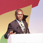 |
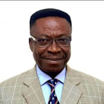
Hon Joseph Boahen Aidoo
Chief Executive,
Ghana
Cocoa Board
AFRICAN APPROACH TO
ADDRESSING GLOBAL WARMING AND CLIMATE
CHANGE: COCOA, THE UNSUNG MOLLIFIER
[bio]
[Abstract]
[paper]
[handouts]
|
 |
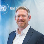
Prof. Daniel Mireku-Gyimah,
University of Mines
and Technology
TO MINE OR NOT TO MINE – THE
ECONOMIC CONTROVERSY AND ITS RESOLUTION
[bio]
[Abstract]
[handouts]
|
 |
Mr. Nick Brown,
Head of Office
UN-GGIM
Global Geodetic Centre of Excellence
HOW SUSTAINABLE AND
RESILIENT ARE THE GLOBAL GEODESY
FOUNDATIONS WE ARE BUILDING ON?
[bio]
[Abstract]
[handout]
|
 |
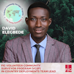 |
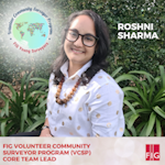
Roshni Sharma and David Elegbede,
FIG Young
Surveyors Volunteer Community Surveyor Programme VCSP
MAPPING THE WORLD A BETTER
PLACE: THE IMPACT OF YOUNG SURVEYORS
ON LAND ADMINISTRATION AND CLIMATE
THROUGH THE VCSP
[bio
- Roshni] [bio
- David] [Abstract]
[handouts]
|
|
Tuesday,
21 May
11:15–11:45
Plenary Dome, La Palm
| Deep-Dive Session on SDG
Commission: SDG
Chair: Mr. Ganesh Prasad Bhatta, Nepal & Mr. Kenneth Norre, Denmark
Join the plenary speakers on stage for a dedicated Q&A session. Dive deeper into the resource challenges in Africa on how our profession can contribute to more sustainable resource management practices for the planet. Share knowledge, brainstorm and formulate actions for FIG to take the inspiring stories and lessons learned on board to achieve the Sustainable Development Goals.
|
Tuesday,
21 May
11:15–12:15
Exhibition Hall, La Palm
| Morning Break: Exhibition and Networking Hour
Unlock unparalleled opportunities for networking and exploration during Exhibition and Networking Hour. Delve into an hour-long immersive experience designed to connect you with leading industry partners and companies and fellow attendees. This dedicated session promises not only extended time to peruse the latest innovations but also invaluable opportunities to forge new connections, exchange insights, and cultivate professional relationships. Don't miss this prime opportunity to amplify your conference experience and maximize your networking potential. Join us for an enriching hour of discovery and collaboration.
|
Tuesday,
21 May
11:45–13:15
Adae Kesie, La Palm
| TS06G: Session en français – 1
Chair: Mr. Marc Vanderschueren, Belgium
Rapporteur: Ms. Godelive Phanzu Vangu, Congo, Democratic Republic of the
Cette session est en français pour permettre une participation active des membres non-anglophones de la FGF (Fédération des Géomètres de Langue Française) et donner la possibilité aux membres de la FIG.
Marc Lievin Vanderschueren (Belgium):
Perspectives de la Fédération des Géomètres Francophones (FGF)en 2024 (12530)
[abstract] [paper] [handouts] [video] Godelive Phanzu Vangu (Democratic Republic of Congo):
Le leadership traditionnel en RDC (12731)
Le leadership traditionnel en RDC
[abstract] [paper] [handouts] [video] Audrey Alajouanine (France):
Mise en œuvre d'un processus complet de collecte, de traitement et d'utilisation des données multispectrales des drones pour l'agriculture (12734)
[abstract] [paper] [handouts] [video] Rodolphe Mawana and Godelive phanzubitaka (Democratic Republic of Congo):
Problematique Des
inondations Dans La Ville De
kinshasa.
(12745)
[abstract] [paper] [handouts] [video] |
Tuesday,
21 May
12:00–19:30
| Technical Tour: The Akosombo Dam
The Akosombo Dam, an awe-inspiring engineering feat, towers
over Lake Volta, offering breathtaking scenery with lush forests
and hills. Lake Volta, the largest man-made lake globally, owes its
existence to this remarkable structure.
Providing electricity to Ghana and neighboring countries like
Togo and Benin, the dam initially fulfilled 20% of Ghana’s electricity
needs, serving 70% of the nation.
Join us for a guided tour to explore the Akosombo Dam and
immerse yourself in its scenic beauty. Gain insights into hydroelectric
power generation and renewable energy through educational
tour of the dam and its power plant. These experiences promote
awareness about sustainable development and the significance of
renewable energy sources.
|
Tuesday,
21 May
12:15–13:15
Plenary Dome, La Palm
|
ANNUAL MEETING - FIG COMMISSION 1
Commission: 1
Chair: Mr. Timothy Burch, Chair FIG Commission1, United States
FIG COMMISSION 1 - PROFESSIONAL STANDARDS AND PRACTICE
Working Groups:
WG 1 - International Ethics Standards
WG 2 - Women in Surveying
WG 3 - International Boundary Settlement and Demarcation
Severine VERNET (France):
OGE-France a Regulatory Body to Supervise the Surveying Profession Driving Forward and Sharing Its Vision of a Profession That Is Transforming Itself and Serving the Public Interest (12583)
[abstract] [paper] [handouts] [video] |
Tuesday,
21 May
12:15–13:15
Plenary Dome, La Palm
| ANNUAL MEETING - FIG COMMISSION 2
Commission: 2
Chair: Dr. Dimo Todorovski, Chair FIG Commission 2, Netherlands
FIG COMMISSION 2 - PROFESSIONAL EDUCATION
Working groups:
WG 1 - Developing and strengthening academic networks
WG 2 - Innovation in Curriculum development implementation
WG 3 - Young surveyors in Education - Learning styles in surveying education
WG 4 - Land Administration Education
|
Tuesday,
21 May
12:15–13:15
Damba 1, La Palm
| ANNUAL MEETING - FIG COMMISSION 3
Commission: 3
Chair: Mr. Markus Schaffert, Germany
FIG COMMISSION 3 - SPATIAL INFORMATION MANAGEMENT
Working Groups:
WG 1 - Geospatial data: professionalism, technology, and services
WG 2 - Urban challenges in developing countries
WG 3 - GIS for sustainable (geo-)spatial planning
WG 4 - LADM and 3D LA
WG 5 - Geospatial next
|
Tuesday,
21 May
12:15–13:15
Plenary Dome, La Palm
| ANNUAL MEETING - FIG COMMISSION 4
Commission: 4
Chair: Dr. Malavige Don Eranda Kanchana Gunathilaka, Chair FIG Commission 4, Sri Lanka
FIG COMMISSION 4 - HYDROGRAPHY
Working Groups:
WG 4.1 – Hydrographic Standards and Guidelines.
WG 4.2 – Sustainable Oceans and Hydrography.
WG 4.3 – Mapping the Plastic.
WG 4.4 – Hydrospatial Domain and Marine Administration.
WG 4.5 – Climate Change induced Sea Level Rise and Adaptation.
Agenda:
- Welcome by the Chair.
- Confirmation of the previous meeting minutes.
- Matters arising from the previous minutes.
- Short briefings by the WGs chairs.
- Suggestions from the National Delegates, Correspondents & Delegates.
- Planning for the other events in 2024 & FIG WW2025.
- AOB.
- Adjournment.
|
Tuesday,
21 May
12:15–13:15
Kundum, La Palm
| ANNUAL MEETING - FIG COMMISSION 5
Commission: 5
Chair: Dr. Ryan Keenan, Chair FIG Commission 5, Australia
Rapporteur: Dr. Kevin Ahlgren, United States
FIG COMMISSION 5 – POSITIONING AND MEASUREMENT
This will be the annual open meeting of Commission 5 at Accra Working Week. It will provide an update on Commission 5’s Work Plan for the Term 2023-2026, and updates on the activities of the Working Groups. National Delegates are warmly invited to present a short (3-5 minute) status of their national activities around Positioning & Measurement, as well as upcoming conferences, events and publications.
This meeting is the ideal opportunity to learn about Commission 5, network with its People, and for anyone to get involved in promoting Positioning and Measurement!
Working Groups:
WG 1 – Standards, Quality Assurance and Calibration
WG 2 – 3D Reference Frames
WG 3 – Vertical Reference Frames
WG 4 – GNSS
WG 5 – Multi-Sensor Systems
WG 6 – Cost-Effective Positioning
Guiding Questions for Discussions:
- What more can Commission 5 be doing as the voice of Positioning and Measurement within FIG, and beyond FIG?
- How can interested people get involved with Commission 5 activities and events?
- How can interested people get involved with a Work Group within Commission 5?
- Panel Discussion: What can we in Commission 5 do, to make the 2026 Congress a memorable and worthwhile event?
-
handouts
|
Tuesday,
21 May
12:15–13:15
Royal Dragon - African Corner, La Palm
| ANNUAL MEETING - FIG COMMISSION 6
Commission: 6
Chair: Prof. Dr. Werner Lienhart, Chair FIG Commission 6, Austria
FIG COMMISSION 6 - ENGINEERING SURVEYS
This will be the annual open meeting of Commission 6. It will provide an update on Commission 6’s Work Plan for the Term 2023-2026, and updates on the activities of the Working Groups.
This meeting is the ideal opportunity to learn about Commission 6, network with its People, and for anyone to get involved in promoting Engineering Surveys!
Working groups:
WG 1 - Deformation Monitoring and Analysis
WG 2 - Dynamic Structural Monitoring
WG 3 - Applications of immersive technologies in Engineering Geodesy
WG 4 - Engineering Surveying Outreach
|
Tuesday,
21 May
12:15–13:15 La Palm
| ANNUAL MEETING - FIG COMMISSION 7
Commission: 7
Chair: Dr. Rohan Bennett, Chair FIG Commission 7, Australia
FIG COMMISSION 7 - LAND MANAGEMENT AND CADASTRE
What more needs to be said?! It’s the C7 Annual Meeting, Ghana 2024 Working Week edition. Don’t be fooled this is not the extended meeting, happening later in the year in Malaysia, but, do come along for a catchup, and a more detailed overview of the 2023-26 workplan progress.
Working groups:
WG 7.1 - Framework for Effective Land Administration (FELA)
WG 7.2 - Fit for Purpose Land Administration (FFPLA)
WG 7.3 - 3D and LADM (3D/LADM)
WG 7.4 - Artificial Intelligence 4 Land Administration (AI4LA)
WG 7.5 - Women’s Access to Land and S4HL
WG 7.6 - Integrated Land Management
WG 7.7 - Education in Land Administration
WG 7.8 - Comparative Land Administration
Rohan Bennett (Australia), Paula Dijkstra (Netherlands), Eva-Maria Unger (Austria) and Christelle Van den Berg (Netherlands):
State of the Cadastre 2024 (12685)
[abstract] [paper] [handouts] [video] |
Tuesday,
21 May
12:15–13:15
Odwira, La Palm
| ANNUAL MEETING - FIG COMMISSION 8
Commission: 8
Chair: Dr. Kwabena Obeng Asiama, Chair FIG Commission 8, Ghana
FIG COMMISSION 8 - SPATIAL PLANNING AND DEVELOPMENT
Working Groups:
WG 1 - Urban-rural land linkages
WG 2 - Unregistered Land and large-scale acquisition/compensation
WG 3 - Spatial Planning Instruments and Climate Change
WG 4 - Digital Transformation for Land Management and Spatial Governance
WG 5 - Spatial Plan and Valuation Information in LADM Context
|
Tuesday,
21 May
12:15–13:15
Dragon - African Corner, Delete
| ANNUAL MEETING - FIG COMMISSION 9
Commission: 9
Chair: Mr. Peter R. Ache, Chair FIG Commission 9, Germany
FIG COMMISSION 9 - VALUATION AND THE MANAGEMENT OF REAL ESTATE
Working Groups:
WG 1 - Definition of Transparency on Real Estate Markets
WG 2 - Best practice Cases on Transparent Real estate Markets
WG 3 - Automated Valuation Modeling (AVM) with machine learning and artificial
intelligence
|
Tuesday,
21 May
12:15–13:15
Plenary Dome, La Palm
| ANNUAL MEETING - FIG COMMISSION 10
Commission: 10
Chair: Ms. Mercy Iyortyer, Chair FIG Commission 10, Nigeria
FIG COMMISSION 10 - CONSTRUCTION ECONOMICS AND MANAGEMENT
Working Groups:
WG 1 - Digital Technologies in Construction
WG 2 - Sustainable Developments in the Built Environment
WG 3 - Cost Information Management
WG 4 - Commercial /Project Management
|
Tuesday,
21 May
13:15–14:30
Restaurant, La Palm
| Lunch
The lunch is sponsored by

|
Tuesday,
21 May
13:15–14:30
Stage area - "the Market", La Palm
| Trimble: Leveraging Trimble Geospatial Solutions for Resilient Environments and Sustainable Resource Management
The FIG Conference 2024 in Accra, Ghana, provides a dynamic forum for practitioners, researchers, and stakeholders to learn and discuss the role of geospatial technologies in fostering resilient environments and sustainable resource management. This presentation will discuss the transformative potential of reality capture and augmented reality technologies and provide an overview of Trimble's software and hardware portfolio with practical examples.
Key themes to be addressed include:
- The benefits of mobile mapping and how AI enables the transformation of vast amounts of rich data into actionable insights for sustainable development.
- How 3D scanning solutions can be utilized to support informed decision-making coastal zones, forest ecosystems, and urban infrastructure to support informed decision-making
- An overview of Trimble hardware and software solutions for cadastral and boundary surveying as well as practical examples in the Fit-for-Purpose Land Administration sector. Map and define land ownership with accuracy.
Join us in Accra, Ghana, as we explore how Trimble products and solutions, along with the seamless, connected workflows they facilitate, contribute to creating resilient environments and promoting sustainable resource management for everyone.
Speakers:
Munnawar Naik, Dennis Belgrado, Gilbert Sosi, Markus Koper
FIG Corporate Platinum Member:

|
Tuesday,
21 May
14:00–16:30
| Social Tour: James Town Walking Tour & Boxing Arena
|
Tuesday,
21 May
14:30–16:00
Plenary 1, La Palm
| TS07A: COCOBOD Session |
Tuesday,
21 May
14:30–16:00
Plenary 2, La Palm
| TS07B: ESG-Valuation, Taxes and Economics
Commission: 9
Chair: Dipl.-Ing. Peter Ache, Chair FIG- Commission 9, Germany
Rapporteur: Mr. Nigel Sellars, United Kingdom
To achieve SDG goals, property owners, investors and local politicians need to be convinced. What could be more convincing than the feeling that something is being done for the environment and at the same time increasing the value of one's own property? This is where the cost survey comes into play and the concrete measurement of property value enhancement effects. We want to discuss both elements and find out what possibilities there are to make the taxation of property fair and at the same time make the effects of SDG activities measurable.
Guiding Questions for Discussions:
- which methods are currently used to determine the value in a tax-fair manner?
- what are the problems and obstacles?
- is it possible to determine whether the value of a property will change if SDG-compliant investments are made?
- what methods are available for this and are these also related to the market?
Michael Dermot McDermott (Australia):
Implementing Values by Setting Goals: What could Possibly go Wrong? (12579)
[abstract] [paper] [handouts] [video] David Hunt (United Kingdom):
Land Tax Reform for Greener Economies in the Caribbean: Trinidad & Tobago Case Study (12611)
[abstract] [paper] [handouts] [video] Michael Nyoagbe, Gloria Afua Poku, Maxwell Akosah-Kusi, Francisca Ameley Armah and Matthias Otu Amanor (Ghana):
Revolutionizing Revenue Streams: Harnessing Drone Technology for Seamless Meter Reading in Disaster Zones (12785)
[abstract] [paper] [handouts] [video] Jean-Yves Bourguignon and Xavier Prigent (France):
Weighting and Optimizing Surface Areas for Economical Management of Existing Buildings (12644)
[abstract] [paper] [handouts] [video] |
Tuesday,
21 May
14:30–16:00
Royal Dragon - African Corner, La Palm

| TS07C: Meeting of Presidents of African Land Professional Associations
Commission: ARN
Chair: Mr. Mohammed Mamman Kabir, Chair FIG ARN, Nigeria
Rapporteur: Mr. Dagnoko Hamed Yacouba, Cote D'Ivoire
The meeting is to be convened as a follow-up to the First High Level Forum Meeting of Presidents of African land professional associations that took place at the African Union Headquarters, Addis Ababa, in November 2023. The Accra meeting will review the outcome of the meeting, access progress made, and chart the ways forward.
The meeting is closed and reserved for the presidents of African land professional associations, their deputies, and secretaries-general of the different associations.
|
Tuesday,
21 May
14:30–16:00
Stage area - "the Market", La Palm
| TS07D: In To Africa: Surveying History Revealed
Commission: History
Chair: Mr. John Brock, Australia
Rapporteur: Prof. Dr. Kazimierz Becek, Poland John Brock (Australia):
From Sydney to Sierra leone - The Travels of NSW First Fleet Surveyor William Dawes (12679)
[abstract] [paper] [handouts] [video] John AYER (Ghana):
LISAG, Tracing the Past and Charting a Strategic Path for a Better Tomorrow (12792)
[abstract] [paper] [handouts] [video] Adam Łyszkowicz and Kazimierz Becek (Poland):
Nicolaus Copernicus, as a Surveyor and Cartographer (12526)
[abstract] [paper] [handouts] [video] John Brock (Australia):
St. Helena Through the Eyes of Its Two Surveyors - Surveyor-General George Whalley Melliss and his His SOn Surveyor John Charles Melliss (12681)
[abstract] [paper] [handouts] [video] |
Tuesday,
21 May
14:30–16:00
Odwira, La Palm
| FIG Academic Forum
Chair: Dr. Dimo Todorovski, Chair, FIG Commission 2, Netherlands
Rapporteur: Prof. Rosario Casanova, Uruguay
The aim of the Academic Forum, is to establish a platform for universities (Academic members) to meet, exchange ideas, and explore potential collaborations. A platform initiating discussions among participating universities to explore the value they derive from FIG, their expectations, and potential mutual benefits they could realize through collaboration.
Agenda for this year’s Academic forum is as follows:
- Opening
- Short intro of present Universities members
(including one highlight and one challenge in your work)
- Presentation from Prof Rosario Casanova: results from the Global Survey on Geomatics/Land Surveying Education
- Inspiring ideas for the added value we could derive from FIG WW gatherings (e.g. joint research).
- Points that could be added to the next year’s agenda of Academic Forum
|
Tuesday,
21 May
14:30–16:00
Kundum, La Palm
| TS07F: Accelerating Land Administration Success with GNSS CORS Networks: Insights for Senior Decision Makers
Commission: 5, 7, ARN, IAG, IGS, UN-GGIM-Africa, UN-GGCE
Chair: Dr. Ryan Keenan, Chair, FIG Commission 5, Australia
Rapporteur: Dr. Kevin Ahlgren, United States
GNSS Reference Stations (aka CORS) are now commonplace in in nearly every nation on Earth – either as standalone stations or part of a networked solution, and contribute to both scientific and civil applications. They can support multiple purposes, ranging from real-time surveying and positioning on land, from the air, and on water.
The ambitious vision for extending land administration across Africa is highly dependent on nations establishing their own national reference frame as well as regional reference frames the establishment and sustained management of GNSS CORS infrastructure.
This session, is the first of two sessions, and will introduce the subject: GNSS CORS Reference Stations in the context of geodetic infrastructure to support and sustain land administration. The second session will be more focussed on technical presentations followed by a panel discussing sustainable CORS infrastructure and practices.
Presentations:
- Setting the Scene -
handouts
Panel discussion:
- Ms. Izuegbu Ogochukwu UJU, Office of the Surveyor-General, (Nigeria)
- Ms. Rachael UMAZI, Land Administration & FIG Commission 7 (Kenya)
- Mr. Aslam PARKER, TRIGNET (South Africa)
- Mr. Nicholas BROWN, Head, UN-GGCE (Germany)
Further Reading:
Izuegbu Ogochukwu UJU (Nigeria):
GNSS CORS and Land Administration
[handouts
Rachael UMAZI(Kenya):
GNSS CORS for Land Administration and Reform
[handouts]
Diogoye Diouf (Senegal):
ITRF and Geodetic Reference Frames in Africa (12365)
ITRF et Référentiels géodésiques en Afrique
[abstract] [paper] [handouts] [video] Markus Bradke (Germany), Ryan Ruddick (Australia), Allison B. Craddock (USA) and Ryan Keenan (Australia):
Exploring the IGS Network: Engaging with the Global GNSS Community (12715)
[abstract] [paper] [handouts] [video] |
Tuesday,
21 May
14:30–16:00
Damba 1, La Palm
| TS07H: What Specific Actions can Individual Surveyors and Professional Bodies take to Achieve Women’s Land Rights?
Commission: 1, 7, S4HL, WB
Chair: Dr. Marisa Balas, Mozambique
Rapporteur: Ms. Kate Fairlie, Australia
On 14 January 2022, FIG signed an MoU with the Stand for Her Land Campaign (S4HL), agreeing to support, promote and encourage collaborative efforts between FIG members and the S4HL campaign actors. In support of this partnership, this session brings together key international and local actors working towards women’s land rights (including rights to own, control and access land) to discuss on-the-ground experiences and good practices relevant to the surveying profession. The key objective of the session is a clear statement from participants on the actions that individual surveyors, FIG member associations and FIG leadership and FIG Commissions can undertake in support of FIG’s MoU with Stand for her Land.
Additionally, in the early 2000s, through FIG Publication 24, FIG helped lead globally in recognising the importance women’s land rights and land access, for social (justice), economic sustainability, and environmental protection. Since then, the work has continued at a more grass-roots level, working with NGOs and the World Bank, to support advocacy campaigns, like Stand for Her Land (S4HL). This session updates on latest developments and brings in leading experts to cast a forward eye on what is still needed.
Marisa Balas (Mozambique), Rosana Albuquerque (Portugal), Christiaan Lemmen (Netherlands) and Kate Fairlie (Australia):
Singular Vision and Collective Action Are Required to Promote Women's Access to Land and Land Tenure Security (12483)
[abstract] [paper] [handouts] [video] Panel Discussion: Francesca Marzatico (New Zealand) and Marisa Balas (Mozambique):
The International Federation of Surveyors (FIG) publication n. 24 “Guidelines
on Women's Access to Land”: still relevant after 20 years.
(12670)
[abstract] [paper] [handouts] [video]
Amy Cripps and Kate Fairlie (Australia):
How Effective Are Initiatives to Recruit Women into Surveying? (12567)
[abstract] [paper] [handouts] [video]
Iyenemi Ibimina Kakulu (Nigeria):
Improving Gender and Women's Access to Land by increasing land availability through land Conservation and land Restoration (12460)
[abstract] [paper] [handouts] [video]
Yenny Andrea Marín-Salazar, Juan Sebastian Oviedo Mozo, Johan Andrés Avendaño Arias, Rolando Crespo and Luisa Cristina Burbano Guzmán (Colombia):
Proposal to Measure Gender Gaps in Land Ownership Access in Colombia Using the Utilization of Administrative Records. (12553)
[abstract] [paper] [handouts] [video]
Leslie Hannay (USA) and Nana Ama Yirrah (Ghana):
Overcoming Barriers to Youth and Women’s Land Access and Tenure Security to Increase Efficiency, Equity, and Economic Empowerment Across Ghana’s Agricultural Value Chains (12528)
[abstract] [paper] [handouts] [video]
Basirata Abudu-Akindali and Rebecca Dengure (Ghana):
Introducing the Young Ones into Surveying Profession ESPECIALLY THE GIRL CHILD (12441)
[abstract] [paper] [handouts] [video]
Gad Asorwoe Akwensivie and Priscilla Donkoh (Ghana):
Women, land ownership and access to credit –
Salient observations from rural Ghana (12782)
[abstract] [paper] [handouts] [video]
|
Tuesday,
21 May
14:30–16:00
Adae Kesie, La Palm
| TS07G: Session en français – 2
Chair: Mr. Jean-Francois Dalbin, France
Rapporteur: Mr. Marc Vanderschueren, Belgium
Cette session est en français pour permettre une participation active des membres non-anglophones de la FGF (Fédération des Géomètres de Langue Française) et donner la possibilité aux membres de la FIG.
[handouts]
FRANCIS GABELE and MARC LIEVIN VANDERSCHUEREN (Belgium):
Code civil belge : de la ruralité aux exigences du XXIème siècle (12531)
[abstract] [paper] [handouts] [video] Godelive Phanzu Vangu (Democratic Republic of Congo):
Votre monde, notre monde : un environnement résilient et une gestion durable des ressources pour tous (12732)
Votre monde, notre monde : un environnement résilient et une gestion durable des ressources pour tous
[abstract] [paper] [handouts] [video] Xavier Prigent (France):
Les nouveaux défis de la planification urbaine et rurale en Europe - Proposition d'un jeu pour mettre en place la stratégie d’aménagement du territoire (12733)
[abstract] [paper] [handouts] [video] Bertin MWANAMBUKA MAFINE and Godelive phanzubitaka (Democratic Republic of Congo):
Planification Integree De
l’utilisation Des Terres
soutenant La Conservation
des Paysages Forestiers
intacts Et L’utilisation
durable Des Paysages
conserves Et Productifs
(12744)
[abstract] [paper] [handouts] [video] |
Tuesday,
21 May
15:30–16:30 | FIG Legacy Project Unveiling: Unity Globally: Mapping Tomorrow
Chair: Mr Stephen Djaba, Ghana
Rapporteur: Ms. Paula Dijkstra, Netherlands
The "Globe of Tomorrow" project seeks to install a globe statue in an elementary school in Accra, Ghana, to honour the FIG 2024 Working Week as a Legacy Project. This statue aims to represent global interconnectedness and encourage young Pupil to explore Surveying and mapping, geography, cultures, and its significance in comprehending and preserving our planet and People. Utilizing local artistry and sustainable materials, the project will integrate educational components to ensure its enduring value as a learning resource.
|
Tuesday,
21 May
16:00–16:30
Exhibition Hall, La Palm
| Afternoon Break |
Tuesday,
21 May
16:30–18:00
Plenary 1, La Palm
| TS08A: Smart Hydrography for Sustaining the Hydrospatial Domain
Commission: 4
Chair: Ms. Tanja Dufek, Germany
Rapporteur: Dr. Kelvin T.K.W., Malaysia
Smart hydrography refers to the application of advanced technologies and data analytics in hydrographic surveys and mapping to enhance the efficiency, accuracy, and overall capabilities of hydrographic operations. Accurate and comprehensive hydrographic information is fundamental to achieving a balance between human activities and the preservation of aquatic ecosystems. This session covers various aspects of hydrography related to sustaining the Hydrospatial domain.
Guiding Questions for Discussions:
- How effective are the todays AI tools in automating the hydrographic processes and products?
- How does the hydrographic solutions support in sustaining the Hydrospatial domain?
- How smart is the present hydrographic techniques’ support in blooming the blue economy?
Sebastian Botsyo, Timothy Scott and Kenneth Kingston (United Kingdom):
Ping DSP – Evaluation of Shallow Water Bathymetry and Object
Detection Capability. (12404)
[abstract] [paper] [handouts] [video]
This is a peer reviewed paper. Dino Dragun, Andrijana Horvat and Srecko Kajic (Croatia):
Automated Solutions in the Offshore Marine Geophysical Data Processing (12486)
[abstract] [paper] [handouts] [video] Markus Kraft, Lukas Klatt and Harald Sternberg (Germany):
Comparison of an EKF based Processing System with a Standard Hydrographic Software Tool using a Low Cost Bathymetric Multi Sensor Platform (12622)
[abstract] [paper] [handouts] [video] Lukas Klatt, Markus Kraft and Harald Sternberg (Germany):
Building a Platform for Testing Underwater Navigation Based on Environmental Sensor Data (12659)
[abstract] [paper] [handouts] [video] Muhammad Algaamdi, Waleed AlMalki, Zeyad Ashanqity, Hamed AlMalki and Faisal AlShehri (Saudi Arabia):
Evaluation of Positioning Methods Used to Fix Navigational Obstructions (12663)
[abstract] [paper] [handouts] [video] Mohd Faizuddin Abd Rahman, Mohd Razali Mahmud, Ami Hassan Md Din and Mohammad Hanif Hamden (Malaysia):
A Novel Approach of Integrating a Near-Seamless Tidal Datum and Digital Elevation Model for Maritime Boundary Delimitation (12747)
[abstract] [paper] [handouts] [video] Gordon Johnston (United Kingdom):
Hydrographic and Cartographic Competency Standards – Challenges and Opportunities (12481)
[abstract] [paper] [handouts] [video] Michael Nyoagbe, David Nunoo, Mawunyo Kofiloto and Rosaline Arthur (Ghana):
Improving Monitoring and Evaluation of Performance using spatial Data: Case Study GWL (12786)
[abstract] [paper] [handouts] [video] |
Tuesday,
21 May
16:30–18:00
Plenary 2, La Palm

| TS08B: Management of Real Estate under ESG Criteria
Commission: 9 & 10
Chair: Prof. Malgorzata Renigier-Bilozor, Poland
Rapporteur: Dipl.- Ing. Peter Ache, Chair FIG Commission 9, Germany
The management of land and buildings is an often underestimated economic factor. Good and sustainable management of property leads to good and sensible utilisation of resources and has a good chance of contributing to a sustainable environment. This also includes improving living and working conditions. This is not just about residential property, but also about public buildings, hospitals, offices and much more. We will discuss how property can be managed well from all these perspectives.
Guiding Questions for Discussions:
- what examples of property management are there?
- where are the economic and ecological risks?
- what are the obstacles and how can or could they be solved?
- what needs to be changed in order to develop a stronger dynamic here?
Bridget Adjei, Eric Tudzi, Anthony Owusu-Ansah and Joseph Kidido (Ghana):
An In-Depth Systematic Literature Review of the Effects of Mining Activities on Land Tenure Systems in Ghana (12504)
[abstract] [paper] [handouts] [video] Stephen Ofori Smith and Akrofi E. O (Ghana):
Spatio-Temporal Change Detection of Urban Green Space As a Result of Real Estate and Residential Development
(Greater Accra)
(12467)
[abstract] [paper] [handouts] [video] |
Tuesday,
21 May
16:30–18:00
Royal Dragon - African Corner, La Palm
| FIG Member Association Forum
Chair: Mr. Tony Wheeler, Australia
Rapporteur: Ms. Paula Dijkstra, Netherlands
FIG Member Association Presidents and representatives are invited to this Forum to discuss issues of relevance and importance to member associations, to network and to exchange. Attendees can raise issues relevant to their association or discuss FIG matters and this meeting will be held prior to the Presidents meeting, so that if needed, messages can be brought to FIG President and council.
[handouts]
|
Tuesday,
21 May
16:30–18:00
Stage area - "the Market", La Palm

| TS08D: Land Governance and Legal Solutions
Commission: 7
Chair: Mr. John Gitau, Kenya
Rapporteur: Ms Jelena Unger, Croatia
Take a deep-dive into the land governance arrangements and issues in various countries, and more specifically, look at legal challenges, solutions and impacts
Guiding questions for discussion:
- What are the biggest land governance issues at the national level?
- Are new legal solutions emerging? How are they being applied? Are they working?
Charisse Griffith-Charles (Trinidad And Tobago):
Incorporating Governance, Sustainability, and Land Policy Issues into Land Surveyors Rules of Practice (12485)
[abstract] [paper] [handouts] [video] Didier Milindi Rugema (Rwanda), Moges Wubet Shita, Sayeh Kassaw Agegnehu (Ethiopia) and Simon Hull (South Africa):
Land Governance Arrangements in Operationalizing Effective Land Administration Systems: Prospects for Evaluation Approach (12516)
[abstract] [paper] [handouts] [video] Jaap Zevenbergen (Netherlands):
Overlapping People-To-Land Relationships; a Problem for Land Registration or an Opportunity for Sustainable Land Use? (12606)
[abstract] [paper] [handouts] [video] Mikael Lilje (Sweden):
Sustainable Land Governance in Focus – Examples from Swedish Support (12560)
[abstract] [paper] [handouts] [video] Michael Barry (Canada) and Rosalie Kingwill (South Africa):
Regularisation by Land Title Adjustment in South Africa: An Inadequate remedy for Cloudy Titles (12420)
[abstract] [paper] [handouts] [video] Further Reading: Dony Erwan Brilianto, Vito Haga Mursa, Wahyu Sari Sabekti, Sandra Maria Stephanie Hutabarat and Ginanjar Drajad Prakoso (Indonesia):
The Implementation of Collaborative Governance in Indonesia's Agrarian Reform (Case Study of the 2022 Agrarian Reform Task Force) (12471)
[abstract] [paper] [handouts] [video] Frank Gyamfi-Yeboah, Jonathan Zinzi Ayitey and Emmanuel Kofi Cobbold (Ghana):
Ground Lease Renewals in Ghana - a Need for Policy Direction? (12574)
[abstract] [paper] [handouts] [video] Kwabena Poku Appiagyei and Emmanuel Offei Akrofi (Ghana):
A Customary Land Conflict Resolution Process Under the Asafo Land Secretariat (12599)
[abstract] [paper] [handouts] [video] |
Tuesday,
21 May
16:30–18:00
Odwira, La Palm
| TS08E: Transforming Ghana's Land Administration System: the Role of the Land Commission
The session will delve into the historical evolution of land governance in Ghana, specifically focusing on the establishment and role of the Lands Commission, the primary government agency under the Ministry of Lands and Natural Resources (MLNR) responsible for land administration. This will include an exploration of the Commission's key functions, such as surveying and mapping, land valuation, registration, and management of both public and vested lands. Additionally, the organizational structure of the Commission will be highlighted to emphasize its dedication to ensuring accessible and efficient services.
Past interventions aimed at enhancing land governance will be discussed, with a spotlight on the formulation of the National Land Policy in 1999. This landmark initiative addressed critical issues of land tenure, ownership, and management. The outcomes of the implementation of the two phases of the Land Administration Project, integral in modernizing the land administration system, will also be examined. These efforts have laid the groundwork for increased transparency and efficiency within the Lands Commission.
The session will further explore transformative interventions showcasing the Commission's commitment to embracing technology and innovative approaches. These include digitization of operations, introduction of online services, improved records management, utilization of geographical information systems (GIS) for enhanced land mapping and management, and fostering collaborations with stakeholders to ensure transparency and accountability in land governance.
Looking ahead, the session will outline the Commission's strategic vision and future actions to sustain progress in land governance. This involves accelerating digitization efforts to streamline processes and enhance service delivery, strengthening partnerships with key stakeholders including government and private agencies, financial institutions, traditional authorities, and civil society organizations. Additionally, there will be a focus on prioritizing capacity-building initiatives to equip staff and stakeholders with the necessary skills for effective land management.
In conclusion, the session will reaffirm the Lands Commission's commitment to modernizing land governance in Ghana. It will reflect on past achievements while charting a path forward towards a future characterized by sustainable land administration and development.
|
Tuesday,
21 May
16:30–18:00
Kundum, La Palm
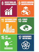
| TS08F: GNSS CORS Reference Stations and Networks – Session 2 for Technical Experts
Commission: 5, 7, ARN, IAG, IGS, UN-GGIM-Africa, UN-GGCE
Chair: Dr. Kevin Ahlgren, United States
Rapporteur: Dr. Chris Pearson, New Zealand
GNSS Reference Stations (aka CORS) are now commonplace in nearly every nation on Earth – either as standalone stations or part of a networked solution, and contribute to both scientific and civil applications. They can support multiple purposes, ranging from real-time surveying and positioning on land, from the air, and on water.
The ambitious vision for extending land administration across Africa is highly dependent on nations establishing their own national reference frame as well as regional reference frames
the establishment and sustained management of GNSS CORS infrastructure.
This session, is the second of two sessions, more technically focussed with a number of pertinent presentations followed by a panel discussion on sustainable CORS infrastructure and practices. The first session, introduced the subject: GNSS CORS Reference Stations in the context of geodetic infrastructure to support and sustain land administration.
Guiding Questions for Discussions:
- What can be done to better utilise GNSS infrastructure for science and climate change?
- Where can I find more information on operational GNSS CORS in Africa? How can I contribute?
- Where can I learn more about GNSS CORS, geodetic infrastructure, reference frames etc?
Aleksei Lapshin and Sergey Staroverov (Russia):
Creation and Development of Continuously Operating Networks in the Russian Federation. Yesterday, Today, Tomorrow. (12509)
[abstract] [paper] [handouts] [video] Saad Al-Qahtani, Abdullah Al-Thawwad, Abdulwasiu Salawu, Meshari Al-Shahrani, Abdullah Al-Qahtani and Othman Al-Kherayef (Saudi Arabia):
The Maintenance of KSA-CORS Network in Saudi Arabia's Desert Areas (12505)
[abstract] [paper] [handouts] [video] Peter T.Y. Shih (Chinese Taipei):
An Analysis of Clock Performance in GNSS Receivers for CORS Applications (12474)
[abstract] [paper] [handouts] [video] Christopher Pearson (New Zealand) and Sebastien Vielliard (France):
Trimble's Support for Modernized Datums in Africa (12426)
[abstract] [paper] [handouts] [video] Further Reading: Wang Junyi, Xu Caijun, Wang Xiaohang, Zhao Xiong and He Kefeng (China, PR):
The Coupling Evolution of Seismic Faults in the Eastern Margin of the Bayan Har Block Before and After Three ≥ M7.0 Earthquakes (12770)
[abstract] [paper] [handouts] [video] Faisal Al Balushi (Oman), Amir M. Abolghasem (Germany), Yousuf Al Wardi, Ismail Al Sheidi and Aseel Almusalhi (Oman):
A New Reference Frame for Oman, Derived by Precise Processing of the CORS Network (12396)
[abstract] [paper] [handouts] [video] Wayneworth Hamilton (Turks And Caicos Islands):
Development of a CORS Network for the Turks and Caicos Islands (12451)
[abstract] [paper] [handouts] [video] Christian Kartey Quarcoo, Ziggah Yao Yevenyo and Bernard Kumi-Boateng (Ghana):
Artificial Intelligence Approach to Predicting Local Crust Movement Using GNSS Continuous Operating Reference Systems Data (12376)
[abstract] [paper] [handouts] [video] |
Tuesday,
21 May
16:30–18:00
Adae Kesie, La Palm
| TS08G: Session en français - 3
Chair: Mr. Marc Vanderschueren, Belgium
Rapporteur: Ms. Godelive Phanzu Vangu, Congo, Democratic Republic of the
OPEN MEETING OF THE BOARD OF FGF
Réunion ouverte du Bureau de la FGF accessible à tous les membres de la FGF.
|
Tuesday,
21 May
16:30–18:00
Damba 1, La Palm
| Critical Emerging Areas for Global Work towards Gender Equality in the Land Sector
Commission: (GLTN)
Chair: Mr. Salaheldin Abukashawa, Sudan
Rapporteur: Ms. Roshni Sharma, Australia
Partners: Global Land Tool Network, UN-Habitat, International Federation of Surveyors (FIG), ISTIDAMA Center for Land and Environmental Governance, Namibia University of Science and Technology (NUST), University of East London, COLANDEF, Kadaster International, Traditional Authority in Zambia; Chief Chamuka, Arab Union of Surveyors (AUS) & Stand For Her Land (S4HL)
This interactive session will explore critical emerging issue areas for gender equality in the land sector and what partners within the Global Land Tool Network (GLTN) have learned through efforts to tackle them. The mini sessions will each feature an expert to provide key lessons learned and pose discussion questions related to the following thematic areas:
- Informal settlements and slums
- Urban/rural nexus—land tenure on the urban periphery
- Indigenous and customary settings
- Land and conflict settings
- Climate change
The sessions will address the use of gender responsive land tools and approaches to ensure that both processes and outcomes are gender responsive. This session is based on GLTN’s experiences using gender responsive land tools and approaches in the GLTN strategic priority thematic areas.
Guiding Questions for Discussions:
- What are the priority emerging areas for gender equality in land tenure, control and administration?
- What tools and approaches have been used to tackle gender equality and inclusion in each of these areas? Lessons learned?
- Why should gender equality be at the centre of the design, implementation, and monitoring of Fit for Purpose Land Administration initiatives? And what are the risks if it is not?
Presenters:
- Salaheldin Abukashawa, ISTIDAMA Center for Land and Environmental Governance
- Roshni Sharma, Co Lead VCSP
- Clarissa Augustinus, Chair FIG Task Force on Climate
- Cathrine Marenga, Namibia University of Science and Technology [handouts]
- Rafic Khouri, Arab Union of Surveyors
- Eugene Chigbu, Namibia University of Science and Technology
- Chief Chamuka VI, Traditional Authority in Zambia
- Nana Ama Yirrah, COLANDEF
- Hellen Ndungu, UN-Habitat
| | Wednesday, 22 May |
Wednesday,
22 May
07:30–09:00
Adae Kesie, La Palm
| FIG Presidents Meeting
Chair: Dr. Diane Dumashie, FIG President, United Kingdom
Rapporteur: Ms. Louise Friis-Hansen, FIG Director, Denmark
This event is convened by the FIG President and is reserved for Presidents or Heads of delegation of Member Associations (or their represewentatives)
|
Wednesday,
22 May
08:00–09:00
Royal Dragon - African Corner, La Palm
| TS09C: Regional Capacity Development Networks – Collaboration Forum 1
Chair: Mr. Mohammed Mamman Kabir, Chair FIG ARN, Nigeria
Rapporteur: Dr. Daniel Roman, Chair FIG Americas, United States
Capacity Development Networks (CDNs) should work collectively to address the local, national, regional and global challenges that influence capacity and capability development (CCD) of their survey and geospatial information professionals. This forum is an opportunity for all participants to contribute, and to “have your say” through respectful sharing and exchanging of experiences and information about CCD.
[handouts]
Session overview.
Welcome - Diane Dumashie, FIG President
UN-GGIM Africa/ AFREF
Education/training opportunities - Rosario Casanova, UN Academic Network/Commission 2
[handouts]
Land administration in the Africa region - Linus Pott, World Bank
[handouts]
Discussions on five challenges:
- What are the top FIVE challenges influencing CCD?
- How can these challenges be overcome?
- What should FIG (and like-minded organisations) do to support or assist CCD?
- What are the next tangible steps?
|
Wednesday,
22 May
08:00–09:00
Odwira, La Palm

| TS09E: Mapping the Surveying Profession’s Climate Impact Potential
Commission: YSN & TF Climate
Chair: Ms. Roshni Sharma, Australia
Rapporteur: Ms. Angela Anyakora, Nigeria
An interactive joint workshop with the Young Surveyors Network and Climate Compass Task Force
Our profession is unique both in interfacing with every other sector and industry on the planet, but moreso in its unique systems-thinking approach to solving problems. This innovative and inspirational workshop will fill you with renewed hope and enthusiasm for the future using the tools and knowledges of our profession to combat an increasingly urgent global challenge that affects us all – climate change.
Join the Young Surveyors Network and Climate Compass Task Force in this workshop where we’ll leverage audience engagement to validate and map out the plethora of ways that surveyors can use our expertise and knowledges to impact management and mitigation of climate-related impacts at all scales, now and into the future (e.g. ground surveys, using spatial data for measuring carbon, wildlife, mangrove forests, watershed rehabilitation, forest fires, and community impacts).
Guiding Questions for Discussions:
- What are the most relevant and urgent climate impacts for each of FIG’s geographical regions?
- What knowledges and expertise do surveyors have to make positive impacts for these?
- What are the gaps in the knowledges and expertise of surveyors? How might we fill these gaps?
- The surveying and climate agenda is rapidly evolving – how can surveyors lead in emergence in this space?
- How can the voices of marginalised groups, including young surveyors, be elevated and equitably heard in this endeavour?
Outline of the worshop:
Opening and Setting the Scene: 15 minutes
A short opening will be provided by the YSN and Climate Compass Task Force to provide an overview of the role of surveyors in the climate agenda (7 minutes), followed by a short presentation on climate change and resilient development in Africa (7 minutes).
Interactive workshop: 45 minutes
The group will then work as a whole and as smaller breakouts as necessary to ideate and brainstorm (in a facilitated manner) to map out the current and potential ways that the profession will continue to have a positive impact on climate. Participants will use post-it notes to write key climate action issues and place on wall.
|
Wednesday,
22 May
08:00–09:00
Kundum, La Palm

| TS09F: Advancing Surveying through Technology including Uncrewed Systems
Commission: 5
Chair: Dr. Chris Pearson, New Zealand
Rapporteur: Mr. David Avalos, Mexico
The introduction of autonomous platforms on the ground, in the air and on the water, has been both a boon for geospatial experts needing to acquire data over larger often hazardous environments, and for clients seeking a swifter completion of their surveying and mapping projects.
Accordingly there is a growing need on surveyors to become aware and proficient around autonomous systems, in particular on how to plan and benefit from them. This session shares a number of case studies on the use of autonomous technologies, and will have a panel discussion allowing questions from the audience.
Guiding Questions for Discussions:
- How can surveyors take advantage of today’s autonomous technology for tomorrow’s projects?
- How can surveyors remain as essential part of projects using autonomous technologies?
 AWARD WINNER: AWARD WINNER:
Janet Tangadzani, Charles Paradzayi and Tanaka Muromo (Zimbabwe):
Application of UAV-based Photogrammetry in Monitoring Slope Deformations in Open Pit Mining Environments: A Systematic Review (12400)
[abstract] [paper] [handouts] [video]
This is a peer reviewed paper.
Audrey Alajouanine (France):
Implementation of a Complete Process for the Collection, Processing and Use of UAV Multi-Spectral Data for Agriculture (12462)
[abstract] [paper] [handouts] [video] Franz Okyere (Ghana), Lena Augner, Fabius Limpaecher (Germany), Joshua Oddoye (Ghana), Ansgar Brunn, Franziska Heering (Germany), Tracy Arthur and Prosper Fometi (Ghana):
Enhancing Ambulance Accessibility in Deprived Regions: A Drone-Based Spatial Data Solution for Ashaiman, Greater Accra (12479)
[abstract] [paper] [handouts] [video] Further Reading: Ngoc Ha Hoang (Vietnam):
Combining Gnss with Terrestrial Measurement Systems for Modernizing the Coordinate Systems in Vietnam (12513)
[abstract] [paper] [handouts] [video] |
Wednesday,
22 May
09:15–11:15
Plenary Dome, La Palm
| PLENARY SESSION 3: Your World - Our World: Inclusive Urban Geospatial Infrastructure
Chair: Mr. Mikael Lilje, FIG Vice President, Sweden
Drawing on Your world- our world that speaks to the diversity of approaches between the generations. This acknowledges why our profession needs to be connected to tackle the incredible pace of change occurring both on planet and in our societies. Our speakers will explore connectivity in urban environments and required professional practices, including government led work and city level governance. And, the ever changing role of geo and data technology in our professional practice- i.e. Ai, geo-data, geo-informatics . will refer to geo- informatics and the importance of the youth to highlight that our profession is in transition.
 |
Mr. Oumar Sylla,
Director, Regional Office for Africa (ROAf)
United Nations Human Settlements Programme (UN- Habitat)
THE IMPORTANCE OF LAND
TENURE IN RAPIDLY URBANIZING AFRICA:
DEMONSTRATING THE CENTRALITY OF LAND
IN ACHIEVING THE SDGS (GOAL 11) AND
THE AFRICA VISION 2063 ACCOMPANYING
PERSON
[bio]
[Abstract]
[handouts]
|
 |
Mr. Bryn Fosburgh,
FIG Foundation President
Senior Vice
President Trimble
DIGITAL TRANSFORMATION,
MACHINE LEARNING, AUTOMATION , AND
ARTIFICIAL INTELLIGENCE (AI): THE
NEXT INDUSTRIAL REVOLUTION
[bio]
[Abstract]
[handout]
|
 |
Mr. Adama Sarr,
Mayor, Senegal (recently FIG Young
Surveyor)
YOUTH AND TECH IN THE CITY
[bio]
[Abstract]
[handouts]
|
 |
Prof. Robert Kaden,
BIM/Digital Twin Specialist
DIGITAL TWINS OF THE BUILT
ENVIRONMENT - CHALLENGES AND PERSPECTIVES FOR
SURVEYORS'
[bio]
[Abstract]
[handouts]
|
|
Wednesday,
22 May
11:15–11:45
Exhibition Hall, La Palm
| Morning Break |
Wednesday,
22 May
11:15–11:45
Plenary Dome, La Palm
| Deep-Dive Session on SDG
Chair: Ms. Rosario Casanova, Uruguay & Ms. Shirley Tendai Chapunza, Zimbabwe
Join the plenary speakers on stage for a dedicated Q&A session. Dive deeper into the topic of urban environments and the digital transformation for a more inclusive and sustainable planet. Share knowledge, brainstorm and formulate actions for FIG to take the inspiring stories and lessons learned on board to achieve the Sustainable Development Goals.
|
Wednesday,
22 May
11:45–13:15
Plenary 1, La Palm
| TS10A: Good Practices of African Academic Institutions in Responding to the Needs of the Land Sector
Chair: Prof. John Tiah Bugri, Ghana
Rapporteur: Mr. Oumy Donde Faye and Patrick Opoku, Ghana
The session will outline the importance of sound land governance curricula to address the needs of the labor market. Furthermore, it will show how support towards research can influence evidence-based decisions related to land governance. Finally, the sessions seeks to underline the importance of creating platforms such as NELGA and their contribution to policy reform and implementation.
[handouts]
Guiding questions for discussion:
- What role do institutions of higher education play in land governance?
- What is the Network of Excellence on Land Governance in Africa (NELGA) and how does it contribute to the implementation of the AU Agenda on Land?
- What are good practices on land governance curricula development? How do they ensure labour market integration of graduates?
- What are good practices on evidence-based decision making in land governance?
Speakers:
- Chikolwa Nsama, on behalf of the African Union Commission, Department of Agriculture, Rural Development, Blue Economy, and Sustainable Environment (DARBE)
[handouts]
- Prof. Eugene Chigbu, Coordinator, NELGA Southern Africa, Namibia University of Science and Technology
[handouts]
- Jonas Kramp, SLGA, GIZ African Union, Addis Ababa [handouts]
- Dr. Agnes Mwasumbi, Coordinator, NELGA East Africa, Ardhi
University [handouts]
- Nana Ama Yirrah, COLANDEF, Ghana
|
Wednesday,
22 May
11:45–13:15
Plenary 2, La Palm

| TS10B: Digital Technologies in Construction – The Future Vision of BIM
Commission: 10
Chair: Ing. Robert Sinkner, Czech Republic
Rapporteur: Mr. Humphrey Togbe Amegadoe, Ghana
BIM has continued to progress with new trends evolving. It is important that we look at the future vision of BIM in areas such as data repositories and different models open to it as we address the future of BIM.
Guiding Questions for Discussions:
- What are the new trends in BIM?
- Why is this awareness important?
- Is Bim required at Higher education Level?
- Theory vs Practice of BIM?
Alexander Bong (Germany), Vladimir Nyvlt (Czech Republic), Hugo Rodrigues (Portugal) and Christian Clemen (Germany):
BIM for Higher Education – Intermediate report from the ERASMUS+ BIM4HEI project (12596)
[abstract] [paper] [handouts] [video] Gabriel Nani and Emmanuel Wiribare (Ghana):
Adoptability of Augmented Reality as a Supplementary Tool in Architecture, Engineering and Construction (AEC) Education in Ghana (12620)
[abstract] [paper] [handouts] [video] Christoph Frey, Christian Dahmen and Christian Clemen (Germany):
ETL processes for the conversion of parcels (2D) and terrain models (2.5D) to openBIM projects using IFC (12626)
[abstract] [paper] [handouts] [video] Kang Seunghun (Republic of Korea):
Use Case of National Digital Twin Standard for Buildings (12547)
[abstract] [paper] [handouts] [video] Krzysztof Bakuła (Poland):
UAV Photogrammetry and Lidar Data in Inventory and Management of Civil Infrastructure Facilities Using Digital Twin (12673)
[abstract] [paper] [handouts] [video]
Esther Oluwafolakemi Ola-Ade, Modupe
Oluwaseyi Ajayi (Nigeria) and Adetayo Onasosen (South
Africa):
Benefits and Challenges of 5d Bim Adoption: Perception of
Quantity Surveyors (12743)
[abstract] [paper]
[handouts]
[video]
Further Reading: Choi Yin, Chelsie Chan, Lung Yan, Christy CHAN and Ki, Vanessa Ma (Hong Kong SAR, China):
Development of the Government BIM Data Repository in Hong Kong (12498)
[abstract] [paper] [handouts] [video] |
Wednesday,
22 May
11:45–13:15
Stage area - "the Market", La Palm

| TS10D: Land Management Tools for Spatial Governance
Commission: 8
Chair: Surv. Jonathan Zinzi Ayittey, Ghana
Rapporteur: Mr. Charles Atakora, Germany
Acquisition and reallocation of land are important land management processes, which have an influence on spatial planning. Hence aligning the use of these tools, spatial governance is paramount. This session will explore the frontiers of the nexus of land management and spatial governance.
Guiding Questions for Discussions:
- What challenges and opportunities for land management tools in spatial planning?
- What are the spatial governance needs in the application of land management tools?
- How do we leverage the push of technologies in land management for spatial planning?
Mustapha Okyere, Eric Paul Tudzi and Bernard Kumi-Boateng (Ghana):
Land-Based Economic Displacement and Livelihood Reconstruction; A survey of Literature (12492)
[abstract] [paper] [handouts] [video] James Chakwizira and Mac Mashiri (South Africa):
Sustainable and resilient priority human settlement development areas: A case of Musligwa local municipality, South Africa (12686)
[abstract] [paper] [handouts] [video] Adrianna Czarnecka, Katarzyna Rędzińska (Poland), Oleksandra Dyda and Olha Pokladok (Ukraine):
Current Planning Practices for Implementing Nature-Based Solutions in Rural Development Projects in Poland and Ukraine (12721)
[abstract] [paper] [handouts] [video] Ogechi Addline Wechie, Kpobari Peter Visigah and Iyenemi Ibimina Kakulu (Nigeria):
Spatial Planning as a Tool for Halting and Reversing Land Degradation in Peri-Urban Towns in Nigeria (12566)
[abstract] [paper] [handouts] [video] Davie Chilonga (Malawi), Angel Shlomo and Carsten Bjornsson (USA):
Managing Urban Expansion – a Case Study from Malawi (12661)
[abstract] [paper] [handouts] [video] Kwabena Obeng Asiama (Ghana):
Governance in the Role of Customary Land Tenure Institutions in Peri-Urban Development (12674)
[abstract] [paper] [handouts] [video] Helén Elisabeth Elvestad (Norway):
Is Land Consolidation Necessary? - a Theoretical Perspective on Norwegian Land Consolidation (12387)
[abstract] [paper] [handouts] [video]
This is a peer reviewed paper. |
Wednesday,
22 May
11:45–13:15
Odwira, La Palm

| TS10E: Investment and Finance Issues in Land Administration
Commission: 7 & 9
Chair: Ms. Christelle van Den Berg, Netherlands
Rapporteur: Mr. Rindert Vos, Netherlands
We’ll look at investment and finance as it relates to land administration from multiple perspectives including funding land system developing; generating revenue; business models; and much more.
Guiding Questions for Discussions:
- What tools are out there?
- What approaches are used?
- Which ones work well?
- Which don’t? What are the gaps that need to be filled?
Bertrand Mercier (France):
A Private Public Partnership Between Land Administration and Surveyors to Serve Cadastre and Land Registry's Update and Sustainability (12518)
[abstract] [paper] [handouts] [video] Raja Ram Chhatkuli, Jagat Deuja, Ganesh Prasad Bhatta (Nepal) and Hellen Ndungu (Kenya):
Land Banking for the Poor and Vulnerable: How Relevant in Nepal? (12571)
[abstract] [paper]
[handouts] [video] Torben Juulsager (Denmark):
Land Surveyor Business Areas in Planning and Realization of Renewable Energy Plants - a Danish Case Study (12542)
[abstract] [paper] [handouts] [video] Jones Ofori-Boadu (Ghana) and Carsten Bjornsson (USA):
The modern trends in Land Administration coupled with a Private Sector arrangement for technical support and funding (12662)
[abstract] [paper] [handouts] [video] Benjamin Ajabuin (Canada), Joseph Kidido and Pascal Zini (Ghana):
Compensation Governance Framework: the Perceptions of Community Members in Selected Mining Communities in Ahafo Region, Ghana (12456)
[abstract] [paper] [handouts] [video] |
Wednesday,
22 May
11:45–13:15
Kundum, La Palm
| TS10F: Mapping the Plastic
Commission: 4 & TF Climate
Chair: Mr. Gordon Johnston, United Kingdom
Rapporteur: Mr. Alexander Ayettey, Ghana
Working Group 4.3 will present the results of plastic waste surveys recently undertaken in Ghana and Sri Lanka. The session is primarily focussed on discussing ways in which the accurate mapping and classification of plastic waste can be offered as a relatively cost effective mapping solutions to communities inundated with plastic waste to assist with the rectification of the problem but must juggle competing demands on stretched budgets.
The first presentation will be the results surveys undertaken at the Korle Lagoon in Accra, Ghana, which is currently recognised as one of the most polluted water bodies on earth. The sites were surveyed using a UAV. Two orthophoto datasets were captured, one in February 2024 and the other in March of this year, by students from the University of Mines and Technology (UMaT), Tarkwa, Ghana under the direction of Senior Lecturer, Dr Naa Dedei Tagoe and processed using deep learning algorithms developed by Working Group 4.3. The presentation will discuss ways in which this solution can assist Ghanaian government agencies and the community in their efforts to restore this once beautiful water body.
Presenters: – Mr. Simon Ironside, New Zealand and Ms. Naa Dedei Tagoe, Ghana
[handouts]
The second presentation will be the results of sites surveyed along the Kelani River, which runs through Colombo, Sri Lanka, close to the river mouth. These UAV surveys captured multispectral and aerial imagery and were undertaken in April 2024 by students from the Sabaragamuwa University of Sri Lanka under the direction of Dr Eranda Gunathilaka. The data was also processed using the deep learning algorithms developed by Working Group 4.3. This presentation will also discuss ways in which our solution can be used to assist the Sri Lankan government and the wider community in remediating this and other waterways polluted by plastic waste. The attached photos are from the Sri Lankan surveys.
Presenter: Dr. Malavige Don Eranda Kanchana Gunathilaka, Sri Lanka
|
Wednesday,
22 May
11:45–13:15
Adae Kesie, La Palm
| TS10G: Cadastral Innovations World Tour
Commission: 7
Chair: Mr. Charl-Thom Bayer, Denmark
Rapporteur: Ms. Katie Pickett, United States
This session brings an overview on many country-level cadastral systems, innovations, developments and challenges - inviting presenters and participants to compare and contrast them, with a view to helping further spark cross-country cadastral comparison.
Guiding Questions for Discussions:
- What’s happening across African, Asian, and European countries?
- Can we make meaningful comparisons?
- What do we need to help us do this better?
Panel Discussion: Pascal Zini, Benjamin Ajabuin and Mustapha Okyere (Ghana):
The Practice of Re-entry and Forfeiture and its Implication on Land Administration in Ghana (12393)
[abstract] [paper] [handouts] [video]
Fabrice Kossou, Damien N'Nledje (Benin) and Christelle van den Berg (Netherlands):
From Paper to Pixels: Benin’s Journey to a Nationwide Digital Land Registry and Cadastre (12614)
[abstract] [paper] [handouts] [video]
Leiv Bjarte Mjøs and Arve Leiknes (Norway):
Documentation of Property Boundaries in Norway – the Røst Case (12643)
[abstract] [paper] [handouts] [video]
Abebaw Abebe Belay (Ethiopia):
Comparative Analysis of Land Policy Instruments to Tackle Land Fragmentation (12699)
[abstract] [paper] [handouts] [video]
Glenn Campbell, Kanchana Kariyawasam, Armin Agha Karimi and Rangika Palliyaarachchi (Australia):
What Effect Will Electronic Cadastral Survey Plans in Australia Have on Surveyor’s Intellectual Property? (12398)
[abstract] [paper] [handouts] [video]
This is a peer reviewed paper.
|
Wednesday,
22 May
11:45–13:15
Damba 1, La Palm
| TS10H: Empowering and Improving the Life of Women in Muslim Communities through increased access to Housing, Land and Property
Commission: GLTN
Chair: Mr. Salaheldin Abukashawa, Sudan
Rapporteur: Mr. Rafic Khouri, France
The global gender gap struggles to narrow. Women still face a disproportionate number of obstacles in accessing productive resources, land and housing compared to men in their communities.
Are these obstacles different in nature and more severe in Muslim communities? Are there specific actions and entry point that proved effective in closing the gender gap in Muslim communities and Muslim-majority countries? How do customary land governance and religious practices intersect in contexts of legal pluralism with regard to gender dynamics?
Building on the research and conceptual frameworks developed by Global Land Tool Network and Arab Land Initiative’s partners in the past years, the session will provide some data and case studies and will propose some recommendations for debate.
[handouts]
Guiding Questions for Discussions:
- With regard to land, housing and property rights, what are the specific needs and solutions for women living in Muslim communities?
- What are the key interventions that proved to have a positive impact?
- Key reflections on addressing women’s land rights in legally pluralistic contexts.
- Key set of action points for land professionals.
Panellists:
Salaheldin Abukashawa, Istidama
Clarissa Augustinus, Chair, FIG Task Force on Climate
Oumar Sylla, Global Land Tool Network,
Rafic Khouri, Arab Union of Surveyors [handouts]
Hellen Ndungu, Global Land Tool Network [handouts]
|
Wednesday,
22 May
11:45–13:45
Royal Dragon - African Corner, La Palm
| CASLE MEETING
Chair: Mr. James Kavanagh, United Kingdom
|
Wednesday,
22 May
13:15–14:30
Restaurant, La Palm
| Lunch |
Wednesday,
22 May
13:15–14:30
Stage area - "the Market", La Palm
| Esri: Meet and Greet with Esri
Meet and greet with Esri” where you will get a unique chance to hear more about Esri, who we are, our ethos, where we came from, what we actually do, and how we help you to be successful. As someone famous once said – Esri is one of the best kept secrets in the world – So, join us at this event for some fun/real facts about Esri.
FIG Corporate Platinum Member:

|
Wednesday,
22 May
14:00–17:15
| Social Tour: Sip and Paint
|
Wednesday,
22 May
14:00–17:30
| Technical Tour: Tema Port Expansion
Meridian Ports Services (MPS) recently completed a USD 1 billion
investment in constructing MPS Terminal 3, the third container terminal at Tema Port, Ghana. This terminal boasts state-of-the-art
equipment and efficient service delivery, enhancing the Port of
Tema’s reputation as the best performing container port in West
and Central Africa.
|
Wednesday,
22 May
14:30–16:00
Kwafie - FIG President's Room, La Palm
| FIG Corporate Members Meeting
Chair: Dr. Diane Dumashie, FIG President
Rapporteur: Ms. Louise Friis-Hansen, FIG Director
|
Wednesday,
22 May
14:30–16:00
Plenary 1, La Palm
| TS11A: GIS, BIM, Digital Twin, and NSDIs: Pushing-forward the Smart City Vision
Commission: 3
Chair: Mr. Daniele Brancato, Italy
Rapporteur: Dr. Enrico Rispoli, Italy
Explore how these technologies and frameworks are driving innovation, sustainability, and efficiency in urban planning and development. Experts will share insights, case studies, and best practices showcasing the transformative impact of GIS, BIM, Digital Twins, and NSDIs in realizing the Smart City vision and creating livable, resilient urban environments.
Guiding Questions for Discussions:
- How can GIS, BIM, Digital Twins, and NSDIs contribute to advancing the Smart City vision and promoting sustainable urban development?
- What are the key challenges and opportunities in integrating these technologies and frameworks into Smart City planning and development processes?
- What are the ethical, legal, and technical considerations associated with the use of GIS, BIM, Digital Twins, and NSDIs in Smart City projects?
- How can cities overcome barriers and challenges to effectively integrate GIS, BIM, Digital Twins, and NSDIs into their Smart City strategies and initiatives?
Kazimierz Becek and Dominik Kazmierczak (Poland):
Assessing Vertical Accuracy of Digital Elevation Model Using Actual Flood Line as Reference (12500)
[abstract] [paper] [handouts] [video] Martin Saeter (Norway):
From Spatial Data Infrastructure to Geospatial Knowledge Infrastructure: the Role of Management and Financing Models (12603)
[abstract] [paper] [handouts] [video] Robert Jurzitza, Oliver Buchmann, Markus Muerth and Robert Kaden (Germany):
BIM and GIS - Bidirectional Data Exchange for Renewable Energy Planning (12612)
[abstract] [paper] [handouts] [video] Luisa Rodríguez Ocaño, Alexander Paez Lancheros and Johan Andrés Avendaño (Colombia):
Roof Capture and Classification for Building Characterization from High-Resolution Images (12653)
[abstract] [paper] [handouts] [video] Liang Zhai, Qin Yan, Zhendong Liu and Po Liu (China, PR):
A Brief Overview of 3D Real Scene Construction in China (12773)
[abstract] [paper] [handouts] [video] Further Reading: Fei Man Chu, Huen Ki Chan and Ka Lam Yip (Hong Kong SAR, China):
Development of Underground Utilities Information System (UUIS) in Hong Kong Special Administrative Region (12447)
[abstract] [paper] [handouts] [video] |
Wednesday,
22 May
14:30–16:00
Plenary 2, La Palm
| TS11B: Land Administration Education
Commission: 2, 7, GLTN, NELGA Southern Africa
Chair: Dr. Simon Hull, South Africa
An opportunity to hear about the latest innovations in land administration education. In this broad and rapidly changing domain, educators need to keep abreast of the latest research and approaches and incorporate these into their curricula. In this session, we will hear some examples of how this is being done.
Guiding Questions for Discussions:
How is land administration evolving in scope and purpose?
- How should educators respond to the changing needs of land professionals in the face of current and future global and regional challenges?
- What is new in the field of land administration education?
Simon Hull, Jennifer Whittal and Rosalie Kingwill (South Africa):
What Is Land Administration? Exploring an Inclusive Definition. (12388)
[abstract] [paper] [handouts] [video] Davey Edwards (USA) and Wiejak-Roy Grazyna Aleksandra (United Kingdom):
Regulation and Accreditation of Surveying Professions - USA and UK - Challenges Going Forward (12421)
[abstract] [paper]
[handouts] [video] Simon Hull, Siphiwe Mphuthi, Patroba Odera, Moreblessings Shoko, Kaveer Singh and Jennifer Whittal (South Africa):
From Geomatics to Geospatial Science and Surveying: Undergraduate Curriculum Review at the University of Cape Town (12450)
[abstract] [paper] [handouts] [video] Angel Collado (Spain) and Kwame Tenadu (Ghana):
What is Geomatics?: Providing Clarity in the Academic and Professional Context (12515)
[abstract] [paper] [handouts] [video] Diana María López Cardona and Johan Andrés Avendaño Arias (Colombia):
Intercultural School of Geography for Life
Community Capacity Building Project for Multipurpose Cadaster
(12543)
[abstract] [paper] [handouts] [video] Evi De La Rosa Ricciardi (Puerto Rico):
Embracing Robotics and Artificial Intelligence in Land Surveying Education (12684)
[abstract] [paper] [handouts] [video] |
Wednesday,
22 May
14:30–16:00
Royal Dragon - African Corner, La Palm
| TS11C: Regional Capacity Development Networks – Collaboration Forum 2
Chair: Mr. Mohammed Mamman Kabir, Chair FIG ARN, Nigeria
Rapporteur: Dr. Daniel Roman, Chair FIG Americas, United States
Capacity Development Networks (CDNs) should work collectively to address the local, national, regional and global challenges that influence capacity and capability development (CCD) of their survey and geospatial information professionals. This forum is an opportunity for all participants to contribute, and to “have your say” through respectful sharing and exchanging of experiences and information about CCD.
[handouts]
Discussions on five challenges:
- What are the top FIVE challenges influencing CCD?
- How can these challenges be overcome?
- What should FIG (and like-minded organisations) do to support or assist CCD?
- What are the next tangible steps?
|
Wednesday,
22 May
14:30–16:00
Stage area - "the Market", La Palm
| TS11D: Measuring Progress, Driving Impact: Surveyors at the Forefront of Sustainable Development
Commission: 2, 7 & TF SDG
Chair: Dr. Marisa Balas, Mozambique
Rapporteur: Dr. Ronald Ssengendo, Sweden
Surveyors are at the forefront of achieving the 2030 Agenda both as data providers and as drivers of impact. This session seeks to examine the contribution of FIG, the FIG Commissions and the global surveying community towards achieving the SDGs. It will explore the progress so far made by surveyors and discuss what surveyors can to do make rapid progress possible.
Guiding Questions for Discussions:
- What is the strategic Influence of surveyors in Achieving SDGs?
- How can we as surveyors measure progress towards achieving the SDGs?
- What are the gaps and opportunities for action that exist?
Paula Dijkstra (Netherlands), Marisa Balas (Mozambique), Rosario Casanova (Uruguay), Søren Brandt Pedersen (Denmark) and Ronald Ssengendo (Uganda):
2030 Agenda - in the minds of all FIG Commissions, Members & Delegates (12656)
[abstract]
[paper] [handouts] [video] Rosario Casanova and Paula Teperino (Uruguay):
Sharing Experiencies of How to Include Training of SDG in Education (12669)
[abstract] [paper] [handouts] [video] Elvena Hayford and Ricardo Penehafo (Namibia):
Communicating SDGS In the Land Sector: Gaps and Opportunities for Action in Southern Africa. (12639)
[abstract] [paper]
[handouts] [video] |
Wednesday,
22 May
14:30–16:00
Odwira, La Palm
| Forum for Regional Bodies (FoRB)
Chair: Mr. Victor Seda, 1VP of APPAT
|
Wednesday,
22 May
14:30–16:00
Kundum, La Palm
| TS11F: Exploring Climate Issues Together - Interactive Workshop Session
Commission: TF Climate
Chair: Ms. Roshni Sharma, Australia
Rapporteur: Dr. Clarissa Augustinus, Ireland
Find out about the latest thinking from practitioners on climate and surveying - but more than that, come along to our interactive participatory session and tell us what you are doing and thinking! And a tutorial on Monitoring the Environmental Impact of Artisanal Mining Activities using Google Earth Engine (GEE) and Esri Story Maps.
Guiding Questions for Discussions:
- What have we learnt about climate and surveying in the first year of the Climate Compass Task Force through its webinars and seminars?
- What are surveyors already doing in the areas of land, water, marine surveying, and climate?
- What are the key opportunities and gaps for surveyors working in this field?
Introduction by chair and Opening by the FIG President, Diane Dumashie.
Presentation of livescribed recording of the three February 2024 Task Force Global Seminars
Panel discussion on what we learnt from the Global Seminars from our different specialties: Naa Dedei Tagoe, Cromwell Manaloto, Angela Anyakora, Kwabena Asiama, David Elegbede, Simon Ironside, Gordana Jakovljevic & Clarissa Augustinus.
Interactive participatory discussion with participants following panel discussion.
Advertise the key climate papers to attend in different Commission sessions.
Short tutorial of 40 minutes on Monitoring the Environmental Impact of Artisanal Mining Activities using Google Earth Engine (GEE) and Esri Story Maps by Naa Dedei Tagoe and Kate Grillo.
|
Wednesday,
22 May
14:30–16:00
Adae Kesie, La Palm

| TS11G: Land Policy Issues and Innovations
Commission: 7 & UN-GGIM EG-LAM
Chair: Dr. Eva-Maria Unger, Austria
Rapporteur: Mr. Anthony Arko-Adjei, Ghana
Explore country- and international-level initiatives, implementations and challenges relating to land policy. Updates on the UNGGIM Framework for Effective Land Administration (FELA) will also be provided.
Guiding Questions for Discussions:
- Is the global agenda on track?
- What about at the national level?
- What is the role of land administration?
- What is the role of FIG and UN-GGIM?
Eva-Maria Unger (Netherlands), Amalia Valesco (Spain), Joep Crompvoets (Belgium) and Rohan Bennett (Netherlands):
Framework for Effective Land Administration (FELA): Research Synthesis (12697)
[abstract] [paper] [handouts] [video] Nikola Vučić and Jelena Unger (Croatia):
Revitalizing of the Cadastre Has Always Depended on State Policy (12506)
[abstract] [paper] [handouts] [video] Mamadou Mballo, Serge Vutegha (Democratic Republic of Congo), Gitau John, Oumar Sylla and Hellen Ndung'u (Kenya):
Land Reforms and Implementation of the Framework for Effective Land Administration (FELA): a Case Study for Customary Land Registry Implementation in the Democratic Republic of Congo (12510)
[abstract] [paper] [handouts] [video] Oyedokun Abiodun and Joseph Odumosu (Nigeria):
Land Administration and Policy Issues in the Nigerian Scenario: An Overview (12430)
[abstract] [paper] [handouts] [video] Opeyemi Michael Ajayi, Kirsikka Riekkinen and Oluwafemi Adekola (Finland):
Exploring Technology Integration Through FELA in Nigeria (12501)
[abstract] [paper] [handouts] [video] |
Wednesday,
22 May
14:30–16:00
Damba 1, La Palm
| TS11H: Valuation of Unregistered Land – Next Stages for Non-Market Value, Expropriation and Extractive Industries
Commission: FIG, RICS, IVSC, CASLE, FGF, UN GLTN
Chair: Mr. James Kavanagh, United Kingdom
Rapporteur: Dr. Michael McDermott, Australia
The Valuation of Unregistered Land (VUL) manual has been gaining significant traction and adoption in land valuation for large-scale land acquisition in the global south. The expert group has engaged with the World Bank, IGAD and numerous national land commissions and professional surveying institutions and is developing a better understanding of this complex and often fractious area of practice. A French translation will also be presented.
Guiding Questions for Discussions:
- What is the impact of non-market issues on VUL?
- What are the basic metrics on the possible costs of re-establishment of livelihoods?
- Is the continuum of land rights still valid?
- What are our initial comments on extractive industries?
James Kavanagh (United Kingdom):
Unregistered Land Valuation (UN GLTN manual) - Fair Compensation for a Just Transformation (12442)
[abstract] [paper] [handouts] [video]
STDM Valuation of Unregistered Land
Eva-Maria Unger, Chair STDM Advisory Committee,
Abdullah Kara, LADM II Development Team &
John Gitau, UN-Habitat GLTN
[handouts]
Value Through Negotiation Committees
Kwabena Obeng Asiama, Chair, FIG Commission 8
[handouts]
|
Wednesday,
22 May
16:00–16:30
Exhibition Hall, La Palm
| Afternoon Break |
Wednesday,
22 May
16:30–18:00
Plenary 1, La Palm
| TS12A: Local Initiatives to Spatial Information Modelling
Commission: 3
Chair: Mr. Leonardo Franchi, Italy
Rapporteur: Ms. Sara Gepponi, Italy
Explore the power of collective action, community engagement, and bottom-up approaches in addressing societal challenges, promoting sustainable development, and fostering positive change. Experts will share insights, case studies, and best practices showcasing the impact of crowdsourced and grassroots initiatives across diverse domains and geographic scales.
Guiding Questions for Discussions:
- What are the key characteristics and defining features of successful crowdsourced and grassroots initiatives, and how do they contribute to progress and positive change?
- What are some notable examples and case studies of crowdsourced and grassroots initiatives addressing global and local challenges, and what lessons can be learned from their experiences?
- How are crowdsourced and grassroots initiatives utilizing spatial data and technology, and community engagement to drive decision-making, advocacy, and action?
- What are the main challenges and barriers faced by crowdsourced and grassroots initiatives, and how can they be overcome to achieve greater impact and sustainability?
- How can crowdsourced and grassroots initiatives contribute to achieving the Sustainable Development Goals and advancing social, environmental, and economic development agendas?
Felix Tabase, Issaka Yakubu, Prosper Basommi Laari and Clement Maunger Dugbatey (Ghana):
Prediction Of Urban Expansion In The Upper Shama Area Using Artificial Neural Networks (12416)
[abstract] [paper] [handouts] [video] Leonardo Franchi, Enrico Davoli, Sara Gepponi and Daniele Camele (Italy):
Real-Time Mapping of the Network of Waterways and Sewers on Italian Territory (12502)
[abstract] [paper] [handouts] [video] Torbjørn Mandahl Pedersen (Denmark) and Naa Dedei Tagoe (Ghana):
A Smartphone-based Reality Capture Solution for Digital Mapping of Subsurface Utilities (12511)
[abstract] [paper] [handouts] [video] Rindert Vos and Gerard Dabroek (Netherlands):
Transparency Versus Security of Privacy-Sensitive Data: How to Deal with This Tension as a (public) Organisation (12522)
[abstract] [paper] [handouts] [video] Firas Fahoum (Israel):
The Use of Multiple Methods to Map the City of Jerusalem and It's Use as a Foundation for a Smart City (12730)
[abstract] [paper] [handouts] [video] |
Wednesday,
22 May
16:30–18:00
Plenary 2, La Palm
| TS12B: Diversity and Collaboration - How Experts can work together to improve transparency
Commission: 9
Chair: Dipl.-Ing. Peter Ache, Chair FIG Commission 9, Germany
Rapporteur: Mr. James Kavanagh, United Kingdom
Transparency in the property market is a fine word. But making it a reality requires a great deal of effort. We experts must demand that property market data, valuation standards and the presentation of property market information be adapted to today's requirements and used by the state. It is a task for all professionals to act together. This session should help to bring together associations that are committed to improving transparency.
Guiding Questions for Discussions:
- what is a clear and unambiguous definition of transparency in the property market?
- how open should data on property sales be?
- how open should information on property ownership rights be?
- what role do government agencies play in this process?
Grazyna Wiejak-Roy (United Kingdom), Peter Ache, Eva Katharina Neubrand (Germany), Bastiaan Reydon (Netherlands) and James Kavanagh (United Kingdom):
Transparency in the Real Estate Market – a Global Comparative Study (12458)
[abstract] [paper]
[handouts] [video] Gad Asorwoe Akwensivie (Ghana):
Real Estate in Africa - Trends and Forecasts (12700)
[abstract] [paper] [handouts] [video] Agnes Mwasumbi and Komu Felician (Tanzania):
Implementation of International Safeguard Standards in Involuntary Resettlement Schemes- Experience from Tanzania (12578)
[abstract] [paper] [handouts] [video] |
Wednesday,
22 May
16:30–18:00
Royal Dragon - African Corner, La Palm

| TS12C: The African Woman Land Professional and Good Land Governance in Africa: Challenges and Opportunities
Chair: Mr. Mohammed Mamman Kabir, Chair ARN, Nigeria
Rapporteur: Dr. Marisa Balas, Mozambique
While women constitute almost 50 percent of the population in Africa and play crucial roles in the continent’s land use and development, they are underrepresented in ownership, access, and decision making on how the African land is used and governed. In land professional spaces, women constitute a decimal and silence minority. In many countries, they constitute less than 1 percent of the membership of the registered land professionals. There are even much fewer professional associations where women occupy leadership positions in Africa. This situation constitutes one of the main challenges in provision of good land governance and in the attainment of SDGs, particularly Goals 5 and 10.
In the bid to address these challenges, the FIG-ARN convenes a meeting of African women land professionals who are attending the FIG 2024 WW in Accra, Ghana. The meeting will review some of these challenges and develop strategies to address the issues. The meeting shall work towards the First All African Women Land Professional Associations Conference in the course of the year 2024.
[handouts]
Guiding Questions for Discussions:
- What are the challenges and cultural hurdles that African women land professionals face in their roles as key stakeholders in the quest for good land governance in Africa?
- What strategies can be developed to counter and overcome those challenges?
- How can women land professionals accelerate the attainment of gender responsive land administration and promote green, resilient, and inclusive land development in Africa?
- How can we increase the number, profile, and visibility of African women land professionals in the actualization of SDGs and the Africa Agenda 2063?
|
Wednesday,
22 May
16:30–18:00
Odwira, La Palm

| TS12E: Digitally Transformed Land Governance in Action
Commission: 7 & 8
Chair: Dr. Jaap Zevenbergen, Netherlands
Rapporteur: Mr. Walter Dachaga, Germany
Digitalisation, digitisation and digital transformation are gaining prominence in policy efforts in many land-related sectors around the world. This session aims to showcase best practices from cross-sectoral digital transformation efforts that (potentially) bridge land administration, land management, land use planning and spatial governance.
Guiding Questions for Discussions:
- Is the integration of land tenure, land registry and land use planning data and processes actually taking place?
- How does digital transformation support this integration?
- What are challenges and opportunities related to the operationalisation?
Leonardo Franchi, Greta Crescimbeni and Enrico Davoli (Italy):
The Italian Cadastral Cartography System.automatic Real-Time Update and Dynamic Online Services (12628)
[abstract] [paper] [handouts] [video] Teimuraz Gabriadze and Elene Grigolia (Georgia):
Electronic Minutes Application - Catalyst for Systematic Land Registration in Georgia (12703)
[abstract] [paper] [handouts] [video] Elene Grigolia and Teimuraz Gabriadze (Georgia):
Smart Contract - New Era of Subsequent Registration of Immovable Property in Georgia (12704)
[abstract] [paper] [handouts] [video] Dorus Kruse (Netherlands):
The Growing Role of Europe with High Value Datasets and the Digital Transformation of the Spatial Data and 3d. (12713)
[abstract] [paper] [handouts] [video] Further Reading: Benjamin Armah Quaye (Ghana):
Modernizing Land Administration in Ghana: the Transformative Initiatives of the Lands Commission (12444)
[abstract] [paper] [handouts] [video]
Note: This paper was not presented at the conference. |
Wednesday,
22 May
16:30–18:00
Kundum, La Palm
| TS12F: Climate Resilience Actions for the Future
Commission: TF Climate; 2, 3, 7, 8
Chair: Dr. Kwabena Asiama, Chair, FIG Commission 8, Ghana
Rapporteur: Ms. Roshni Sharma, Australia
Surveyors can address the challenges presented by climate change by using different approaches for a range of situations. Innovative approaches include: integrating surveying and climate data from earth observation to ground surveys, using spatial data for measuring carbon, wildlife, mangrove forests, watershed rehabilitation, forest fires, and community impacts.
[handouts]
Guiding Questions for Discussions:
- What were the most difficult aspects of linking surveying and climate data in your work?
- What were the barriers and opportunities for surveyors in your climate related work?
- What are the capacity gaps in the profession when addressing climate challenges?
- The surveying and climate agenda and technology is evolving very quickly, how can surveyors stay on top of these changes.
Enoch Mensah, Michael Nyoagbe, David Nunoo and Francisca Ameley Armah (Ghana):
Live Water Demand Management Using Geospatial Dashboards and GNSS-Enabled Smartphones (12784)
[abstract] [paper] [handouts] [video] Daniele Brancato and Cromwell Manaloto (Italy):
Forest Fires and Climate Change – the Italian Law 353/00 to address economical speculation, portal security, data analysis (12491)
[abstract] [paper] [handouts] [video] Joycelyn Makena Kaaria (Kenya):
Application of Land Administration in Securing Wildlife Migratory Routes in Kenya: Challenges and Prospects (12613)
[abstract] [paper] [handouts] [video]
Dr. Victor Nnam and Dr. Olayemi Odumosu (Nigeria):
Trend
Analysis of Remotely Sensed Greeneries and Green-House Gases
Data for Enugu Metropolis (12375) [abstract] [paper]
[handouts] [video] Panel Discussion: Ogochukwu Uju Izuegbu and Usman.S Lay (Nigeria):
Flood Vulnerability Mapping of Ogbaru Local Government Area, Anambra State, Nigeria (12380)
[abstract] [paper] [handouts] [video]
Florian Lebourdais (France):
The Role of the Surveyor in Disaster Management What Is Disaster Management? Understanding Risks, from Prevention to Mitigation and Reconstruction (12427)
[abstract] [paper] [handouts] [video]
Daniel Owusu-Ansah and Sakina Ayiku Kanor (Ghana):
The Youthmappers' Impact on Building a Resilient Environment (12389)
[abstract] [paper] [handouts] [video]
Nelson Nieto, Alexander Páez, González Mónica and Johan Avendaño (Colombia):
Study of the Mangrove Forest with Earth Observation: Hyperspectral Field Data and Satellite Images for a Better Understanding of This Strategic Ecosystem and Its Relationship with Ethnic Communities of the Colombian Pacific Region (12654)
[abstract] [paper] [handouts] [video]
Adamu Bala (China, PR), Ademola Fidelix Fasuba, Umar Barde (Nigeria) and Saied Pirasteh (China, PR):
Urbanization Effects on Land Surface Temperature in Soba Local Government Area, Kaduna State, Nigeria: A Spatio-Temporal Analysis (12488)
[abstract] [paper] [handouts] [video]
|
Wednesday,
22 May
16:30–18:00
Adae Kesie, La Palm

| TS12G: Cadastral AI and Remote Sensing
Commission: 7
Chair: Dr. Kirsikka Riekkinen, Finland
Rapporteur: Dr. Juerg Luethy, Switzerland
Artificial Intelligence (AI) and Remote Sensing bring opportunities and threats to land administration. This session takes a technical focus looking at how AI can support reimagining cadastral data capture (i.e., automatic boundary detection), process automation (e.g., OCI vs ICR), and cadastral data analytics.
Guiding Questions for Discussions:
- Help! Are the robots are stealing my job?
- How do we implement AI at scale?
Kim Dongwoo (Republic of Korea):
The Way to Improve Cadastral Resurvey Project with Making Google Street View Using 360 Camera (12549)
[abstract] [paper] [handouts] [video] Enrico Davoli, Leonardo Franchi, Daniele Camele and Sara Gepponi (Italy):
Monitoring of Cadastral Cartography Through the Use of Artificial Intelligence Aimed at Protecting Public Assets (12632)
[abstract] [paper] [handouts] [video] Tsz-kin NG and Nok-hang NG (Hong Kong SAR, China):
Semantic Segmentation-based Study of Solar Panel Footprints in Hong Kong (12687)
[abstract] [paper] [handouts] [video] Rodolfo Yesid Meza Patacón and Sonia Constanza Garzón Martínez (Colombia):
Utilizing Sentinel 2 Imagery and Cadastral Data to Analyze Urban Growth, in Colombia (12677)
[abstract] [paper] [handouts] [video] Alexander Ayettey, Kwabena Obeng Asiama and Anthony Arko-Adjei (Ghana):
UAVs for Land Regularization (12646)
[abstract] [paper] [handouts] [video] Ruiqian Zhang, Yan Qin, Xiaogang Ning and Zhang Hanchao (China, PR):
Multimodal Foundation Model Based Siamese Network for Change Detection in Remote Sensing Imagery (12774)
[abstract] [paper] [handouts] [video] |
Wednesday,
22 May
16:30–18:00
Damba 1, La Palm
| TS12H: Construction Contract Management
Commission: 10
Chair: Mr. Siew Weng Siew, Malaysia
Rapporteur: Mr. Blessed Tochukwu, Nigeria
The effective management of Construction Contracts is imperative to project success. This session will look at country practices for successful contract management and compare with best global practices.
Guiding Questions for Discussions:
- What are the best global practices in contract management?
- Why do contracts and projects fail?
- What are the imperatives for project success?
Tochukwu Blessed Enyinna and Oduwegwu Obianinulu (Nigeria):
The Role and Need to Engage Young Quantity Surveyors as Construction Economics Experts as we build back together. (12348)
[abstract] [paper] [handouts] [video] Bolaji Sotunde (Nigeria):
Enabling Project Success Through the Synergy of Commercial and Project Management (12780)
[abstract] [paper] [handouts] [video] Henry Opoku Gyampoh, Prince Sasu, Akwesi Ampomah Poku and Francis Ayerizemi Akunyagra (Ghana):
Management of the Construction of Tailing Storage Facility Under Multiple Contractors – the Role of the Survey Consultant (12645)
[abstract] [paper] [handouts] [video]
Ken Creighton, Head of Building Cost
Information Service (BCIS) UK
Quick demo to introduce the services of Building Cost
Information Service International. This service provides cost
estimation data that provides average building prices across 69
countries across the world. |
Wednesday,
22 May
19:00–22:30
| Gala Dinner
Welcome to the Gala Dinner of the FIG Working Week! Get ready for an unforgettable evening filled with cultural immersion and unforgettable musical experiences that will leave you wanting more. Enjoy the festivities and let the music move you!
| | Thursday, 23 May |
Thursday,
23 May
09:00–11:30
Plenary Dome, La Palm
| FIG General Assembly Day 2
Chair: Dr. Diane Dumashie, FIG President
Rapporteur: Ms. Louise Friis-Hansen, FIG Director
Minutes of the General Assembly
Reports from
- Member Association Forum
report handouts
- Director General Forum
meeting handouts |
report
- Academic Member Forum
report
- Regional Bodies Forum
report
- Corporate members meeting
report handouts
- Task Forces
- Task Force on FIG and the Sustainable Development Goals
[handouts]
- Task Force on the role of FIG in International Trends
and Future Geospatial Information Ecosystem
[handouts]
- Task Force on Diversity and Inclusion in the Surveying
Profession
[handouts]
- Task Force on Reimagining the Climate Action Agenda for
the Global Surveyor Community through FIG
- Networks
- Young Surveyors Network [handouts]
- Standards Network
- FIG Regional Capacity Development Networks
- Africa Network Report [handouts]
- Asia/Pacific Network report
- Americas Network report
- Permanent Institutions
- FIG Foundation [handouts]
- Report on the 9th FIG Regional Conference - Held In
Kathmandu, Nepal [handouts]
- Report on the FIG Working Week 2028 in Paris, France
[handouts] [promotion video]
- Report on the FIG Working Week 2027 in Stavanger, Norway [handouts]
- Report on the FIG Congress 2026 in Cape Town, South Africa [handouts]
- Report on the FIG Working Week 2025 in Brisbane, Australia [handouts]
Closing remarks by FIG president, Diane Dumashie [handouts]
|
Thursday,
23 May
11:30–12:30
African Village, La Palm
| Farewell ...and welcome to Brisbane
Delegates are invited to farewell the FIG Working Week 2024 and its host city in an informal environment. Join us as we toast to a successful event and at the same time have a taste of the FIG Working Week 2025 in Brisbane, Australia.
- Hosted by FIG Working Week 2025, Brisbane, Australia
|
Thursday,
23 May
13:30–18:00
Odwira, La Palm
| Fit for Purpose Workshop
Commission: 7
Chair: Mr. Israel Taiwo, Nigeria
ADAPTING, ADOPTING AND EVOLVING APPROACHES TO LAND ADMINISTRATION; TOWARDS EFFECTIVE UPSCALING OF FFP APPROACHES
- Dive into the Future of Land Administration at FIG Working Week 2024!
With flexibility, inclusiveness, participation, affordability, reliability, attainability and upgradeability in perspective, join us to dive into the Future of Land Administration at FIG Working Week 2024!
This event promises riveting discussions on "Adapting, Adopting and Evolving Approaches to Land Administration; Towards Effective Upscaling of FFP Approaches."
A portion of the event will focus on the connection between FFPLA and WLR, and how FFPLA can help improve women's access to land and security of tenure. By highlighting the importance of FFPLA in this context, we can emphasize its role in promoting gender equality and women's empowerment.
Join us at FIG Working Week i
More information, see
https://fig.net/fig2024/ffp.htm Setting the
scene (What should be achieved)
By Israel Taiwo, Chair of FIG WG
[handouts]
The Origin of the FFPLA Concept
By Stig Enemark, FIG Honorary President
[handouts]
Rethinking Misconceptions about the FFPLA Concept
By Israel Taiwo, Chair of FIG WG
[handouts]
Towards Effective Upscaling of FFP Approaches;
Experiences from Implementations – .
- Christelle van den Berg [handouts]
- Salah Abukashawa - GLTN
Partner
- Markus Kopper - Trimble [handouts]
- Brent Jones - ESRI [handouts]
FFPLA Publication (Survey, content, responses, etc.)
By Israel Taiwo, Chair of FIG WG
[handouts]
Initial Presentation of the request/idea
By Marisa Balas
[handouts]
| | Friday, 24 May |
Friday,
24 May
06:30–18:30
| Social Tour: Central Region: Kakum National Park and Cape Coast Castle
|
|
© International Federation of
Surveyors, FIG 2024 |
|

