FIG Commission 7 Annual meeting 2013, "Land Policies and
Land Governance International Symposium" and Workshop
21-25 October 2013, Yaounde, Cameroon
|
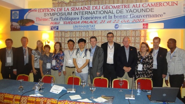
Group of international participants to FIG Com7 Annual Meeting
|
A series of events was held in the Djeuga Palace hotel in Yaounde, the
capital of Cameroon in October 2013:
- The Annual Meeting of FIG Commission 7 on Cadastre and Land Management
(21 – 22 October 2013),
- The General Assembly of the FGF – the Fédération des Géomètres
Francophones (22 October 2013),
- A Training Workshop in Land Administration (23 October 2013) and:
- A International Symposium on Land Policies and Land Governance (24
October 2014).
Commission 7 welcomed 20 delegates from 12 countries at the Annual
Meeting.
During the meeting and related events there were intense discussions with
our colleagues from Africa on the development of national cadastres.
Developments, innovations and challenges were under debate. There was
agreement that the “fit for purpose approach” as proposed by Prof
Stig Enemark and other simple but evolving solutions are most relevant
to be considered in the further development of Cadastre in Cameroon – and
also in many other countries. Theses light but evolving solutions are a
clear way forward and a real alternative for the existing complex, slow and
expensive procedures in land titling. So far, only a fraction of the total
number of parcels in the region is surveyed and titled. Many people cannot
afford participation in the land titling process. Substantial improvements
in performance are needed to provide nationwide cadastral coverage within a
reasonable timeframe. These fit approaches are a flexible way for building
the spatial framework in terms of technology and investment choices.
Identification of all lands and their occupants is the first step - and is
considered to be far more important then accurate boundary surveys. Best
practise from Rwanda and Lesotho confirms that satellite imagery and aerial
photo’s can be used for data acquisition – with a general boundary approach.
In some states in Nigeria the approach proved to work and could be managed –
also from financial perspective.
Surveyors can and should take the lead and organise the process with
grassroots surveyors doing the fieldwork. Recognition and inclusion of land
use rights and customary tenure (joint ownership) in land administration is
critical for success. Quality improvements can be done later, integrated in
the maintenance process for cadastral data, which may be CORS based. The fit
for purpose approach needs of course capacity, training, awareness,
institutions/organisation and ambassadors. FIG can give institutional
support; the profession at local level can bring solutions. Africa is on the
move.
Some other highlights from the presentations and discussions:
- Capacity building and e-learning for land administration are very
much in the focus of interest world wide – at global (FAO, UN Habitat)
and local level.
- A new version of the Cadastral template website is under development
and will be launched during the FIG Kuala Lumpur Congress in 2014.
From the country reports it became clear that improvement of the quality
of the cadastral map is an issue which can be approached in different ways –
depending on the existing situation and available budgets. One approach is
resurvey (with field- and/or photogrammetric methods), other approaches are
in map renewal with transformations and (manual) adjustments based on
available accurate co-ordinates of subsets of the boundary points. Or in
combinations of all approaches. Resurvey is applied in South Korea – it was
calculated that this approach can be budgeted if the costs of dispute
related court cases are taken into account. Accurate cadastral data can be
important for NSDI.
- An International Property Measurement Standard is under development.
- In several countries there is attention to possibilities of 3D
Cadastre and also for integration of elevation data.
A successful workshop on the Land Administration Domain Model was
organised in Malaysia. The workshop was combined with training on the Social
Tenure Domain Model. The STDM is really a key development within the Global
Land Tool Network/UN Habitat. STDM and LADM based software tools are under
development by GIS suppliers and open source communities.
A report on climate change and impact for the profession is expected to
be published during the Kuala Lumpur Congress in 2014. Geographic
information is the foundation for policy development.
In Switzerland a serious benefit is calculated for society from spatial
infrastructure. Key registers (also called authentic registers or base
registers) are under implementation is several European countries (Denmark,
The Netherlands). Cadastral data are base data. The FIG Report on Spatially
Enabled Society is a success.
Trimble provides new solutions for data acquisition specific for Land
Administration.
- Remarkable were:
- Netherlands Kadaster provides GIS functionality to notaries in support
to preliminary subdivisions,
- Belgium provides a very nice set of statistics on the web – also in
English,
- Use of mobile phones in support to subdivisions in Sweden,
- Application of land swaps in relation to infrastructure and other
developments in Nigeria, also to
avoid evictions,
- The discussion on IP addresses related to every parcel in Switzerland.
About 20 delegates from 12 countries joined the annual meeting and the
General Assembly of FGF was joined by 80 delegates. The symposium and
workshop attracted about 150 colleagues. FIG Honorary President Prof.
Stig Enemark was one of the participants.
The organisation of the event was only possible because of the close
co-operation with UN Habitat, the Fédération des géomètres
francophones and the great support from our sponsors ESRI and
Trimble and our Cameroon's colleagues. Big thanks !
The Commission 7 Annual Meeting in 2014 will be held in Quebec, Canada
during the Geoconference 2014 from 7 – 11 October. More information soon:
www.geocongres2014.ca
Daniel Roberge, Chair
FIG Commission 7
|

Commission Chair Mr. Daniel Roberge is speaking at the Com.7 Annual
Meeting for working group |
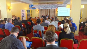
Why land tools matter for policy and governance?
- UN HABITAT |
|
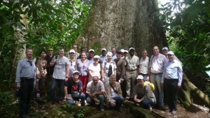
A group of participants visiting the Méfou Primate Park |

Yaoundé city center, New and Old together |
25 October 2013
|


