FIG Commission 3

|
Work Plan 2003-2006
 Original work plan in .pdf-format.
Title
Spatial Information Management
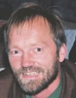 Mr. Gerhard Muggenhuber, Chairperson of Commission 3
Terms of reference
- Management of spatial information on land, property and hydrographical
facts (including related processes, procedures and resources);
- Spatial data infrastructure – data models, standards, availability and
legal aspects;
- Management and transfer of knowledge and skills needed for SIM;
- Impacts on organizational structure, business models, professional
practice and administration;
- Management of spatial information supporting environment protection,
sustainable development and poverty reduction.
Mission Statement
- Bringing awareness to successful SIM approaches in the “Information Age”
by showing good practice like reliable spatial information for better
decision making. Decision makers on all levels expect reliable spatial
information and not only maps.
- Supporting the use of SIM-tools for decision makers and citizens
to support the goals of participatory democracy
- Share good practice on managerial processes and infrastructure needed
for handling data, using information and distributing knowledge.
- Encouraging decision-makers for a more extensive use of spatial
information also within good e-government and e-commerce.
- Criterion of success: to initiate and provide activities so interesting
that colleagues will regard the commission as one base on their professional
lives.
- Progress activities mainly through working groups (WGs) and Joint-WGs,
which will participate in the planning of workshops and short seminars held
during and outside FIG working weeks; submit progress reports about these
events.
- Present the final outcomes of Commission work as reports, statements
and/or publications accessible also through the web.
General
Commission 3 –Working Groups (WG) focuses on contribution of spatial
information for sustainable development. The elements for achieving this goal
are on national as well as international level with contributions to “e-Government
and SIM”; clarification on needed “SIM infrastructure” for GSDI;
sharing experience best practice with „State of the art of SIM“. The WG
on “Knowledge in SIM” provides the overarching principle for sharing
and transferring knowledge achieved.
Interactive Information Flow between providers, partners and customers
(PPP).
Policy Issues
SIM is a facilitator for IT based services for administration as
well as for citizens. By thus SIMS will have even the role of an
integrator of components for a Spatial Information Infrastructure within an
Information society.
- Services and workflows for decision makers and citizens in
participatory democracy
- Government – business – customers: relations and activities
- Integration and cooperation in a distributed environment
- Individual vs. business in SIM
- Mobile society
- SIM and LBS in an e-Government context
Chair
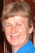 |
Kari Strande
Norway
E-mail: kari.strande[at]statkart.no |
Co-Chair: Peter Laarakker (the Netherlands), e-mail:
peter.laarakker[at]kadaster.nl
Specific projects and outputs
Based on cooperation with other WG and other Commissions this WG will:
- Report on good practice of Spatial Information within e-Government
supporting citizens in participatory democracy
- Facilitate experience exchange
- Show consequences for administration and citizens of SIM and LBS
accessible on the web
- Provide recommendations to the way we go within SIM and LBS
- Provide links to information and minutes of workshops
- Work out a Web-demo, if supported by OGC, ESRI or other sponsors
A detailed work plan with milestones will be published on the website of
Commission 3.
Workshops
- Workshop on Mobile Society and Location Based Services in an
e-Government context
Beneficiaries
Surveyors and citizens accessing and contributing to e-Government on
a national as well as on a local level. Contributing to better access to
general users of spatial data.
Harmonization of data, information, tools (LBS) and workflows as components
of GSDI.
Policy Issues
- NSDI / GSDI: Spatial Data + Information Infrastructure
- modelling, geo-visualisation
- Legal aspects in SIM
- Standards Network on international (ISO/TC 211, OpenGIS Consortium,
etc.) and on regional level.
- SIM and LBS as tools:
- Making geo-database suitable for mobile phones
- Improve basic references (geo-referencing, transport-internet)
- Role of surveyors in LBS
- Share current experiences and technical visions of the future.
- Gain knowledge from industry.
- Inform future decisions and implementations.
- Inform the big picture on drivers, trends and technologies.
Chair
 |
Keith Murray
United Kingdom
E-mail: Keith.Murray[at]ordnancesurvey.co.uk |
Co-chair: Martin Scheu (Germany), e-mail:
scheu[at]grit.de
Specific projects and outputs
Based on cooperation with other WG and other Commissions this WG will:
- Contribute to the Inter-Commission activity (COM3, 5 leaded by COM3) on
"Mobile society and Location based services"
- Co-Chair of Commission 3: Keith Murray (UK), e-mail:
KMurray[at]ordsvy.gov.uk
- Contribute to the Inter-Commission-cooperation on "Standardization"
- Co-Chair of Commission 3: Martin Scheu (Germany), e-mail:
scheu[at]grit.de
A detailed work plan with milestones will be put on
the web site of Commission 3.
Workshops
- Joint COM3/5-Workshop on Mobile Society and Location Based Services
Beneficiaries
- Surveyors, associations engaged with spatial data and users of spatial
data and spatial information.
Development and State of the Art of SIM (analysis of the nation-wide
activity in SIM among participating countries, and world-wide picture and best
practice of institutional structures, as well as contents of data bases) and
establishment of a FIG - metadata base about SDI.
Policy Issues
- To increase cooperation between different jurisdictions, disciplines,
professional groups, Public-Public and Public-Private-Partnerships
- To positively influence organizing and business models as well as
procedures on different layers of administration
- To raise awareness and encourage participation regarding:
- Institutional structures and Spatial Information Infrastructure
- Data availability and Spatial Data Infrastructure
- To work towards capacity building and transfer of experience within
a detailed work plan with milestones will be
published on the web site of Commission 3.
- Com3
- To facilitate the development of NSDIs
Chair
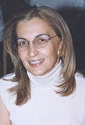 |
Chryssy Potsiou
Greece
E-mail: chryssyp[at]survey.ntua.gr |
Co-Chair: Uzo Okafor (Namibia), e-mail:
uzookaf[at]mweb.com.na
Specific projects and outputs
Based on cooperation with other WG and other Commissions this WG will:
- Create a metadata base with information about the state of the art of SIM
at national level and maintain an up to date web site WEB-Inventory of best
practice in regarding “State of the art of SIM”
- Show good practice on the managerial processes
- Share and provide experiences in SIM and NSDI
- Contribute to the Inter-Commission activities
- Contribute to the Inter-Commission activity (COM3, 5, 7, leaded by COM5)
on
“Low Cost Surveying Technology and Techniques for Developing Countries”.
Co-Chair of Commission 3: Chryssy Potsiou
(Greece), e-mail:
chryssyp[at]survey.ntua.gr
A detailed work plan with milestones will be published on the web site of
Commission 3.
Workshops
- Joint Workshop: UN/ECE-WPLA, FIG Com3 and Com7 on "Spatial Information
Management for Sustainable Real Estate Market - Best Practice Guidelines in
nation-wide Land Administration“ will be held in Athens, Greece, 4-7 June 2003
Beneficiaries
Surveyors, associations engaged with spatial data and users of spatial data
and spatial information.
Working Group 3.4 - Knowledge Transfer in SIM (education,
training)
A Joint Working Group with Commission 2
Policy Issues
Integration of resources of FIG Com.2 and 3 using the experiences in
knowledge transfer on one hand and the know-how of spatial information
management on the other hand.
- Where to get knowledge, training etc.
- Not only data are needed and information is not yet knowledge.
Infrastructure is changing quite fastly, but also methods of training have to
be adopted because the “half-life-time” of knowledge becomes shorter.
- How to bridge tangible information with intangible knowledge.
- Cooperation between sister organizations, optimizing regional structures
Chair
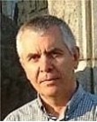 |
Prof. Bela Markus
Hungary
E-mail: mb[at]cslm.hu
(appointed by Commission 2) |
Co-Chair: Mohammed Timoulali (Morocco), e-mail:
timoulali[at]atlasnet.net.ma (appointed by Commission 3)
Specific projects and outputs
Based on cooperation with other WG and other Commissions this WG will :
- Develop methods and share experience on education, training in SIM
- Develop a position paper on a regional approach for a NSDI.
Workshops
- Joint COM2/3-Workshop on "Education and Training in SIM"
Beneficiaries
Teachers and students within any education, learning and training
environment.
Integration of COM2 and COM3 resources using the experiences of
professionals in knowledge transfer from one side and the know-how of spatial
information management (SIM) from the other side.
Co-operation with Sister Associations
Cooperation on Spatial Information Management for Sustainable Real Estate
Market with UN-ECE-WPLA
Commission 3 contributes to the joint UN/ECE-WPLA and FIG Workshop in Athens,
4-7 June 2003.
Cooperation on GSDI with GDSI and EUROGI
Commission 3 contributes to 6th GSDI Conference in Budapest, 16-19
September 2002
Cooperation on international standards on spatial data with ISO and
OPENGIS
Especially promoting implementation of ISO TC211.
Contacts and cooperation with sister organizations
Inter-Commission Activities
- Joint WG of Commissions 2 (lead) and 3 on:
- "Knowledge in SIM"
- Co-Chair of Commission 3: Mohammed Timoulali (Morocco), e-mail:
timoulali[at]atlasnet.net.ma
- Contribution to the Inter-Commission activity (Commissions 3 and 5
leaded by Commission 3) on:
- "Mobile society and Location based services"
- Co-Chair of Commission 3: Keith Murray (United Kingdom), e-mail:
KMurray[at]ordsvy.gov.uk
- Contribution to the Inter-Commission-cooperation on
- "Standardization"
- Co-Chair of Commission 3: Martin Scheu (Germany), e-mail:
scheu[at]grit.de
- Contribution to the Inter-Commission activity (Commissions 3, 5 and 7,
leaded by Commission 5 on
- Contribution to the Inter-Commission activity (Commissions 3 and 7,
leaded by Commission 7) on
- "3D-Cadastre"
- Achieving a common understanding of the terms and issues involved in
a 3D-Cadastre.
- Integrating advanced Spatial Information Management with legal and
organizational settings needed for a 3D-Cadastre.
- Developing the frame and strategy for an ongoing improvement process
of existing spatial information considering additional dimensions of
geodata (3rd dimension, temporal data, etc.).
- Co-Chair of Commission 3: Yerahmiel Doytsher (Israel), e-mail:
doytsher[at]technion.ac.il
Co-operation with the United Nations Agencies
Other Activities
Active involvement of regions
Commission 3 will actively involve underrepresented regions like Africa,
Latin America, Middle East, and Asia by exchanging information. Commission
will try to reduce conference fees in order to enable or to encourage regional
participation and try to raise money for funding participation of groups like
students. Commission will also encourage participation by using e-mail and
web.
Respect cultural and linguistic issues
Commission 3 endorses the underlying concept that respect for Cultural and
Linguistic issues is very important and that the Commission will be sensitive to
these issues in the way it works. This will be implemented by encouraging
multilingual abstracts and presentations in general meetings and through the use
of an appropriate regional language during regional meetings.
Information delivery
Commission 3 has an ambitious approach on management of information and
communication. This includes an active Commission 3 home page, linkages to other
relevant information and events in order to keep commission delegates and all
FIG members informed about the work of the Commission (including former
activities of secretary): Commission 3 Vice-Chair for Administration and
Information: Reinfried Mansberger (e-mail:
mansberger@boku.ac.at).
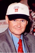 |
Commission 3 Vice-Chair for Administration and
Information
Reinfried Mansberger
Austria
E-mail: mansberger[at]boku.ac.at. |
Calendar of Events
2003
- 13-17 April 2003 FIG Working Week,
Paris, France
- 4-7 June 2003 UN/ECE and FIG
joint Workshop, Athens (FIG Com3, Com7)
- Dec. 2003 Commission 3 Annual Meeting (Morocco)
2004
- May 2004 FIG Working Week, Athens, Greece
- Sept.-Dec. 2004 Commission 3 Annual Meeting (TBD, preference for Asia)
2005
- May 2005 FIG Working Week, Cairo, Egypt
- Sept.-Dec. 2005 Commission 3 Annual Meeting (TBD, preference for Latin /
South America)
2006
- August-September 2006 FIG Congress, Munich, Germany
Commission Officers
Commission Chair
 |
Gerhard Muggenhuber
Federal Office for Metrology and Surveying (BEV) International Affairs
Schiffamtsgasse 1-3
A-1025 Vienna
AUSTRIA
Tel. + 43 676 7354300
Fax + 43 1 211 76 4701
Mobile phone + 43 676 8210 4700
E-mail: geomugg[at]gmx.at |
Chair Elect 2004-2006 and Chair 2006-2010
 |
Dr. Chryssy Potsiou
National Technical University of Athens
9 Iroon Polytechniou Str.
GR-15780 Zografos
GREECE
E-mail: chryssyp[at]survey.ntua.gr |
Vice-Chair on Administration and Information
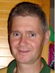 |
Dr. Reinfried Mansberger, Commission 3 Information
Manager
Institute of Surveying, Remote Sensing and Land Information
Universität für Bodenkultur Wien
Peter-Jordan-Strasse 82
A-1190 Vienna
AUSTRIA
Tel. + 43 1 47654 5115
Fax + 43 1 47654 5142
E-mail: mansberger[at]boku.ac.at |
Chair Working Group 3.1 - e-Government and e-Citizen
 |
Kari Strande
Statens Kartverk
Advicer International affairs
Servicebox 15
N-3504 Hønefoss
NORWAY
E-mail: kari.strande[at]statkart.no |
Chair Working Group 3.2 - SIM infrastructure
 |
Keith Murray
Head of Geographic Information Strategy
Ordnance Survey
Romsey Road
Southampton SO16 4GU
UNITED KINGDOM
E-mail: Keith.Murray[at]ordnancesurvey.co.uk |
Chair Working Group 3.3 - State of the art of SIM
 |
Dr. Chryssy Potsiou
National Technical University of Athens
9 Iroon Polytechniou Str.
GR-15780 Zografos
GREECE
E-mail: chryssyp[at]survey.ntua.gr |
Chair Joint Working Group 2.4 - Knowledge in Spatial Information
Management
 |
Prof. Bela Markus
College of Geoinformatics
University of West Hungary
P.O.Box 52
H-8000 Szekesfehervar
HUNGARY
Tel. + 36 22 516 522
E-mail: mb[at]geo.info.hu
|
28 November 2002
|


