The plenary sessions focused on aspects of the theme Recovery from Disaster in a variety of international contexts.
PLENARY SESSION 1 - 3 May 2016 |
|||||
Theme: The Christchurch story “Christchurch’s response to the 2011 earth quake” |
|||||
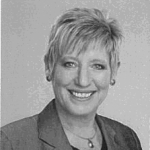
Hon. Lianne Dalziel Mayor of ChristchurchTopic Focus:
|
 Welcome address, read... |
||||
|
Hon Lianne Dalziel (LLB) was elected as the Mayor of Christchurch in October 2013, after serving for 23 years in the New Zealand Parliament, the last four terms as the Member of Parliament for Christchurch East. Lianne served as a Cabinet Minister in the 5th Labour Government under the leadership of Prime Minister Rt. Hon Helen Clark (1999-2008). During that time Lianne held a number of portfolios, including Immigration, Commerce, Food Safety, Women’s Affairs & Senior Citizens and associate roles in Education and Justice. After the change in government in 2008, she was elected to chair the Commerce Select Committee, which had oversight of the regulation of the non-banking finance sector. The Christchurch East electorate was severely affected by the 2010/11 Canterbury Earthquake Sequence and Lianne played an important role in ensuring that her constituents had access to accurate information, as well as ensuring that their concerns were communicated to decision-makers. Lianne was invited to join the UNISDR’s Parliamentary Advisory Group on Disaster Risk Reduction in 2012. With this background, Lianne has become a champion of resilience, with Christchurch selected as one of the first tranche of cities to participate in the 100 Resilient City Network pioneered by the Rockefeller Foundation. |
|||||
|
|||||
During his 30 years in civil construction Duncan has been driven by a need to find solutions to engineering problems. He is a qualified Civil Engineer whose expertise has been instrumental in the success of numerous projects and programmes of projects in Australia and New Zealand. In the period between May 2011 and December 2014 Duncan was the General Manager for the Stronger Christchurch Infrastructure Rebuild Team (SCIRT). SCIRT was established as a unique collaborative public/private partnership to deliver the NZ$2.2 billion programme of projects to rebuild publicly-owned, earthquake-damaged horizontal infrastructure (water, wastewater, drainage and roading) in Christchurch, New Zealand. Duncan’s leadership style is authentic, high-energy and empowering. He believes that organisations flourish when there is an intentional focus on developing leadership capabilities. Duncan is well practiced in establishing the right business systems to support delivery. His experience with all levels of Government in Australia and New Zealand helps ensure that business systems can deliver the information Clients need to deal with any situation. A veteran of 15 years involved in relationship style contracting, Duncan is a strong advocate for multiple organisations working collaboratively to achieve ‘shared outcomes’. In 2013 Duncan was made an honorary Fellow of the Institute of Civil Engineering UK and appointed as the 10th Brunel International Lecturer. He is also a Fellow of Engineers Australia and the Institute of Professional Engineers New Zealand. |
|||||
PLENARY SESSION 2 - 4 May 2016 |
|||||
Theme: Disaster Management and Recovery framework – The Surveyors response |
|||||
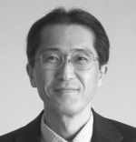
Dr. Hiroshi Murakami
|
 |
||||
|
Dr. Hiroshi Murakami is currently the Deputy Administrator of the Geospatial Information Authority of Japan. He has been working extensively on R&D and policy development in the organization for the past 30 years including his appointment to Chief of the UN Cartographic Section in 2001 until 2005. He holds Ph.D. from the University of Georgia, and Masters from Graduate School of Science, Tohoku University. He is currently the President of UN-GGIM-AP |
|||||
Mr.
Gregory Scott
|
 |
||||
|
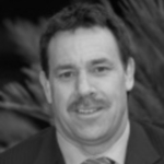
Greg Scott leads the Secretariat for the United Nations Committee of Experts on Global Geospatial Information Management (UN-GGIM), providing strategic policy advice and leadership in the coordination and implementation of UN-GGIM initiatives with Member States and related International Organizations involved in national, regional and global geospatial information management. He is also responsible for developing the substantive content for the Committee of Experts, High Level Forum's, international technical capacity development workshops, and other international fora. Greg previously spent more than 20 years in Geoscience Australia in a number of key roles delivering Australia’s national topographic mapping and derivative geospatial programs, and providing independent scientific analysis and advice in the use of geospatial information for emergency management, critical infrastructure protection, and lifeline network functionality. Greg possesses formal qualifications in Cartography and Survey Mapping, has a Graduate Diploma in Geography from the Australian National University, and is now studying towards a PhD at the University of Melbourne’s School of Engineering. |
|||||
Mr. Keith Bell
|
 |
||||
|
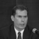
Dr. Keith Clifford Bell joined the World Bank
in 2003 and been the primary land specialist for the East Asia
Pacific Region. During his tenure with the World Bank he has
worked in some fifteen countries across Asia, the Middle East
and Latin America, including conflict and fragile states as well
as in support of post-disaster reconstruction. Prior to the
World Bank, he spent more than two decades in the Australian
public and private sectors, which has included heading land
agencies in two states, as well as programs for national mapping
and also the national coordination of spatial data
infrastructure. Dr. Bell, an Australian national, is a licensed surveyor and professional engineer (civil). He is a Fellow of several professional institutions including the Institution of Surveyors Victoria Australia, the Institution of Engineers Australia and the American Society of Civil Engineers. |
|||||
PLENARY SESSION 3 - 5 May 2016 |
|||||
Theme: The Public, The Private and the Peoples response for Disaster Management and Recovery in the Surveying Profession - New technologies |
|||||
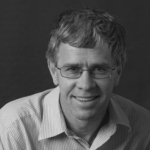
Mr. Mark Nichols
|
 |
||||
|
Mr. Mark Nichols has over 30 years’ experience with Trimble in leadership roles working on the development and application of technology products to improve productivity, work place safety and sustainability. His experience spans the Geospatial, Agricultural, Mining, Civil and Building Construction industries. His most recent roles have been as the Chief Operating Officer of the joint venture Caterpillar Trimble Control Technologies LLC between Trimble and Caterpillar for the application of geospatial information technologies to the earthmoving industry and as the General Manager for Trimble Planning Solutions Pty. This is an Australian based company using geospatial information to balance social, environmental and cost constraints to deliver the optimal alignments for new road and railway in the developing countries around the world. |
|||||
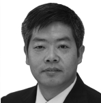
Prof. Dr. Jixian Zhang
|
 |
||||
|
Dr. Jixian Zhang is Director of National
Quality Inspection and Testing Center for Surveying and Mapping
Products, Vice President of Chinese Society of Mapping and
Geoinformation (CSSMG) and Editor-in-Chief of International
Journal of Image and Data Fusion (IJIDF). He was President of
Chinese Academy of Surveying and Mapping (CASM) from July 2006
to February 2016. He has built up his reputation in China through many years’ research work in the fields of photogrammetry and remote sensing, land surveying, cadastral surveying and mapping, and management of academic programmes and organisations, and made remarkable contributions to the development of the surveying profession in China. He has published over 200 articles in reputation journals and 7 books, won five prestigious National Award of Science and Technology Progress of China and one Geospatial World Excellence Awards.
On the evening of Saturday 4 September 2010, University of Canterbury Student Sam Johnson began a Facebook event to mobilise student volunteers to help with the earthquake response. Within a week, more than 3,500 people had joined to volunteer their time to support the community. The Student Volunteer Army, as they became known, offered assistance after every significant earthquake in clearing silt, delivering food and chemical toilets, distributing information and simply being a smiling face at the door. After the 22 February 2011 earthquake, the Student Volunteer Army continues to organise, support and encourage volunteering in Canterbury today through the Volunteer Army Foundation. |
|||||
Programme at a glance:
|
Tuesday 3 May |
Wednesday 4 May |
Thursday 5 May |
|
| 9.00-10.30 | Opening Ceremony | Plenary Session | Plenary Session |
| 10.30-11.00 | Coffee/tea Break Exhibition opens |
Coffee/tea Break | Coffee/tea Break |
| 11.00-12.30 | Plenary Session | 8-10 parallel Technical Sessions | 8-10 parallel Technical Sessions |
The plenary sessions covered disasters from various angles, and disasters were also a theme at many of the technical sessions including all the areas of surveying. The first plenary session was dedicated the “Christchurch Story” which was told by the Mayor of Christchurch, Hon. Lianne Dalziel, the Associate Minister supporting Greater Christchurch Regeneration, Hon Nicky Wagner and Mr. Duncan Gibb Founding General Manager of SCIRT (Stronger Christchurch Infrastructure Rebuild Team). The “Christchurch Story” was followed by some very strong and impressive photos from immediately after the earthquakes and the rebuilding process on the longer run. These photos more or less talked for themselves. The presenters pointed out that a large amount was paid out in the first week after the earthquakes in order to keep people alive, and that “we should have been better prepared if we had learned from the earlier experience”. One vital focus was to get business up and running as fast as possible so that a “normal” life could be somehow maintained, and to show the inhabitants of the area that “we are here to help you”; e.g. establishing free legal advise. It was furthermore stated that “it is all about people” pointing out that you cannot communicate too much in such a crisis situation and finally that “hope is not a method”.
The first speaker in the second plenary session Dr. Hiroshi Murakami almost did not make it to the Working Week because Japan was hit by earthquakes just three weeks before the Working Week and his help was needed. Luckily he still managed to come, and could give the participants another real-life insight in a disaster area. He pointed out that improvements are needed to prepare for future catastrophes, hereunder to have updated maps of areas that can help to compare the situation before and after a disaster. Gregory Scott, leader of the secretariat for the United Nations Committee of Experts on Global Geospatial Information Management (UN-GGIM), presented the global perspective with impressive statistics on disaster loss – both in terms of numbers of affected people (more than 1.5 billion) and in money (more than one trillion dollars). The Post-2015 Development Agenda is actionable, and data about people and place is an indispensable element in this agenda.
Keith Bell, World Bank, stated that 80% loss of people in connection with disasters come from low income countries. The complexity for these countries is much larger than in the developed world. The best situation is of course to prepare for disasters, but after a disaster the key term is “Build Back Better” – and one of the first examples of this took place in Indonesia. The “Build Back Better” concept should be used to rethink an area and not “just” build up what was there before. It is important is to have reliable geospatial data – and the World Bank recommends to get this on a Fit-for-Purpose basis that secures that there will be data although it may not be fully detailed. Finally, Keith Bell has already previously asked whether FIG can lead national professional bodies to put surveyors on the pro bono humanitarian map, and in his plenary speech he again took the opportunity to encourage FIG. The network of the Young Surveyors is a good example of how this can be started.
This line was followed at the third plenary session. The final speaker was Sam Johnson. Sam is a shining example of youth leadership. He was the leader of the Student Volunteer Army (SVA) in the aftermath of the 22 February Christchurch earthquake and gave and inspirational talk on harnessing students/youth in response to disaster situations. The SVA tapped into a well of good will and enthusiasm to help people. Their work is now part of Christchurch. Sam has now gone on to help people in Nepal and his message is to question processes in a disaster situation. His preferred method is to galvanise volunteers, what he calls utilising the powerful skills of the unskilled. This is, he argues, “perfect in its imperfection”. Sam also challenged FIG and Member Associations to establish a network of young surveyor volunteers to respond to disaster relief - Surveyors without Frontiers
Mark Nicholls (Trimble) stated that the profession is moving from maps to models. He presented an impressive description of Trimble’s role right after the earthquakes in Christchurch. Surveyors need to keep their current skillsets but enhance them to become spatial data experts, understanding and interpreting a plethora of data from several sources. The challenge is to effectively manage spatial information from everywhere including 1cm accurate data available for everyone. This requires the Surveyor to
Professor Jixian Zhang gave a very impressive presentation on the use of remote sensing and photogrammetry in disaster response in the Chinese context. The Chinese Government has invested heavily in satellite based remote sensing, photogrammetry, airborne mapping including unmanned platforms/UAVs and mobile mapping system to respond to and mitigate natural disasters in China Photogrammetry and remote sensing play an important part of the National Disaster Action Plan, covering (in part)
Future challenges to be overcome are:
